
“What a tremendous, awe-inspiring scene! Nature has moulded her works, here, on a grand scale, — and soon we shall see, as we may even now, that Art has caught the inspiration of the scene, and well seconded her efforts, in giving to it a sublime effect, and a finish truly admirable.” — Horatio Gates Spafford, A Pocket Guide for the Tourist and Traveller, 1824
Horatio Spafford wasn’t the only traveler thrilled by the dramatic scenery at Little Falls. This stretch along the Mohawk River, barely a mile long, was the highlight of the trip along the Erie Canal for many packet passengers.
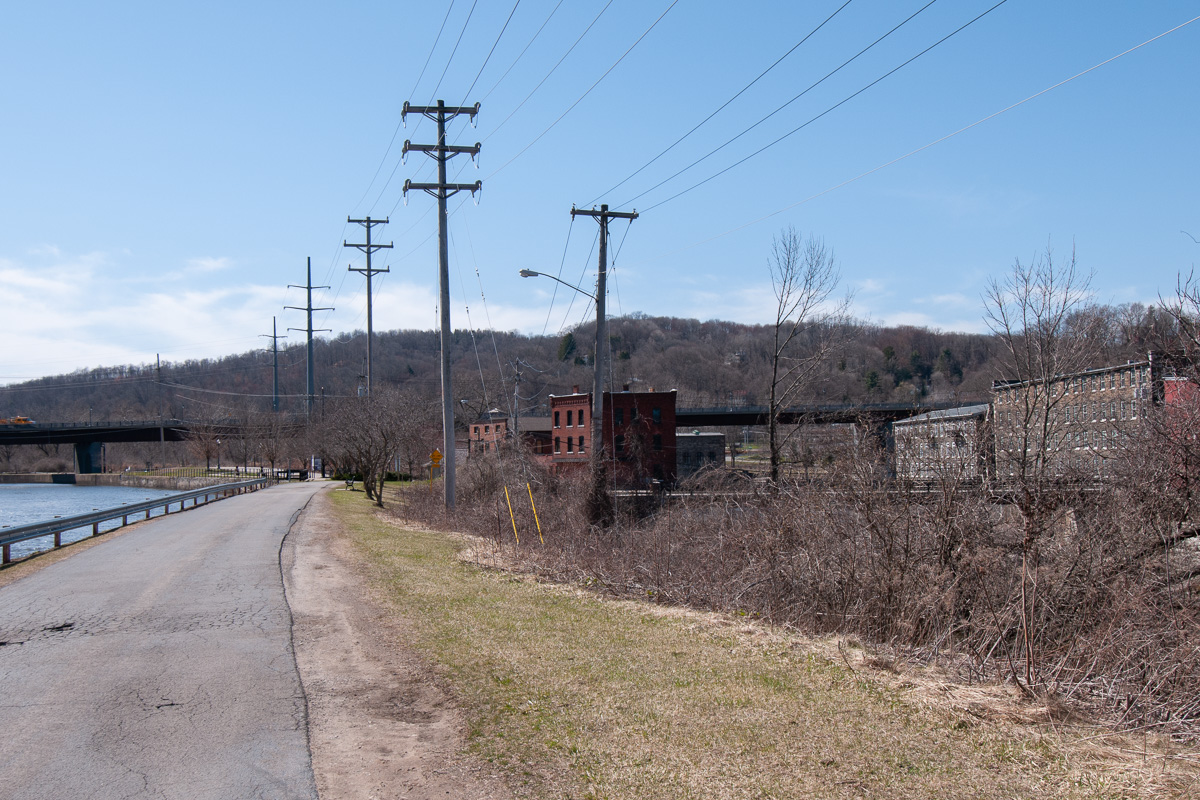
But things have changed a lot since then. The Mohawk has been walled in and its course altered by two hundred years of development. Hills and islands have been reshaped and removed to make way for railroads, highways, and a modernized canal.
The cliffs that once lined the narrow gorge may be the most conspicuous casualties of all this progress. Those on the north side, including a famous landmark named Profile Rock, were half buried when the channel was raised for the New York State Barge Canal in the early 20th century. Those to the south were cut away, first to make room for the double locks of the Enlarged Erie in the mid-19th century, and later for the even wider channel of the Barge Canal.
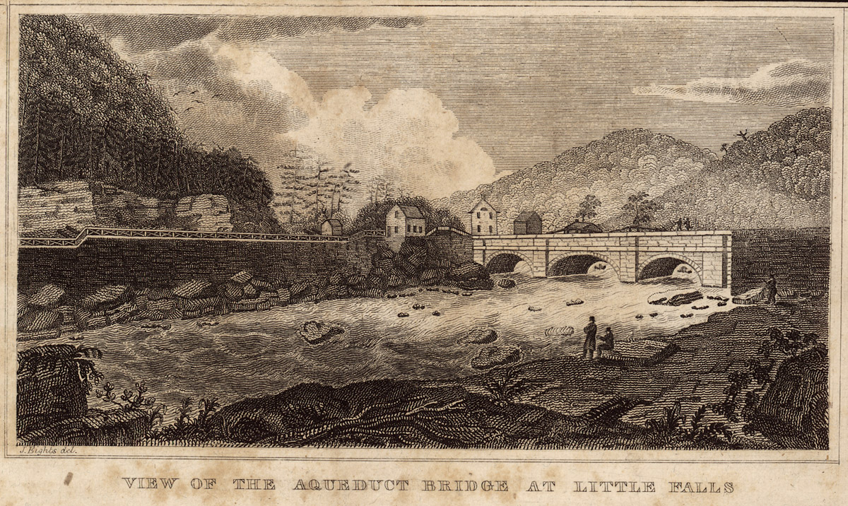
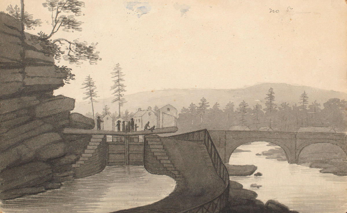
The idyllic landscape sketched by John Henry Hopkins is long gone.
To recreate the historical landscape, we’ll pretty much have to start from scratch.
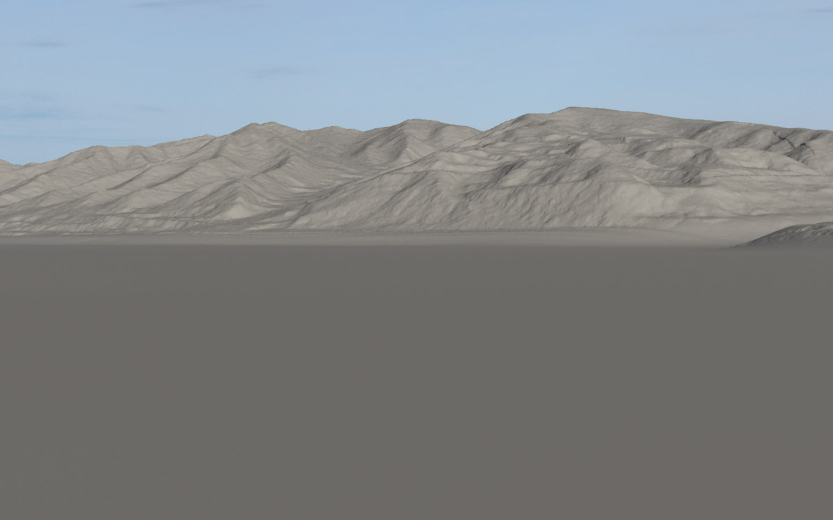
The Mohawk River valley narrows dramatically as it cuts through the glaciated, hilly terrain at Little Falls. The 40-foot drop in elevation at the rapids represents a significant step along the river’s long descent to tidewater at the Hudson.
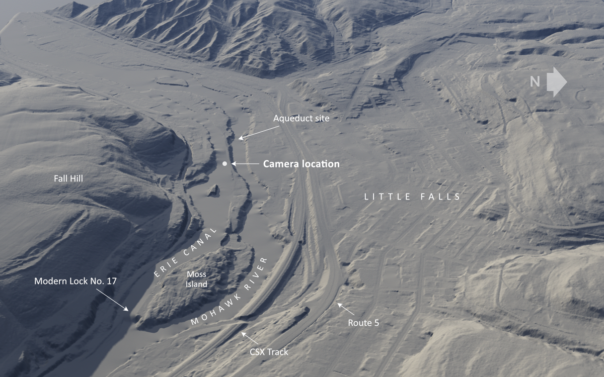
Digital elevation data, downloaded from the New York State Geographic Information Systems Clearinghouse and rendered in Terragen, shows how the valley has been extensively altered over the years. The camera position shown here will give us a view similar to the one sketched by Hopkins in 1825.
As with previous scenes, we will use the modern elevation data as a starting point, and modify it to recreate the historical landscape. But this time few features can be retained. Only the hills to the west of our position have survived relatively unscathed. We will keep those and remove everything else, including the Mohawk River gorge. The resulting basic landscape is perfectly flat, a digital blank slate except for the distant hills.
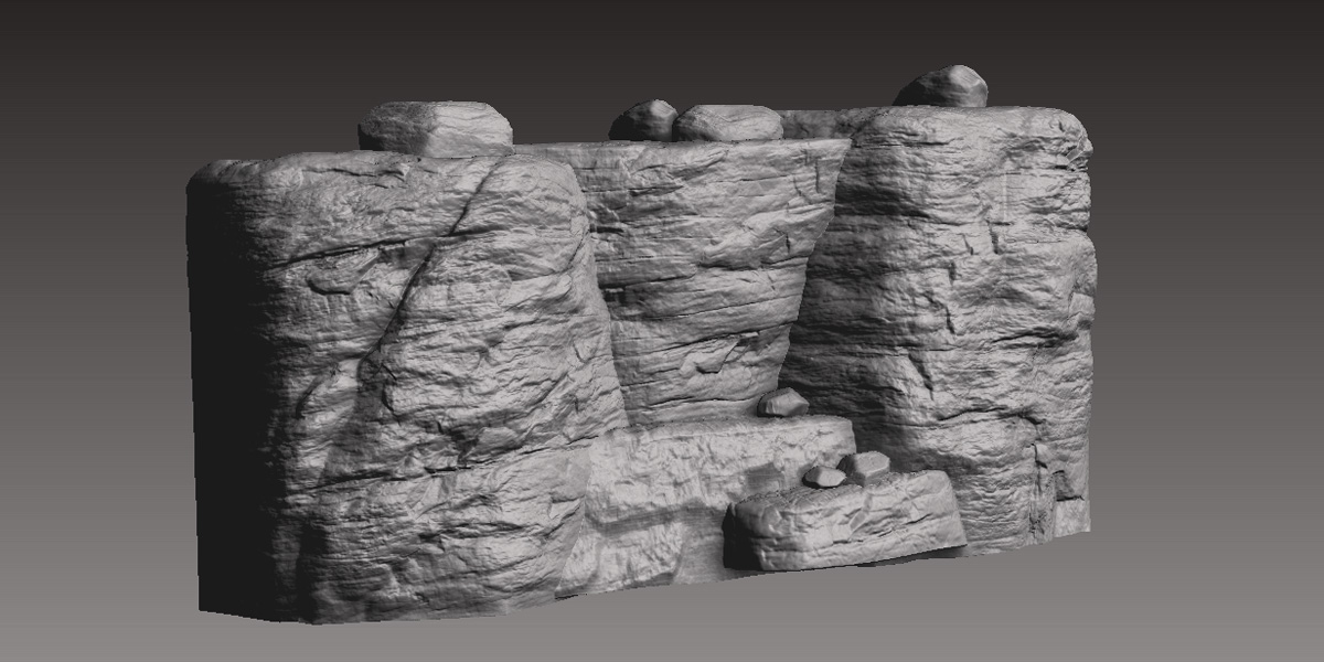
The rocky ledge depicted by Hopkins and Eight has a very distinct structure. After attempting to model it in Terragen and other applications, I decided to create it in ZBrush, a 3D application that allows you to sculpt digital objects as if they were made of clay. The sculpting process is labor intensive, but fortunately we need need only a small section.
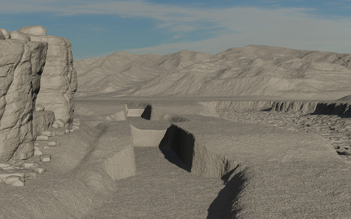
The flattened digital landscape is then reshaped to add the rocky channel of the Mohawk River. The land surface is terraced and “excavated” to provide homes for the two locks. The sculpted cliff is placed in the scene, and channels for the bypass flumes, which diverted excess water around the locks, are added between the cliff and locks.
Hopkins, whose sketches are generally very accurate, for some reason ignored the bypass flumes. This allowed him to place the cliff near the canal, probably closer than it should have been. He also simplified the scene by omitting a second lock, which should appear in the distance. For the sake of historically accuracy, I’m including the flume and second lock.
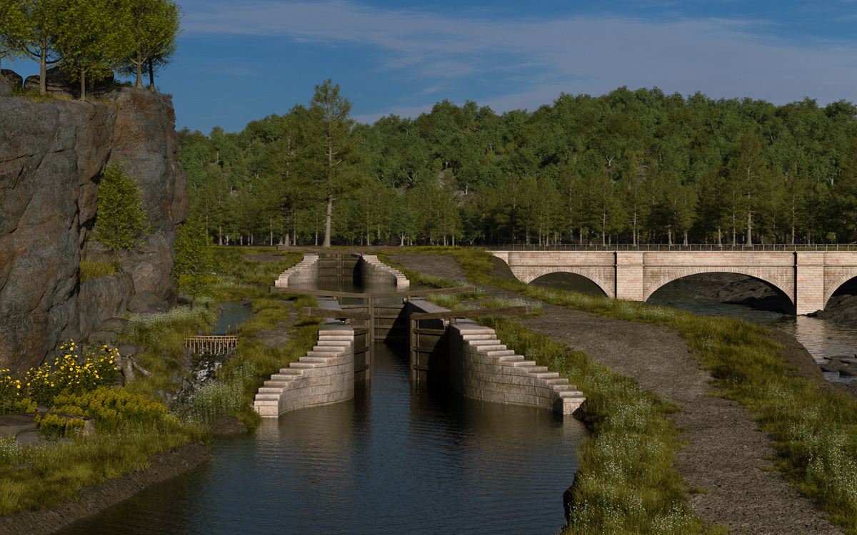
The landscape begins to look better with the addition of water, foliage, the aqueduct, and locks. There is much yet to be done: More structures, such as buildings and fences, need to be added. Plus boats, of course, along with crews and passengers, teams and drivers, and tenders to operate the locks.