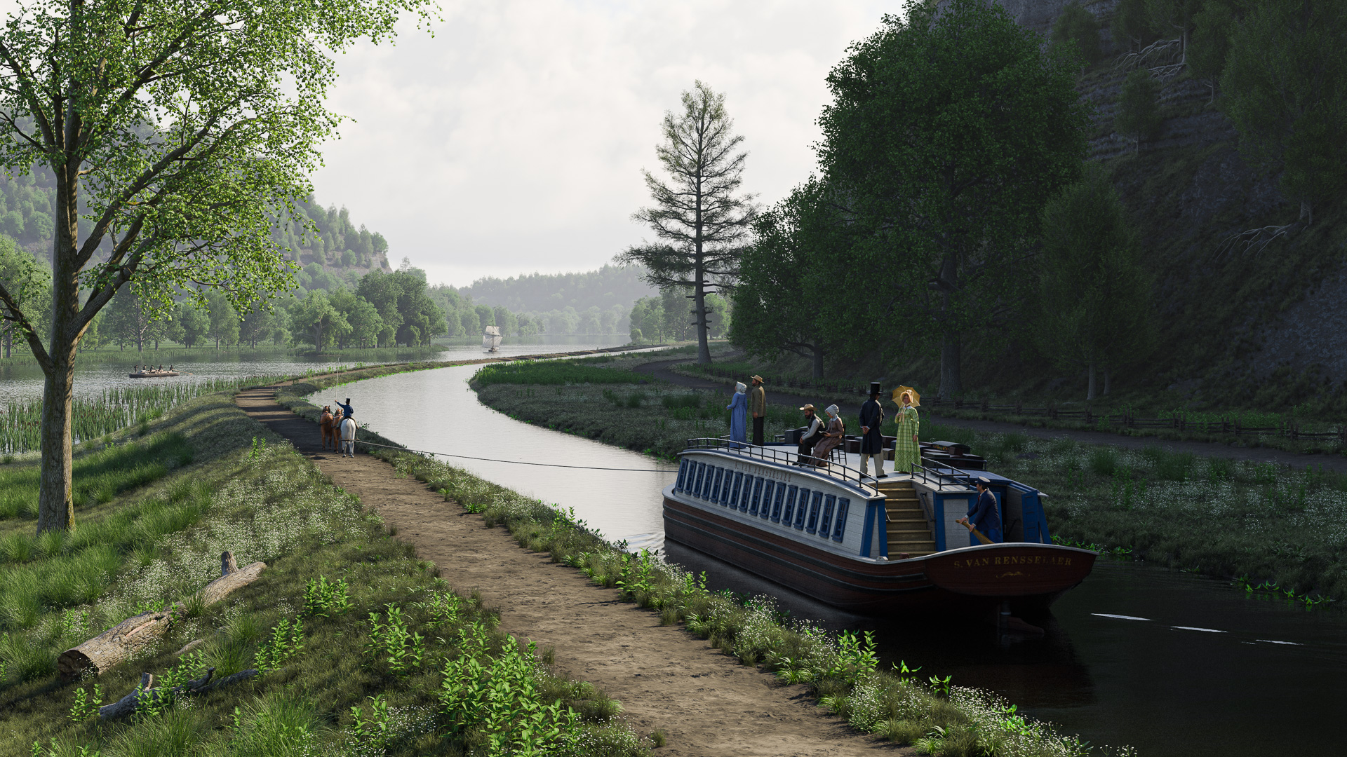
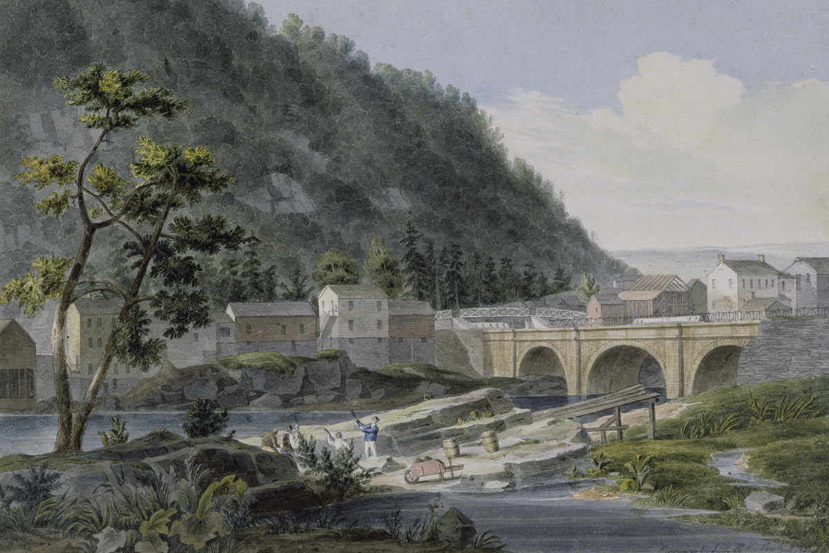
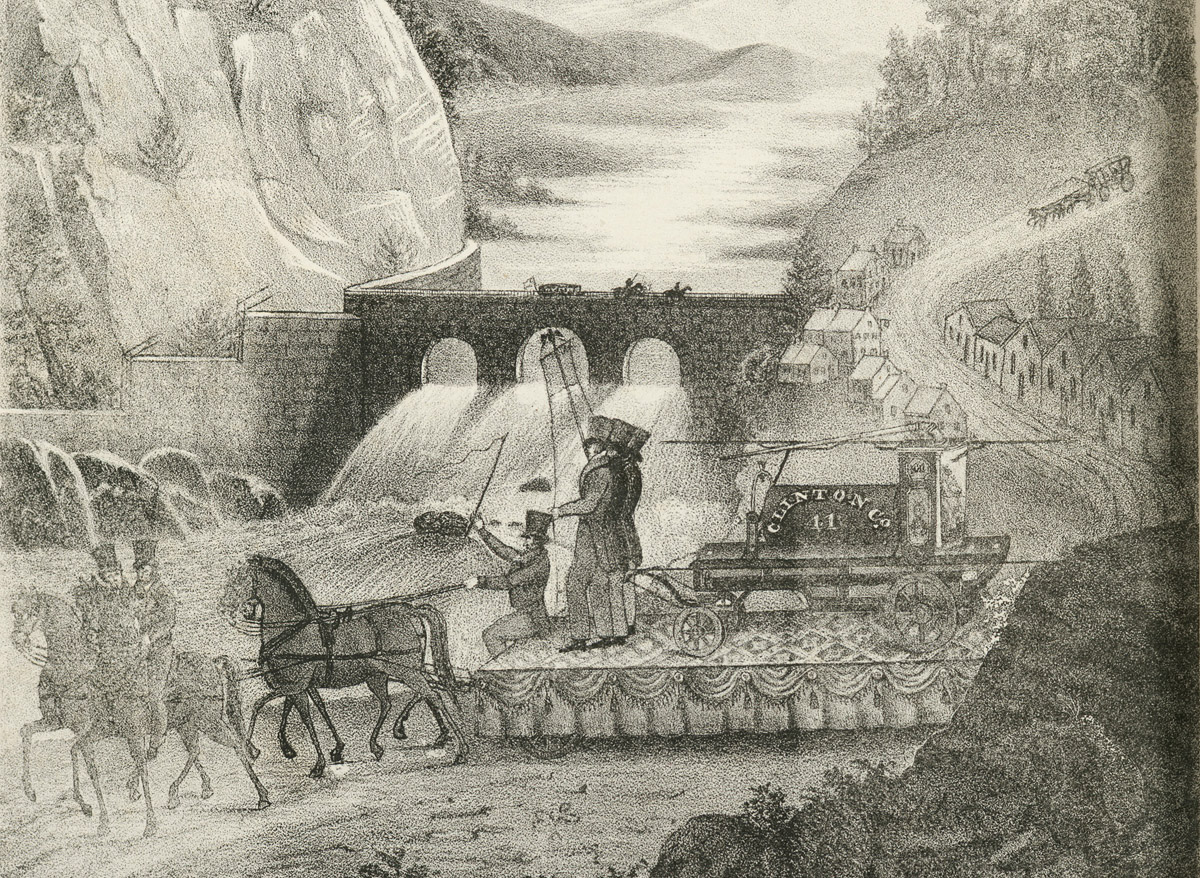
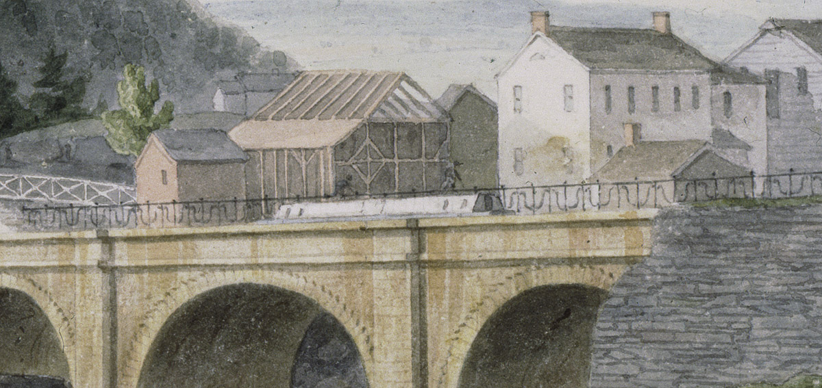
The village of Little Falls was once one of the most famous locations along the original Erie Canal. Early lithographs, engravings, and paintings show packet boats traversing the wild, romantic landscape as the canal skirts boulder-strewn rapids and rocky cliffs.
But today the original Erie depicted in the lithographs is long gone. The canal enlargement of the mid-19th century and construction of the New York State Barge Canal in the early 20th blasted or drowned many of the cliffs and rocky islands that had long distinguished this section of the Mohawk River.
It is hard to imagine how this place once looked, and easy to forget why it played such an important role in our early history.
The Little Carrying Place
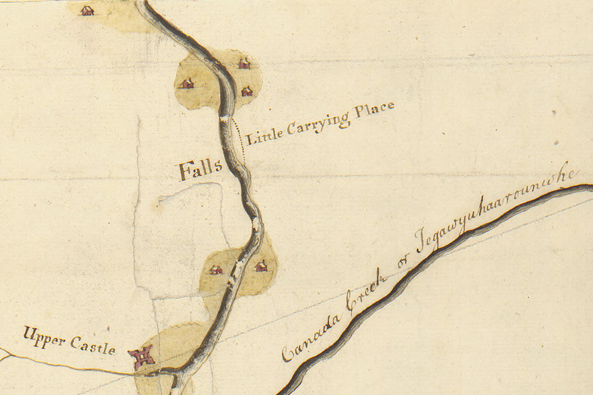
The Little Falls were so named because they were the lesser of two major obstructions to navigation on the Mohawk River. Cohoes Falls, directly above Albany, was a more significant barrier. The Little Falls in turn were not even a waterfall so much as a bottleneck. This was a place where the valley narrowed dramatically and the river swirled around large boulders along a series of shallow rapids. The rapids extended three-quarters of a mile and dropped about 40 feet.
This was enough to force early navigators to beach their bateaus on the riverbank and drag them, along with their cargo, to the other end of the rapids. The section became known as the Little Carrying Place, and later, as the settlement of Little Falls took shape, businesses sprang up to provide room, board and other amenities to weary boatmen working their way up- and downriver. Eventually portage companies were formed which, for a fee, carted goods and boats on large wagons.
Building a bypass around the rapids became a top priority for the Western Inland Lock Navigation Company, chartered in 1792 to improve river navigation along the Mohawk. Construction of a short canal with five narrow locks soon commenced, employing “nearly three hundred laborers, besides a competent number of artificers,” according to a company report. Despite chronic financial problems, the difficulty of excavating through solid rock, and a lack of engineering experience on the part of the company’s officers, by November 1795 the canal around the Little Falls was completed “as to allow the passage of boats.” The village now had its own canal basin and waterfront.
Unfortunately – from the point of view of local residents and merchants – twenty years later surveyors would locate the new Erie Canal on the opposite side of the Mohawk, threatening to leave Little Falls high and dry.
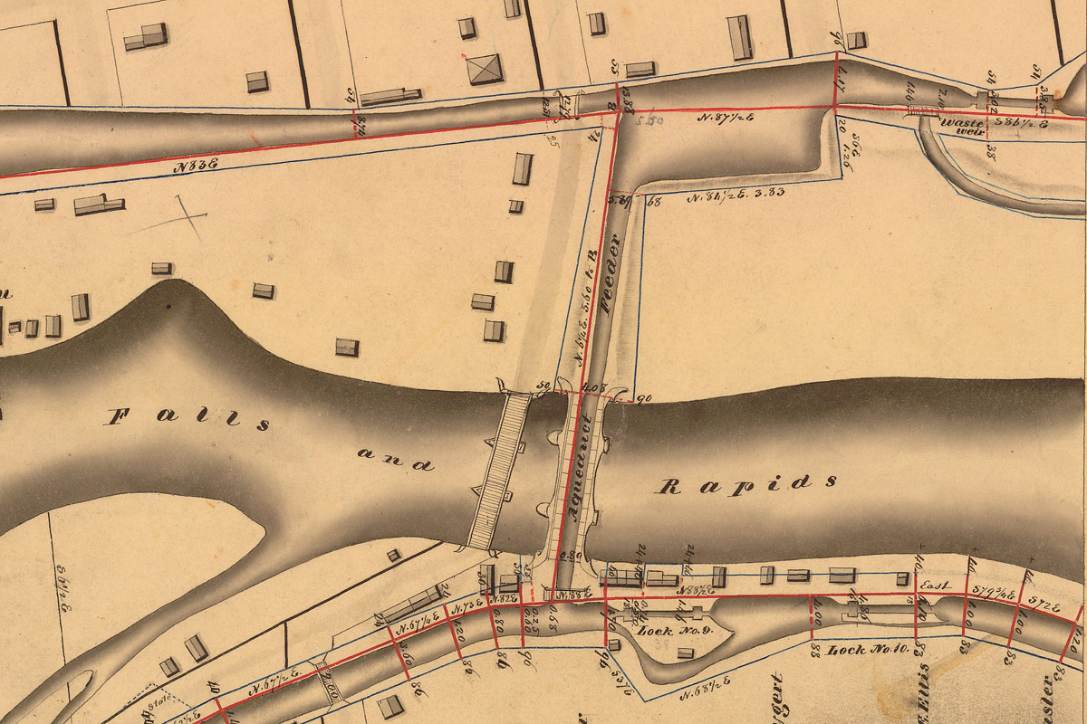
The solution was to build an aqueduct to connect the new canal on the south bank to the old one on the north, and like all good solutions it included something for everyone. Little Falls would be connected to the new canal, making its waterfront accessible to freighters and passenger packets. In turn, the old canal would become a water source — a feeder — for the new canal. And, incidentally, boats on the Mohawk could now come and go as they pleased between the river and the new canal.
‘This splendid work’
The new aqueduct would be one of many built along the Erie Canal. The Genesee River Aqueduct at Rochester would be the longest, at 802 feet. Others, built on the lower Mohawk, may have been more impressive feats of engineering. But none could match the aqueduct at Little Falls. The graceful, arched design, juxtaposed against the wild Mohawk River gorge, would be seen as vivid evidence of the victory of art over nature.
The aqueduct was constructed in 1822 by Ara Broadwell of Utica, a mason and contractor who had been building locks, culverts, and aqueducts along the canal since early 1818. The cost of the work, which took only about eight weeks to complete, is not itemized in the 1823 state comptroller’s report, but the report does specify $45,532.50 paid the previous year to Broadwell for stonework on the aqueduct and seven locks above the Falls.
The aqueduct’s opening was noted in the Oct. 22, 1822 edition of the Utica Gazette in an item widely reprinted in other New York state newspapers:
“The aqueduct across the Mohawk river at Little Falls was finished last week and filled with water. This is a structure of considerable magnitude, built entirely of stone, and in point of solidity and beauty, probably not exceeded by any work of the kind in the United States.”
In their 1823 report, the canal commissioners fill in a few important details:
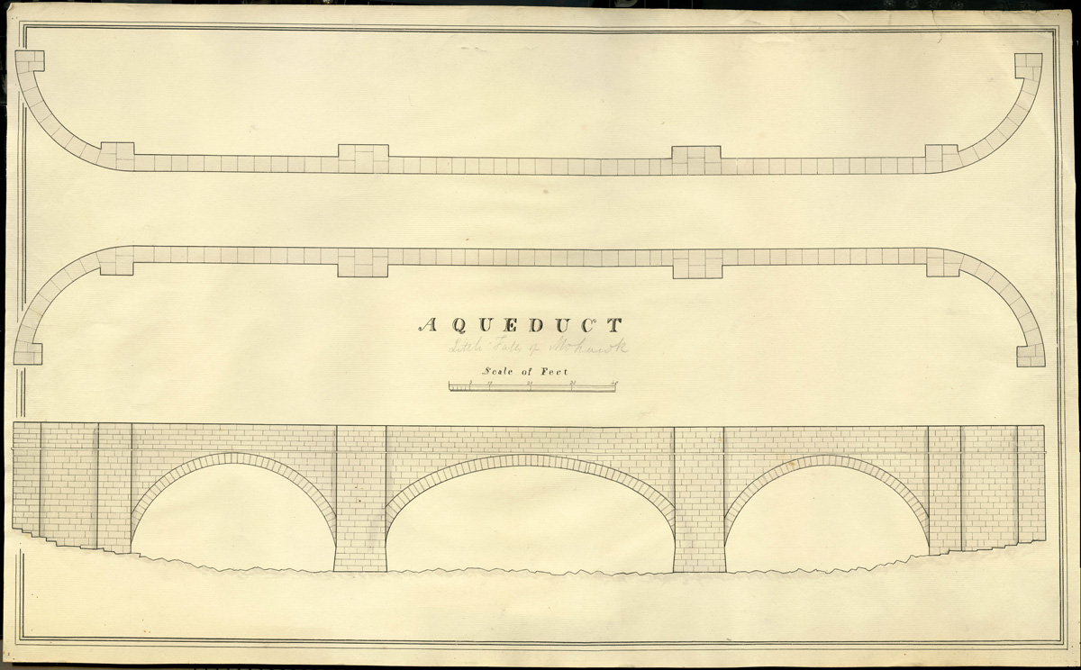
“The aqueduct is a handsome structure of hewn lime stone, consisting of three arches, with abutments and piers resting on a foundation of solid rock; the centre arch of seventy feet chord spans the river; the other two are of fifty feet each . . . . The whole work supports two parapet walls, four feet broad, four and a half feet in height, and measuring two hundred and fourteen feet in length, and having a water way between them of sixteen feet.”
The opening ceremony did not go quite as planned. A perhaps unintentionally droll account published a few days later in the Little Falls People’s Friend is worth quoting in full:
“Thursday, the 17th inst. having been named as the day when the first boat would pass over this splendid work, an immense concourse of people were assembled to view the operation. By about 3 o’clock P. M. our streets were rendered almost impassable by the crowd; the anxiety to see all that was going on was really surprising. At length the water was admitted from the old Canal and poured rapidly across to the new. All eyes were now directed to behold the first glimpse of the anticipated Packet-boat, and ‘expectation fairly stood on tip-toe.’ At this moment, a skiff entered from the Basin, and in this little barque, Capt. Robert Gillespie, of German Flatts, William, son of the late Wm. Alexander, and James Dowling, obtained the honor of being the first navigators of the Little Falls Aqueduct. But unfortunately, an accident soon after happened to the banks at the junction of the Aqueduct and the Erie canal; and it was found also, that the former, from the mortar’s not having had time to dry, emptied the water through the arches. These circumstances prevented the packet from passing that day, and greatly disappointed the spectators. But the deficiency will soon be supplied, and visitors may shortly be gratified with the wished for sight every day.”
Recreating the aqueduct
The new aqueduct instantly became one of the iconic symbols of the new canal and a popular subject for contemporary artists. We have many good images that can be used as references. One of the finest, painted by John William Hill when he was 18 or 19 years old, is included at the top of this post.
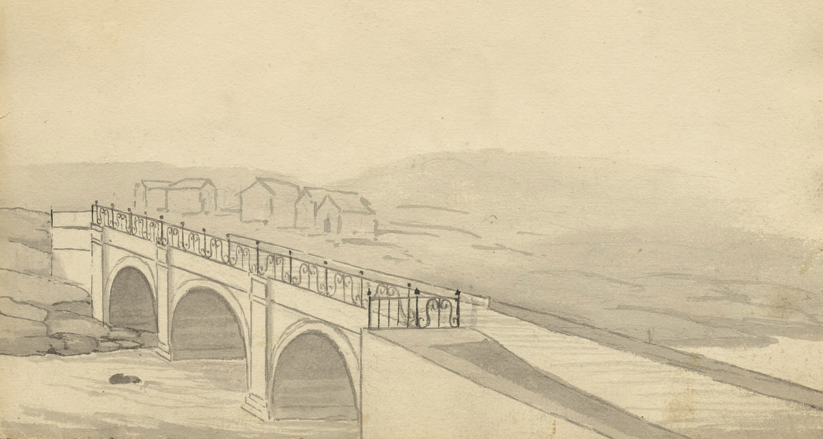
Another good source is a set of watercolor sketches by John Henry Hopkins, an Episcopalian bishop who kept a journal of his travels in November 1825. While his entries regarding the Erie Canal are remarkably concise (“Wednesday, Nov. 9. Still on board the boat proceeding to Utica. Arrived as far as Montezuma by night fall.”), the sketches he created while passing the long hours on deck offer detailed views of the canal only days after it opened. (We will meet Hopkins again in later posts.)
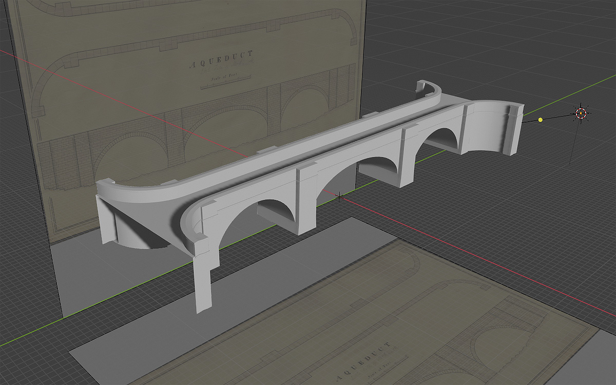
But we will start with an unsigned, undated plan and elevation of an aqueduct found among the papers of John B. Jervis in Rome, New York.
John Jervis is a prime example of the self-made man. He began his career as an axman on an early Erie Canal survey party and, largely self-taught, quickly rose through the ranks of the canal’s surveying and engineering corps. In a career that eventually spanned nearly 50 years, he became America’s preeminent civil engineer — a designer of canals, railroads and, most famously, the Croton Aqueduct in New York City.
The title of the drawing is simply “Aqueduct,” and even though someone has pencilled in the words “Little Falls of Mohawk” underneath, it is possible that it represents a generic aqueduct design. In fact it closely resembles stone aqueducts found on the Chesapeake & Ohio Canal and elsewhere. But the dimensions vary only slightly from those provided by the canal commissioners, and the elevation drawing perfectly matches the east face of the aqueduct shown in Hill’s watercolor.
The Jervis drawing, Hopkins sketch, and Hill painting all indicate that the aqueduct did not have a towpath. This was a surprise at first. But the old canal that it was connected to was not a towpath canal, and the aqueduct’s primary purpose was to serve as a feeder. So this makes sense when you think about it.
These sources provide most of the information needed to start working on a digital model of the aqueduct, which will be the centerpiece of a new scene to be set at Little Falls in 1823.
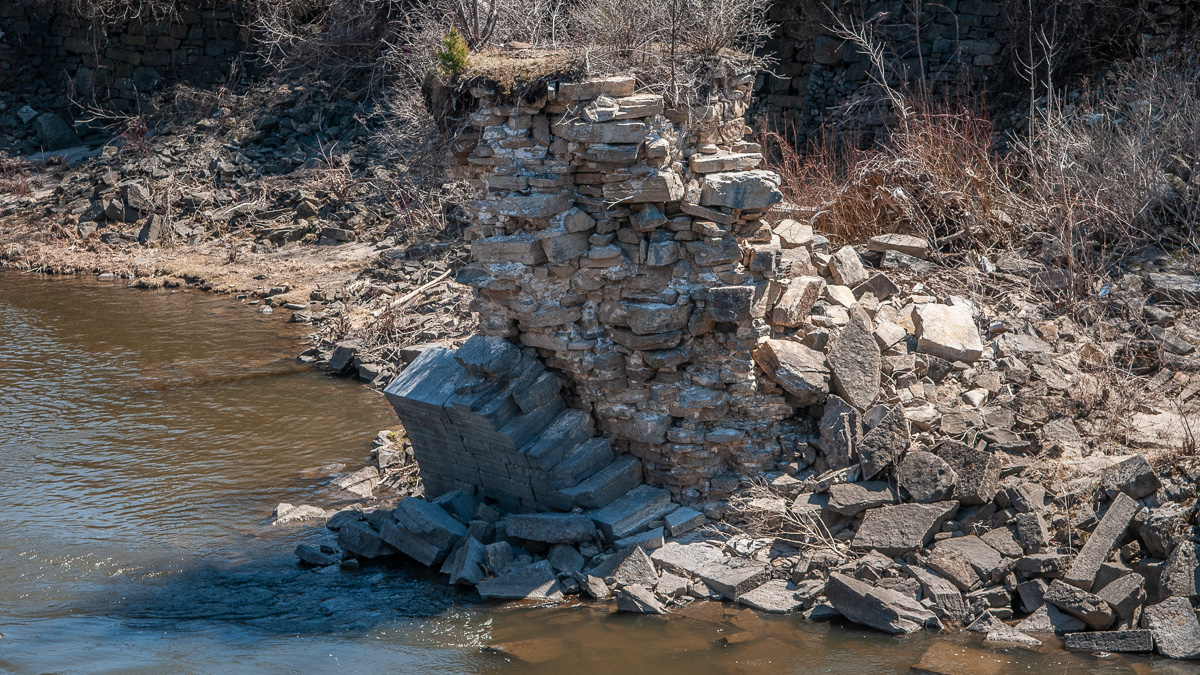
The passing years have not been kind to the Little Falls Aqueduct. Photographs show it in use — or at least watered — through the 19th century. But eventually the old Western Inland Lock Navigation Company canal was filled in to make way for development, depriving the aqueduct of its purpose. Maintenance stopped and, before the turn of the 20th century, it began to crumble. The central arch of this beautiful structure somehow defied the elements more or less intact until the 1990s, when most of it was washed away. Only a remnant, part of the southern pier of this arch, survives today.