The past few weeks have been spent modeling and placing the buildings in the scene, just as they would have appeared in 1916. Enough historical photos of the area survive to allow us to do this with some accuracy.
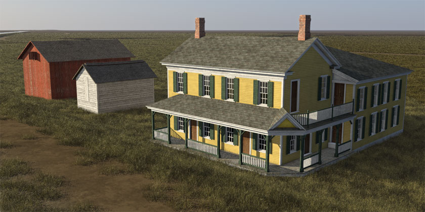
The largest building is the hotel, known then as the Ryan House, located on the north side of the canal. The front section of the building dates from 1815, prior to the construction of the original Erie Canal. The back half was a separate home, moved into position and attached in 1850.
To make room for the canal enlargement in 1912, the entire structure was moved again – on rollers, 50 yards due north, where it remains today as the Adams Basin Inn, a local bed and breakfast.
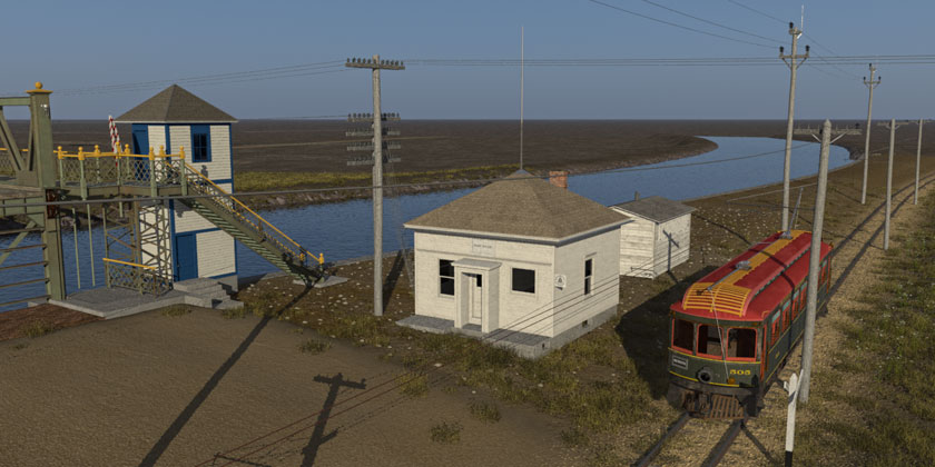
The second group of buildings is on the south side of the canal. The main building served as the post office and telegraph office as well as, apparently, the telephone office for Adams Basin. A square, rather nondescript frame building, it was also moved to make room for the canal enlargement and turned 90 degrees to face Washington Street, the road that the bridge carries over the canal.
The purpose of the small shed behind the post office is a puzzle. It shows up in every historical photo of this location that I’ve seen. All of those images date from the period of the canal enlargement and bridge construction, so there may be some connection. A tool shed, perhaps, or a field kitchen to feed hungry workers? The chimney vent and side windows, which open vertically like the panels on a street vendor’s cart, suggest the latter. By 1916 it that service would no longer be needed, but the shed will remain in our scene.
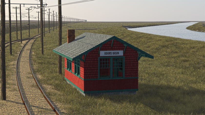
The final building was the most difficult to track down. The Buffalo, Lockport & Rochester railway station is clearly marked on the 1924 plat map of the area. But no trace of it survives. No photographs, either. At least, so it seemed.
But after several months of searching I came across a reference, via Google, to a small box of photos housed in the rare books section of a local library. The photos documented the enlargement of this section of the canal from 1908 through 1912. A visit to the library and perusal of the box turned up three images that included – yes – the interurban railway station.
The photos confirmed the station’s location. The design was similar to those used in other small communities, such as Spencerport and Gasport, though this one was smaller than those.
In placing the buildings I discovered that the interurban railway track was located in the wrong place. It was moved a few meters south and “regraded” to fix the road crossing. Other changes to the base terrain followed so that now, overall, it’s more accurate than before.
Besides the buildings, I’ve also placed the utility poles that carried the electrical power lines for the railway, the telegraph lines for the steam road, and telegraph and telephone lines along Washington Street.
It seems our ancestors were getting used to living beneath an expanding web of wires that, today, we take for granted and rarely notice. I’ve often wondered what they must have thought.