
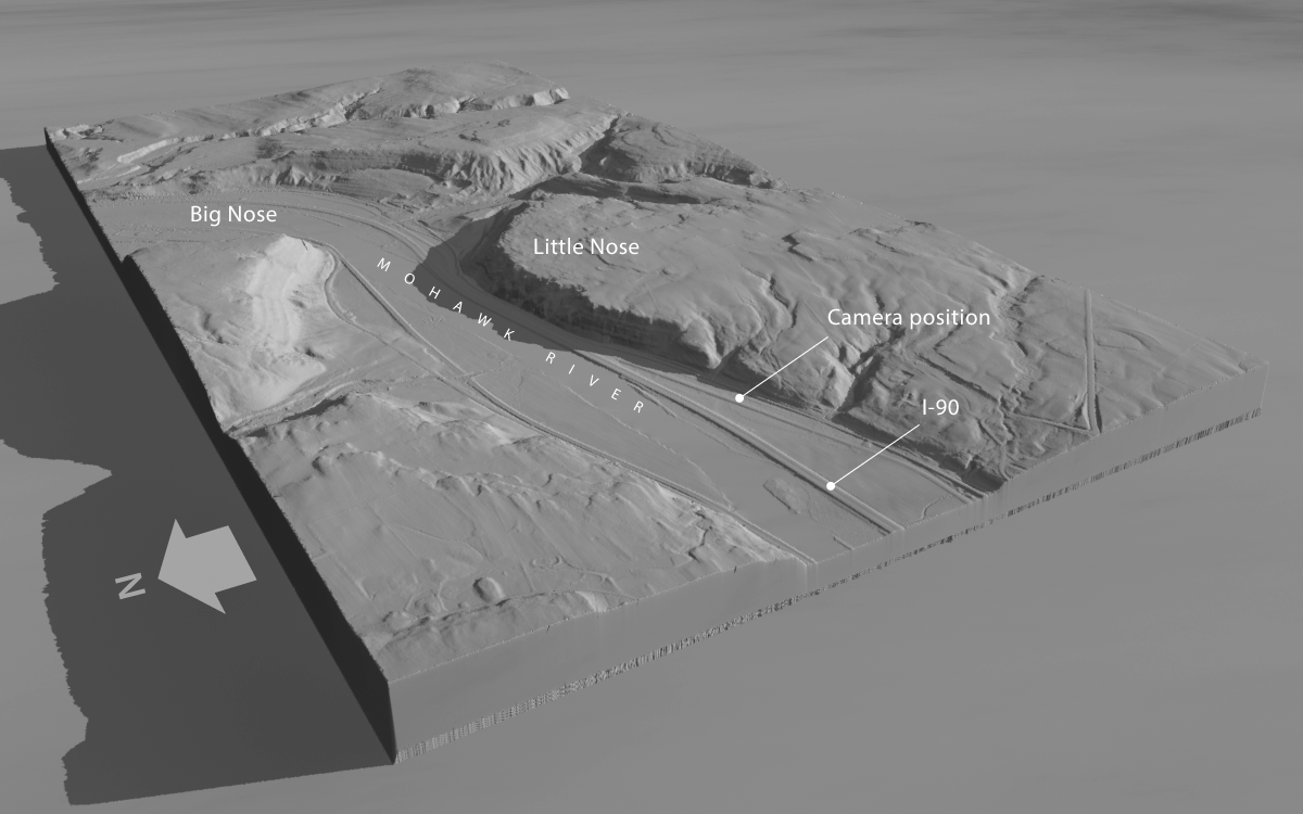
The water gap at the Noses has been a vital communications corridor for millennia. Carved long ago by the post-glacial Iromohawk River as it drained Lake Iroquois, an enormous meltwater reservoir formed by the retreating ice sheet, the gap was viewed as the work of Providence by early proponents of the Erie Canal. Besides providing a natural pathway for the canal, it eventually accommodated railroads, highways, and the New York State Thruway.
As a result the valley has been heavily altered. Aside from the Thruway, which was built in the 1950s, construction in the early 1900s rechanneled and deepened the Mohawk to carry Barge Canal traffic.
Our challenge will be to visualize how the valley would have appeared to early canal travelers – to turn back the clock two centuries.
From the ground up
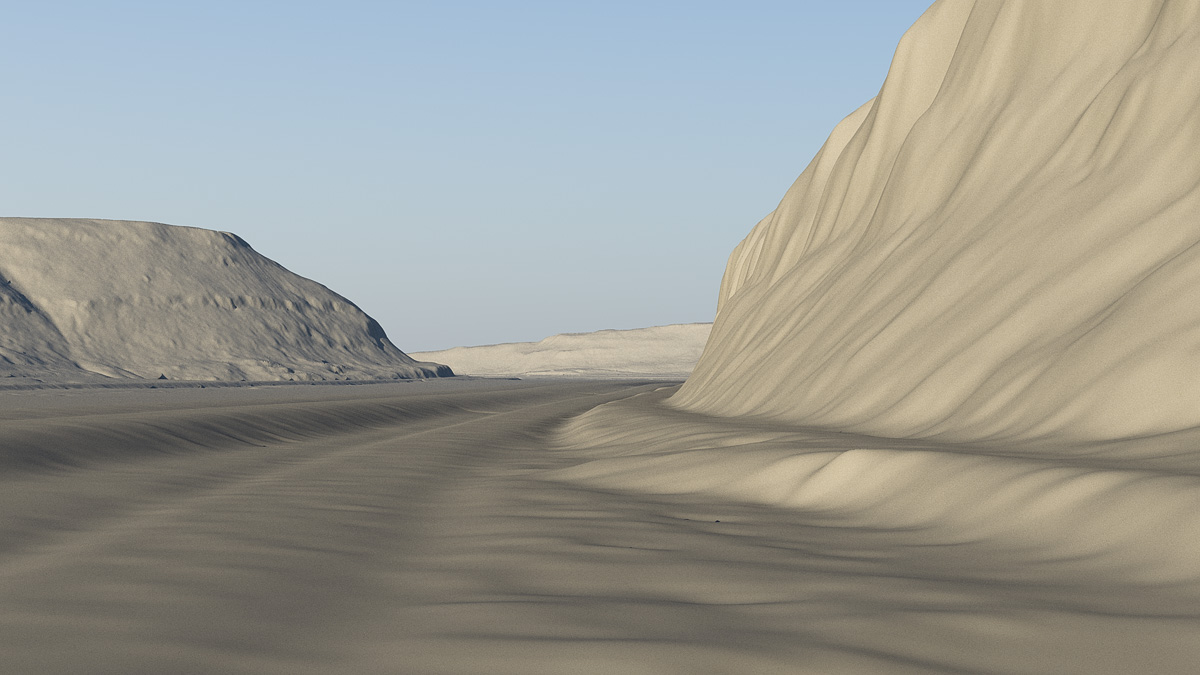
Fortunately, we don’t have to start from scratch. Digital elevation data of the area is freely available from the New York State Geographic Information Systems website. The data, gathered by satellites that precisely map the height of the earth’s surface, can be imported into Terragen and rendered as a three-dimensional scene. The resolution is fine enough to allow us to position the camera at ground level.
But even so, details of the cliffs and ground are indistinct. And modern artifacts, like the Thruway embankments, will have to go.
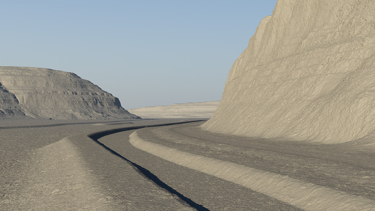
In Terragen, the vertical displacements of the valley floor are edited to remove those artifacts. Then, using Holmes Hutchinson’s 1833 survey maps as a guide, the bed, berm, and towpath of the canal are added, as well as a narrow road hugging the base of the cliff. The Mohawk channel is returned to its rightful place.
High-frequency details in the cliffs and ground surface are also restored.
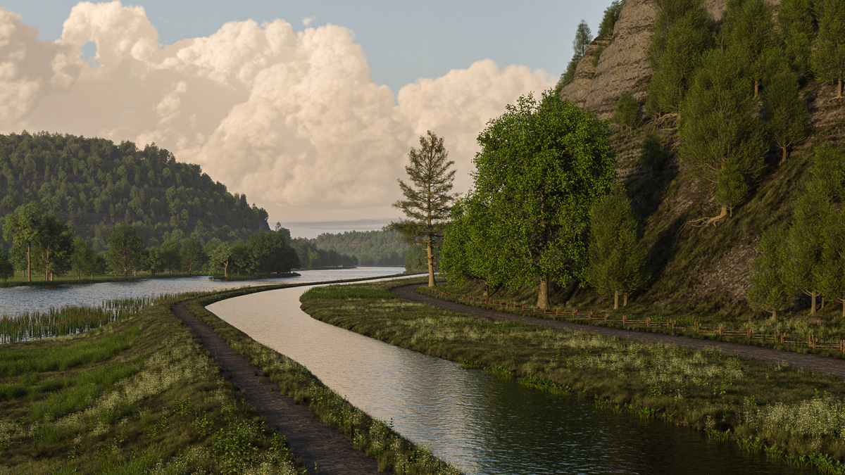
Next, topsoil, road, towpath and cliffs are shaded. Water surfaces are placed for the river and canal. Native ground foliage and tree species are created – grass, sedges, cattails, white pine, cedar, cottonwood, hickory, and others – and distributed throughout the scene. Some towering cumulus clouds add a little drama.
Aside from the inevitable tweaks and refinements, the terrain is finished. The next steps will be to create models of an Erie Canal packet boat, Durham boats to sail on the river, and crews and passengers.