Restoring a lost valley

The Noses DEM
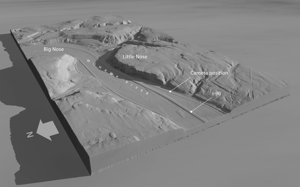
This high-altitude, oblique rendering of area around the Noses was created in Terragen with digital elevation data available from New York state. The view faces southeast and shows the course of the Mohawk River, the New York State Thruway (I-90), and the location of the ground-level camera that will capture our scene.

The water gap at the Noses has been a vital communications corridor for millennia. Carved long ago by the post-glacial Iromohawk River as it drained Lake Iroquois, an enormous meltwater reservoir formed by the retreating ice sheet, the gap was viewed as the work of Providence by early proponents of the Erie Canal. Besides providing a natural pathway for the canal, it eventually accommodated railroads, highways, and the New York State Thruway.

As a result the valley has been heavily altered. Aside from the Thruway, which was built in the 1950s, construction in the early 1900s rechanneled and deepened the Mohawk to carry Barge Canal traffic.

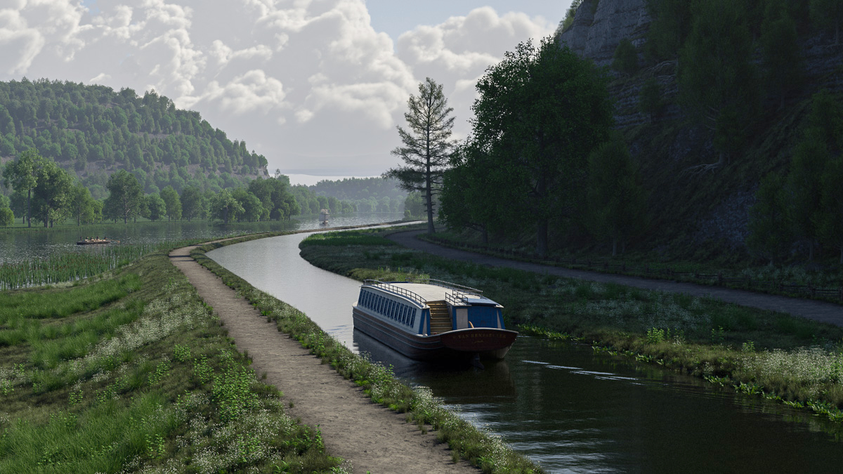
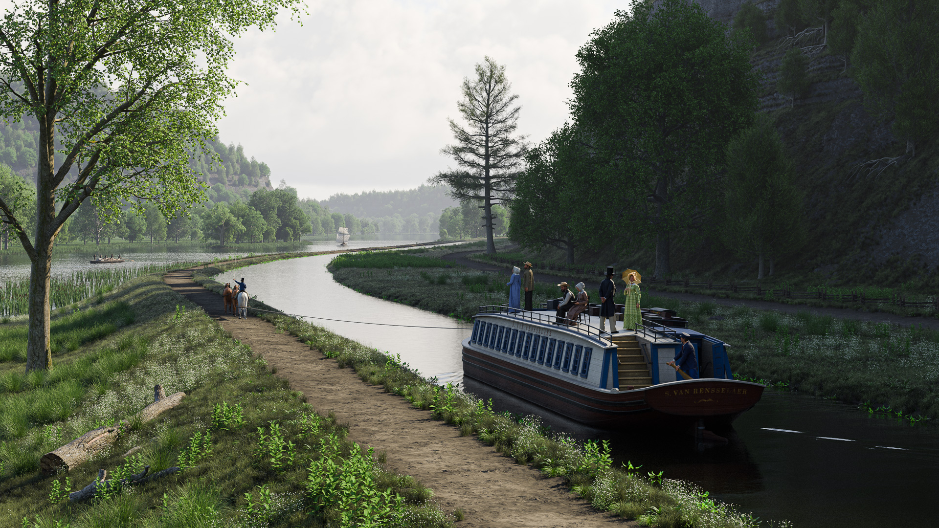
Our challenge will be to visualize how the valley would have appeared to early canal travelers – to turn back the clock two centuries.

Basic terrain
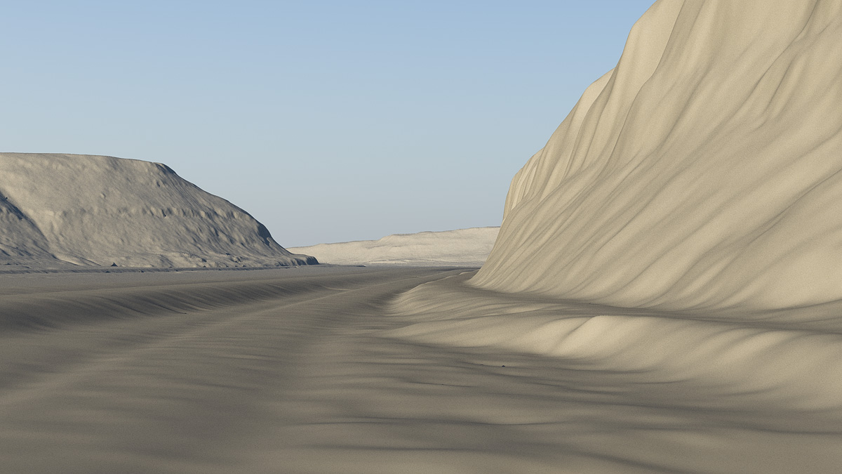
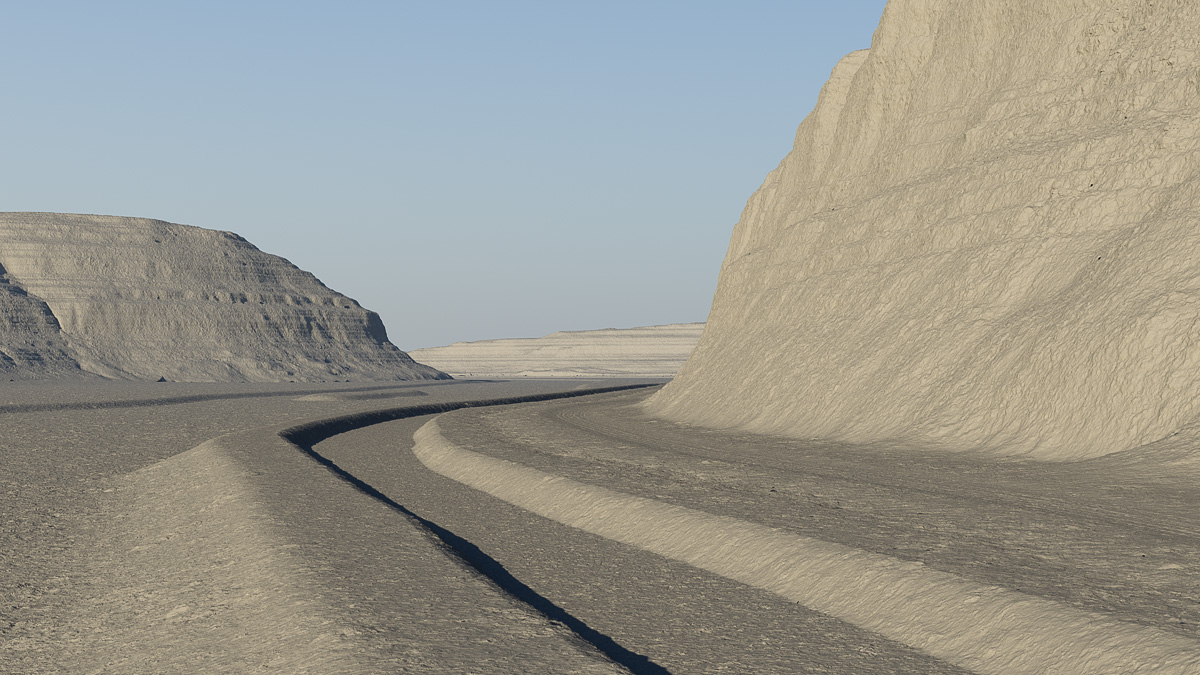
This is the view through the ground-level camera, facing roughly east. The road embankments for I-90 (left) and Route 5S (right) are clearly visible.

From the ground up

Fortunately, we don’t have to start from scratch. Digital elevation data of the area is freely available from the New York State Geographic Information Systems website. The data, gathered by satellites that precisely map the height of the earth’s surface, can be imported into Terragen and rendered as a three-dimensional scene. The resolution is fine enough to allow us to position the camera at ground level.

But even so, details of the cliffs and ground are indistinct. And modern artifacts, like the Thruway embankments, will have to go.

Modified terrain
In Terragen, the terrain is edited to remove the road embankments and to add the berms and bed for the Erie Canal. The Mohawk River has been returned to its pre-20th century location.

In Terragen, the vertical displacements of the valley floor are edited to remove those artifacts. Then, using Holmes Hutchinson’s 1833 survey maps as a guide, the bed, berm, and towpath of the canal are added, as well as a narrow road hugging the base of the cliff. The Mohawk channel is returned to its rightful place.

High-frequency details in the cliffs and ground surface are also restored.

Terrain with foliage
The ground and cliffs are shaded, and foliage and water surfaces are added, to complete the terrain.

Next, topsoil, road, towpath and cliffs are shaded. Water surfaces are placed for the river and canal. Native ground foliage and tree species are created – grass, sedges, cattails, white pine, cedar, cottonwood, hickory, and others – and distributed throughout the scene. Some towering cumulus clouds add a little drama.

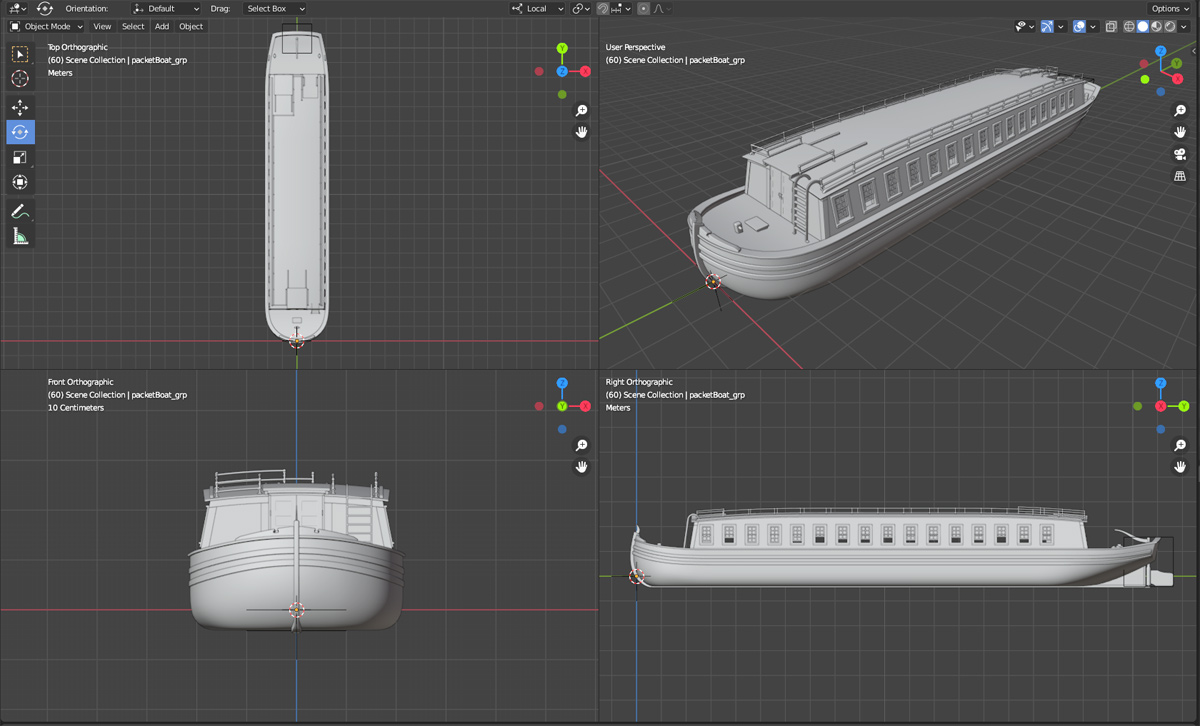
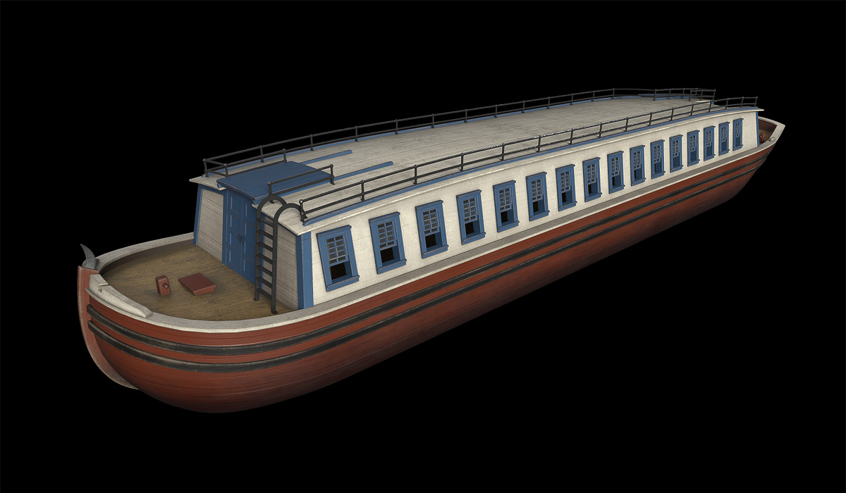
Aside from the inevitable tweaks and refinements, the terrain is finished. The next steps will be to create models of an Erie Canal packet boat, Durham boats to sail on the river, and crews and passengers.

Navigating the Noses

Travelling on the Erie Canal
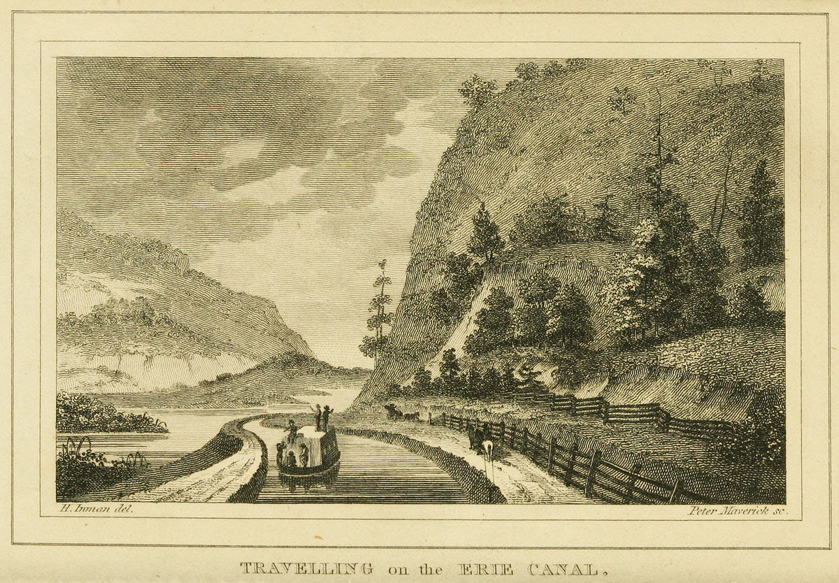
An Erie Canal packet boat passes the Noses in this view, published in the 1825 edition of “The Northern Traveller” by Theodore Dwight. The landscape is rendered accurately; however, the towpath should be on the opposite side of the canal. Henry Inman, the artist (designated “del” here, for “delineator”) was an early 19th-century portrait and landscape painter. Peter Maverick, the engraver (“sc” for “sculpsit”), is also remembered as one of the first lithographers in the United States. (Library of Congress)

The subject of the next Erie Canal scene will provide a welcome change of pace. Instead of the scarred and blasted landscape of the Deep Cut, we’ll go to a place where the canal engineers accommodated nature, where the canal’s gentle curves paralleled the Mohawk River as both made their way toward Albany and the Hudson River.

The place is known as The Noses, named for two cliffs that frame a narrow gap in the hills. The Mohawk flows between them as it crosses the Appalachian ridge, forming the only east-west water route that breaks through that mountain barrier over its entire extent from Maine to northern Alabama. It is the key geological feature that made the Erie Canal possible in the first place.

Plan of the river &c from Albany to Oswego in America
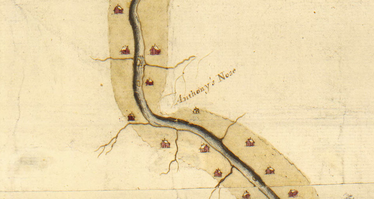
Anthony’s Nose is included as a distinctive landmark in this 1756 map of the Mohawk River. (William L. Clements Library/University of Michigan)

The Noses themselves are landmarks with references dating back to the colonial era. Back then, the larger cliff was known as “Anthony’s Nose.”

Anthony’s Nose, on the north side of the Mohawk, is today simply called “Big Nose.” Facing it across the way, on the south side, is Little Nose. The gap in between is an historic line of communication, and after the canal was built the railroad soon followed. Today, the New York State Thruway (Interstate 90) takes the same route.

The Noses by Phil Scalia
A view of The Noses as they appear today, looking west. The New York State Thruway passes below. To its left, visible through the trees, is State Route 5S, which closely follows the path of the old Erie Canal. Today, the “canalized” Mohawk River carries Erie Canal boat traffic. (Photograph copyright Philip Scalia 2016)

A children’s book published in 1852, Marco Paul’s Voyages and Travels: Erie Canal, describes a trip through the gap by rail:

“For there is a place here called the Pass of the Mohawk. It is where the river flows through a narrow passage in the mountains, with extensive ledges of rock and lofty cliffs on either hand. As the train of cars advanced up this defile, Forester and Marco perceived that the mountainous ranges approached nearer and nearer, until the river, the turnpike, the railroad and the canal were crowded close together and Marco could look down upon them from the window of the car, running side by side, and hemmed in on either hand by precipices of ragged rocks.”

David Vaughan Map of the Noses
This map of Erie Canal at the Noses was drawn in 1851 by David Vaughan. It shows the original Erie Canal as well as proposed changes for the First Enlargement. The map is upside-down, with south pointing toward the top edge. (New York State Archives)
David Vaughan Map Detail West
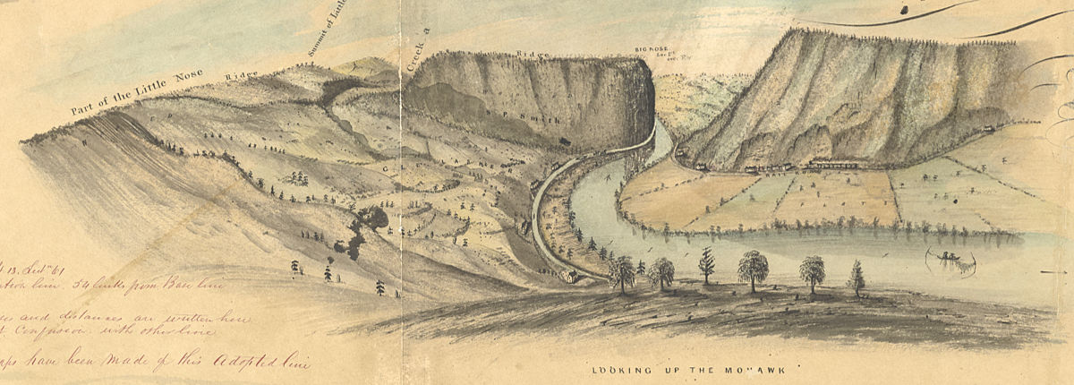
A drawing from David Vaughan’s 1851 map matches the view captured by photographer Philip Scalia, above. Areas that today are wooded were clearcut for agriculture in the 19th century. (New York State Archives)

Historical references

There is a wealth of visual information about this area, dating from an 1811 survey map drawn by Benjamin Wright, who later became the Erie Canal’s chief engineer. We also have a spectacular map created by draftsman David Vaughan in 1851. Vaughan’s map is useful because it features detailed drawings – one of his hallmarks – that provide clues to the state of the landscape. Today the area is mostly covered with second-growth woods. But in the early 19th century much of it would have been cleared for farming.

Even more valuable are the so-called Holmes Hutchinson maps of the Original Erie. These were the result of a survey of New York’s canal system commissioned by the state legislature and carried out 1832–1843. The maps, beautifully executed in in ink, wash and charcoal, depict the canal line at a scale of two chains — 132 feet — to the inch. There are nearly 1,000 altogether, and high-resolution scans of all of them are available at the New York State Archives website.

Holmes Hutchinson Map
This Holmes Hutchinson 1833 survey map precisely locates the path of the original Erie Canal and the Mohawk River channel. This is the area that will be depicted in the foreground of our scene. As with other 19th-century survey maps, this one identifies the cliff south of the canal as Big Nose. (New York State Archives)

The map shown here locates the foreground of the scene, so it and its neighbors will be used to help reconstruct the area as it would have appeared in the early 19th century.

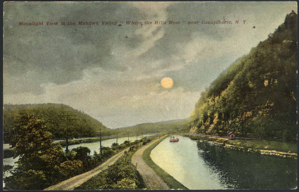
Several postcards, printed in the early 1900s, also survive. The original Erie Canal was long gone by then, superseded by the mid-19th-century First Enlargement. But they depict the Noses and Mohawk River before the final Barge Canal enlargement and the incursion of the New York State Thruway, both of which dramatically altered the topography of this historic corridor.

Moonlight View in the Mohawk Valley
An early 20th-century postcard presents a romantic, hand-tinted view of the Enlarged Erie Canal at The Noses. (“Moonlight View in the Mohawk Valley,” Madden Collection, The Canal Society of New York State.)

Finishing touches

Excavation of the Deep Cut
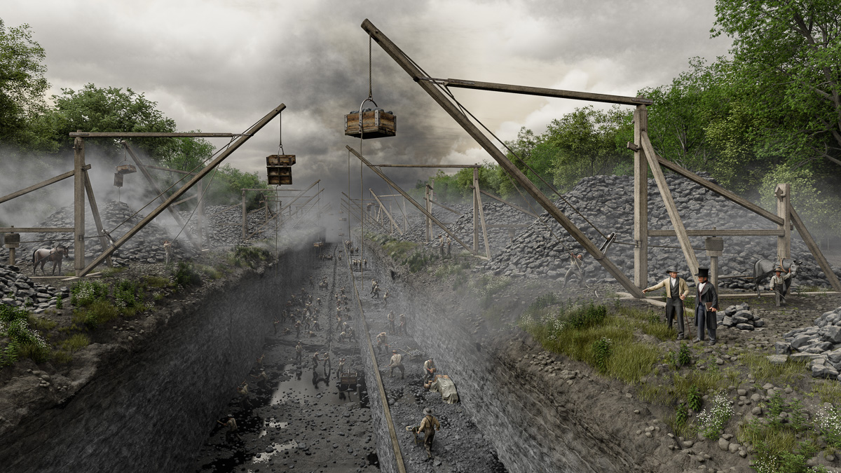
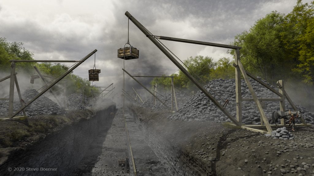
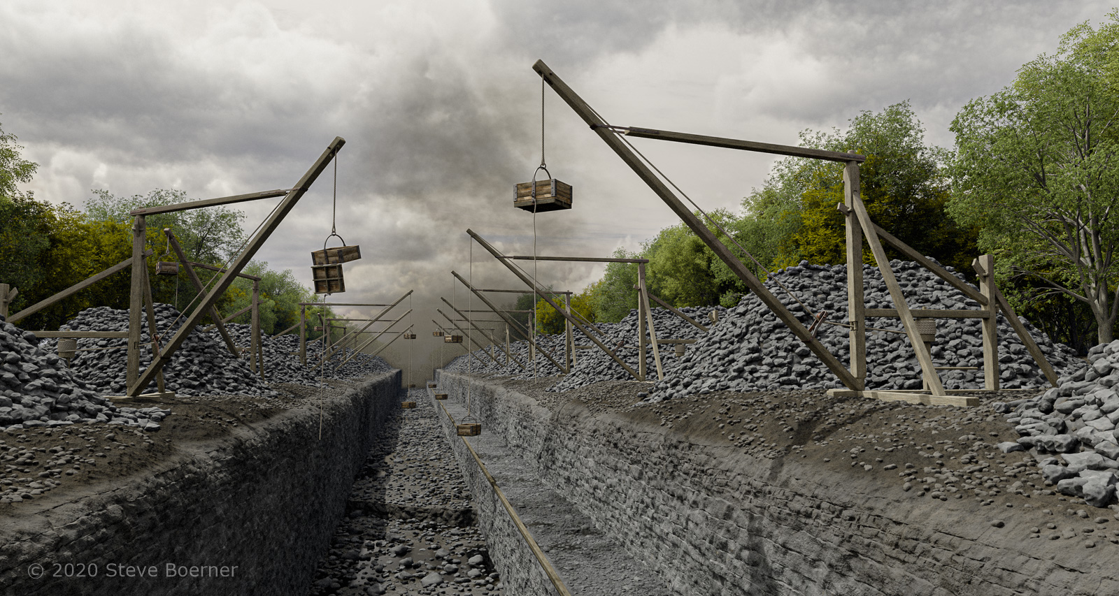
Final rendering of the excavation of the Deep Cut, June 15, 1824.

The Deep Cut Excavation scene has finally reached the final step: fixing mistakes, correcting small problems, and fine-tuning a few small details.

Foliage
An assortment of native plants that would have been around to recolonize the grubbed landscape: annual daisy fleabane (left), ragweed, and pilewort.

By summer 1824 work had been ongoing for several seasons, and in upstate New York it doesn’t take long for Mother Nature to start reclaiming lost territory. So a few species of foliage – hardy pioneers like ragweed and daisy fleabane – have been added to the grubbed surface on either side of the cut.

Excavation of the Deep Cut
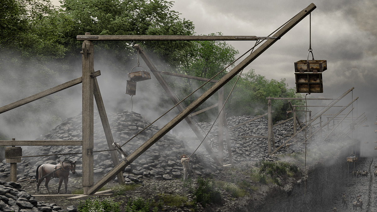
Observers at the time noted that a single man could pull the jib of Orange Dibble’s horse-powered crane into position.

A narrow ditch, excavated by workers to drain away excess water, has been added to the floor of the cut. Dust clouds have been inserted and the position of the sun finalized at 9:50 a.m., June 15, 1824, just out of the upper left corner of the frame.

Excavation of the Deep Cut
By the summer of 1824, work along this section of the Deep Cut was reaching its maximum depth of 31 feet. Excavation was constantly delayed by water, which seeped into the cut from the surface and springs, and workers chiseled a ditch to redirect it. Meanwhile the surface of the towpath was leveled and a wooden sill was added to prevent the canal boats’ tow ropes from getting snagged.

That will have to do it for now. In researching the scene I’ve been struck by how little we know about day-to-day work on the Deep Cut. The evidence is fragmentary and incomplete – bundles of invoices, a handful of eyewitness descriptions (some written years later), a single lithograph drawn “from life.”

Excavation of the Deep Cut
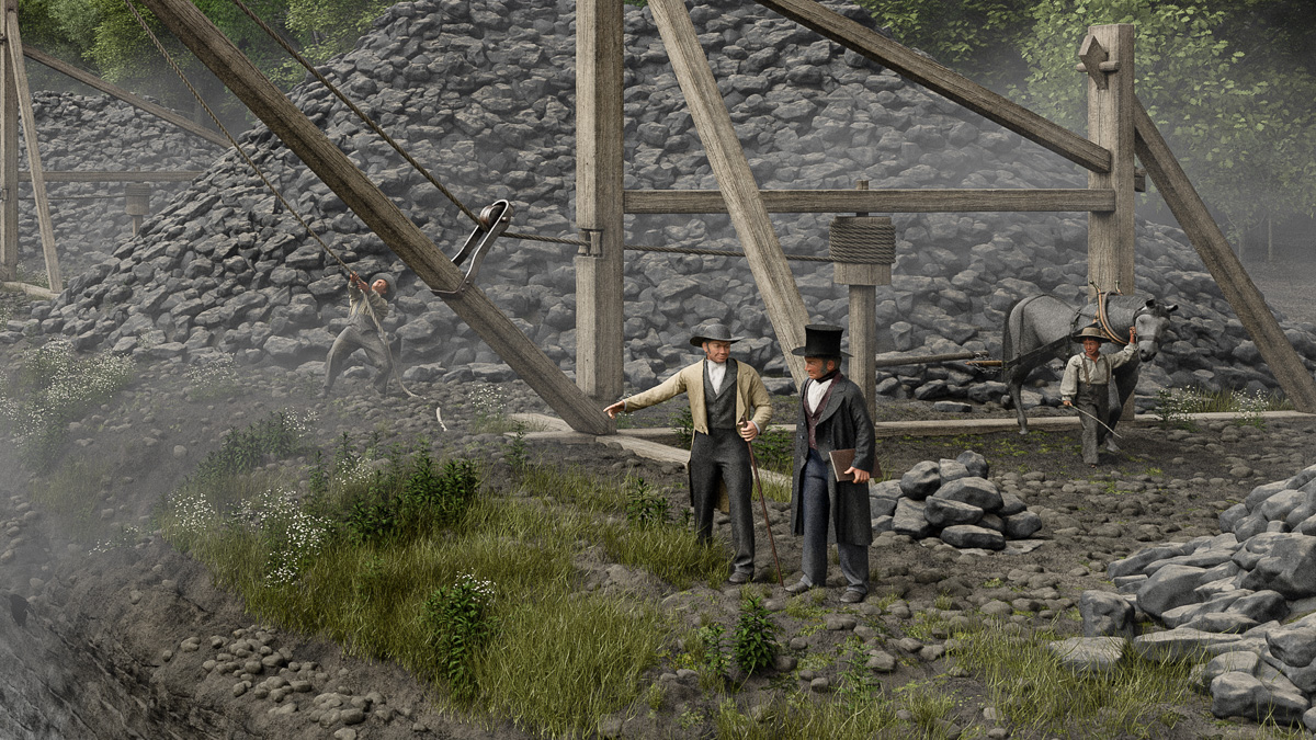
The contractor and engineer inspect the progress of the work.

Tantalizing clues to other details occur here and there, including references to horse-powered water pumps in contractor receipts and the canal commissioners’ reports, and the patent record for Darius Comstock’s excavator. But the clues aren’t enough to go on, so those details had to be omitted. This landscape is just a partial reflection, accurate but with a few missing pieces. The actual scene no doubt would have been a little busier and more chaotic.

The contractor and the engineer

Contractor and Chief Engineer
The final two figures for the Deep Cut scene represent real people: Darius Comstock, contractor (left), and Nathan Roberts, principal engineer for the western section of the Erie Canal.

The Deep Cut scene has been populated with laborers drilling, chipping, and hauling rocks. Only two figures remain to be added. Both will represent real people.

In 1822 the four original Mountain Ridge contracts were subdivided into six contracts. The contract for Section 3, which commenced one mile south of the locks, was awarded to a local landowner named Darius Comstock.

The Comstocks, a family of Quakers from Massachusetts, had recently settled in Farmington, southeast of Rochester. Like many other newly arrived Yankees, several members of the family were restless to move further west.

An opportunity presented itself as land went on sale in the Holland Land Purchase west of the Genesee River. Nathan and Zeno Comstock purchased parcels in a sparsely settled area near Eighteen Mile Creek. This was a stroke of good fortune, for that very spot – which surveyors would soon designate as the place where the Erie Canal would ascend the Mountain Ridge – would become the village of Lockport.

Other members of the Comstock family joined them, including Darius, who, once canal construction began, would submit his bid for Section 3.

Palmyra Herald
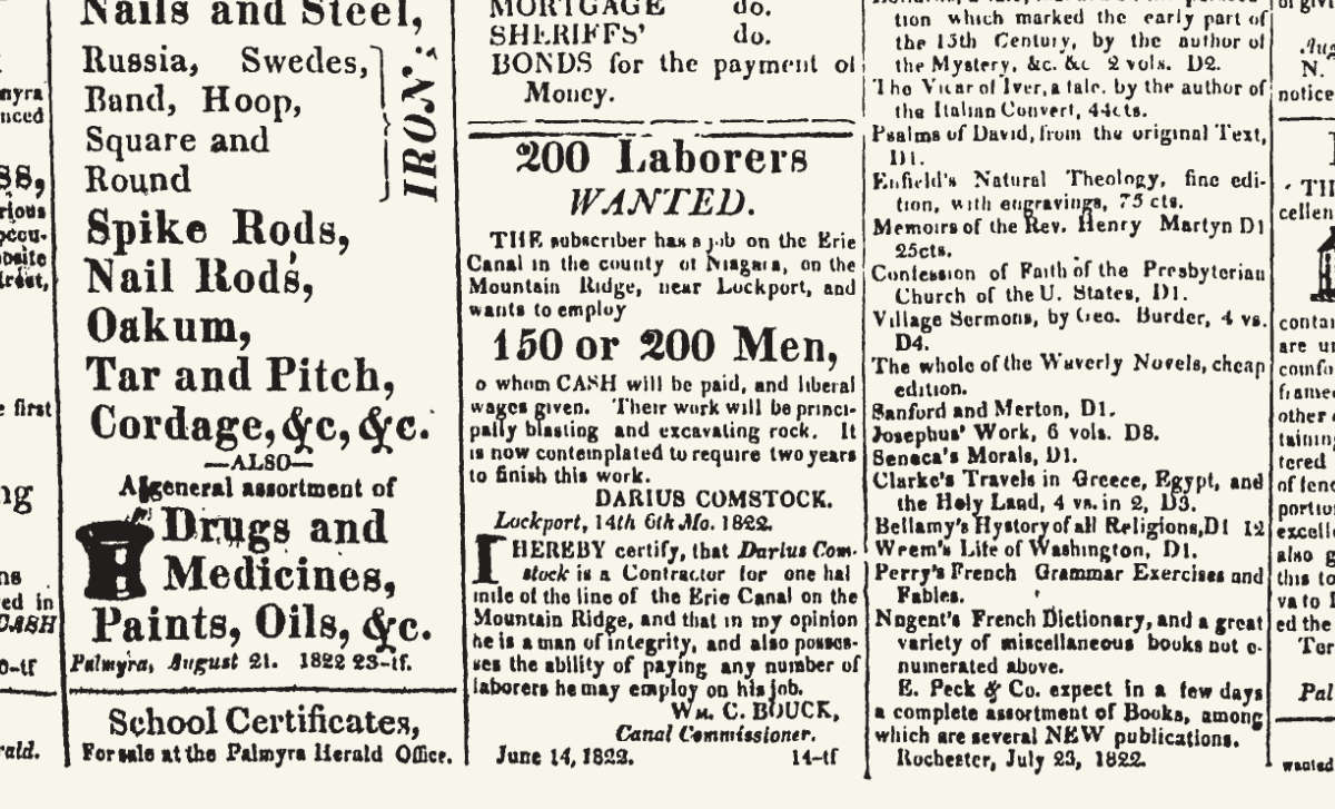
A notice placed by Darius Comstock in the Sept. 18, 1822 issue of the Palmyra Herald and Canal Advertiser advertises places for 150 to 200 laborers for his section of the Deep Cut. Canal contractors routinely advertised more positions than were available to in an effort to suppress wages. (New York Historic Newspapers)

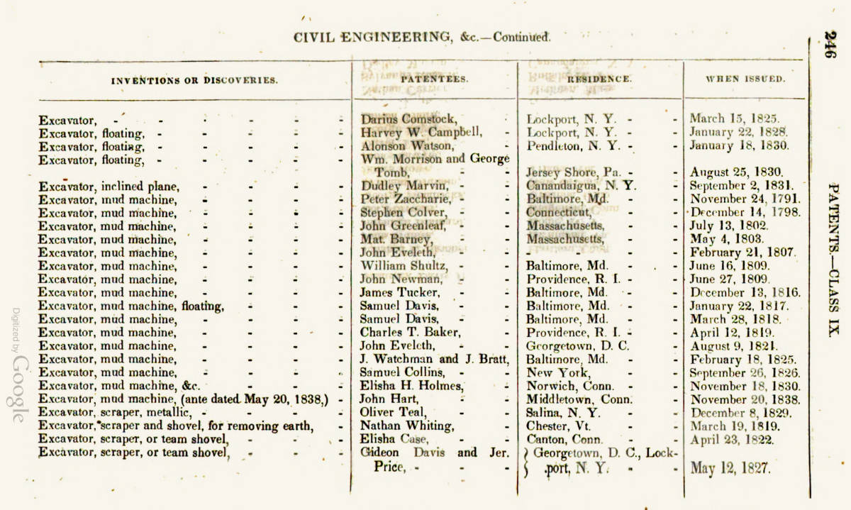
Besides being a pioneer, a savvy land speculator, a pillar of the community, and abolitionist, Darius Comstock was also, apparently, an inventor. A list published by the government in 1840 records a patent issued to him in March, 1825, for an “excavator.” What it looked like, and how it operated, will probably remain a mystery. Any records filed at the United States Patent Office would have been destroyed in the December 1836 fire (along with the records for Orange Dibble’s crane and many other early American inventions).

Digest of Patents
A list of patents published in 1840 includes a reference to an “excavator” patented by Darius Comstock in 1825. (Google Books)

Whether Darius Comstock made use of his patent is not known. His section of the Deep Cut had been completed the year before. By 1825, even before the Erie Canal was finished, his attention was diverted further west, yet again. Soon he would relocate to help establish a new Quaker community in Adrian, Michigan.

Nathan Roberts, who in 1822 was put in charge of the canal between Lockport and Buffalo, had no formal training in engineering. In this regard he was no different than any of the other Erie Canal engineers. Every one of them learned their profession on the job.

Roberts had started his career as an itinerant mathematics teacher on the New York frontier. In Whitestown, where he taught school, he no doubt was very familiar with water navigation on the nearby Mohawk River. One of his students was Canvass White, who also would become an Erie Canal engineer.

Hired by Benjamin Wright to take part in the initial 1816 canal survey, Roberts’ gift for mathematics would continue to open doors. He quickly rose in the ranks of the fledgling engineering corps and is best remembered as the designer of Lockport’s iconic “Flight of Five” staircase locks.

Later, as a graduate of the “Erie Canal School of Engineering,” Roberts would take charge of other civil engineering projects, including a new railroad bridge over the Potomac River at Harper’s Ferry.

Troy Sentinel
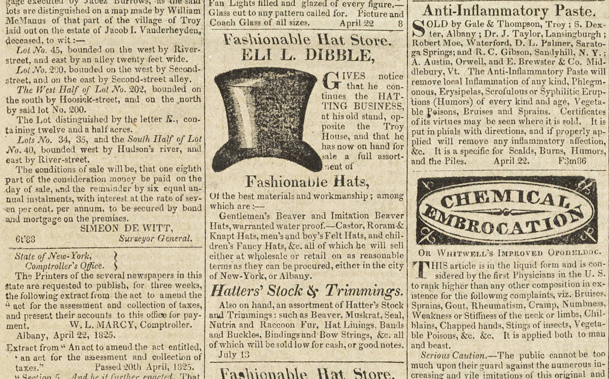
Several advertisements for “Fashionable Hats,” including those made by Eli L. Dibble, graced the pages of the Troy Sentinel in 1825. (New York Historic Newspapers)

Designing the characters

Apparently there are no surviving images – paintings or silhouettes – of Darius Comstock, so I was free to make my own interpretation of how he may have looked. We do have a painting of Nathan Roberts, done some 20 years after the canal was built.

The clothing they might have worn is open to conjecture. For the purposes of the illustration, I’m assuming that, as successful men, they would have dressed the part. Though as a devout Quaker, Comstock would have worn clothing that was somewhat more plain.

But not homespun. Despite its location on the New York frontier, Lockport now was connected to eastern markets by the canal, which was navigable from the foot of the locks all the way to New York City. Items that previously would have been considered luxuries – including fine fabrics – were arriving daily.

The Tailor's Master-Piece
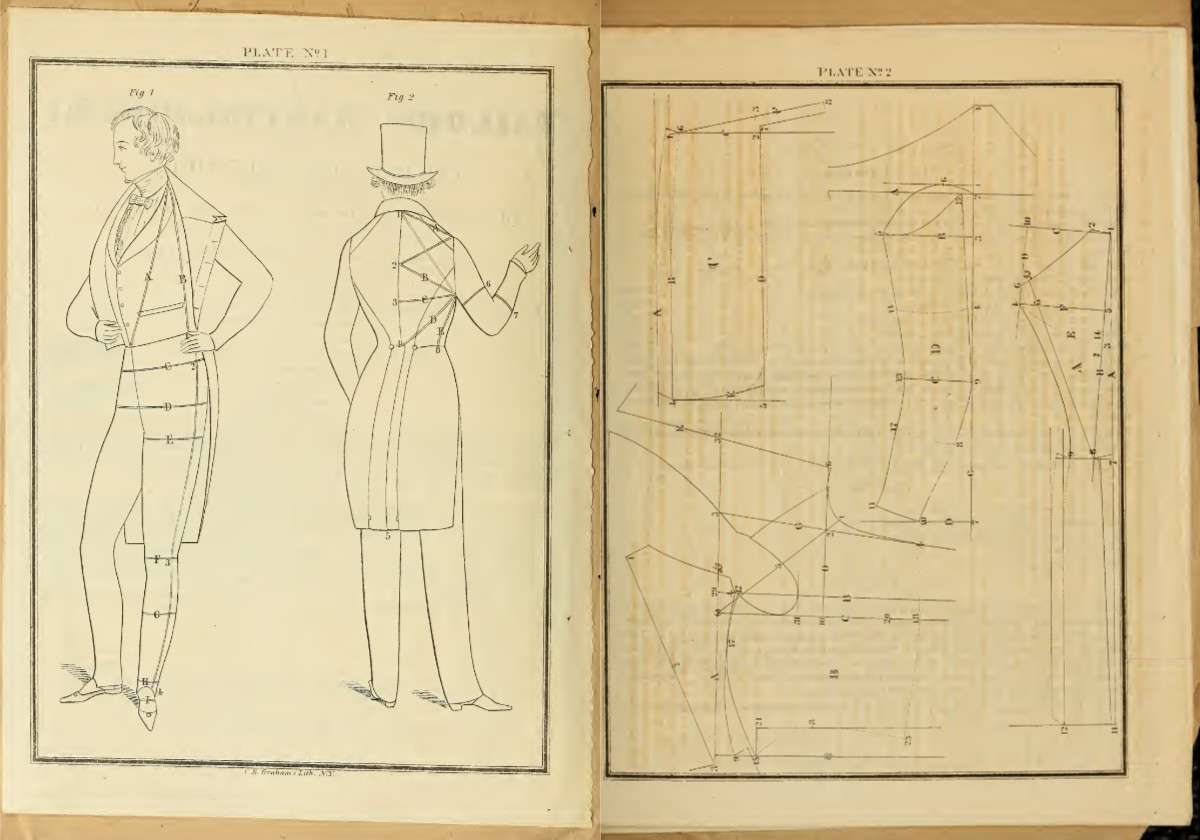
Two plates from The Taylor’s Master-Piece, published in 1840, show how to measure and cut a man’s coat. (Library of Congress via Internet Archive)

As for Roberts, well, as principal engineer he probably wore the three-piece suit of the day – pantaloons, waistcoat, and frock coat. And a top hat, of course, which in the early 19th century was considered de rigueur.

Fortunately, several 19th-century tailor’s guides – from The Taylor’s Complete Guide to The Tailor’s Friendly Instructor – have been digitized are are available online. The patterns they include are not like today’s patterns; they are really measuring guides. But (after some study and more than a little head-scratching) they can be picked apart and adapted.

Marvelous Designer
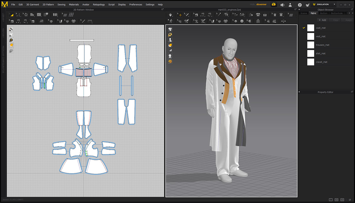
Clothes make the man: Historical clothing patterns from 19th-century tailoring manuals are adapted and fit to a character in Marvelous Designer.

Using Marvelous Designer, a CAD-based software application, the patterns can be cut out, stitched together, and fit to the human character models. The program then handles the clothing simulation, taking gravity and fabric characteristics into account. The clothed characters are then moved into Terragen and shaded.

I’ve been using Marvelous Designer for a while now – all of the laborer’s clothing in the scene are variations of the same simple work shirt and trouser patterns – but these more upscale outfits were a challenge. It’s given me a much greater appreciation for anyone who works in the garment industry, especially designers, dressmakers and tailors. It’s a good thing my rough efforts are strictly digital.

Paddy on the canal

Canal worker
Test rendering of a canal worker model, in period clothing, for the Deep Cut scene.

One of the most enduring myths about the Erie Canal is that it was built by Irish immigrants. In fact, the majority of its 363 miles were contracted out to and dug by native New Yorkers. In their 1819 report, the canal commissioners had proudly reported that “three-fourths of all the labourers” working on the canal “were born among us.”

But there are many reasons why the tale of Irish workers has been so persistent.

To begin with, by the commissioners’ own account fully one-fourth of the laborers working on the canal during the first full year of construction were immigrants. While that group would have included people of many nationalities, most probably came from Ireland. As work progressed that number grew until Irish workers predominated along certain sections of the canal.

Those sections were among the worst places to work along the line. They included the Cayuga Marsh, the Great Embankment, and the Deep Cut. Native-born Americans, it seems, were more than willing to leave the dirtiest, most dangerous work to the latest arrivals.

Worker with pickaxe
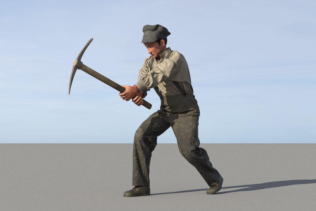
A canal worker wields a pickaxe in another test rendering.

Predominantly young, male and single, the Irish brought from the old country entrenched notions about masculine behavior, a strange religion, and a stranger language. They soon earned a reputation for fighting, which “native” Americans attributed to the bottle, because the Irish had a reputation for that as well.

By all accounts, they were a rough bunch.

But antebellum American society already was violent, especially along the frontier. Americans of all classes, to put it mildly, drank like fish.

But the stereotypes became excuses to keep the newcomers in their place. In Lockport they were relegated to drafty, squalid shacks along the excavation and in “Lowertown,” while established citizens maintained a prosperous, middle-class existence in the “Upper Village.”

Paddy Upon the Canal
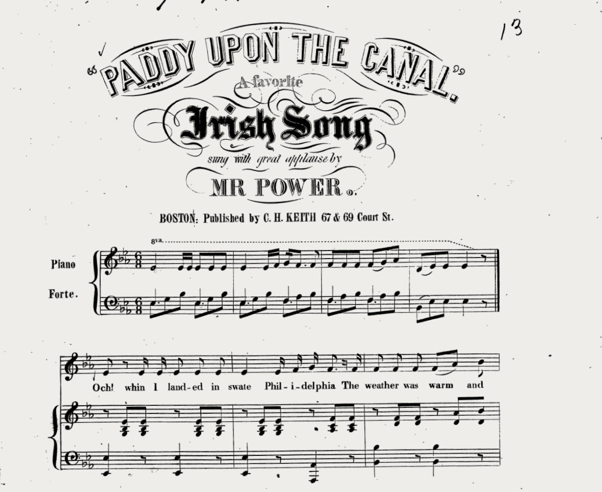
Sheet music for “Paddy Upon the Canal,” published in 1843. (Library of Congress) You can listen to a recording here.

The Irish workers’ reputation for violence and drink may well have been exaggerated. We will never know for certain, because the workers themselves and their families, for the most part, were illiterate and left behind no records.

But when all was said and done, the Irish and other immigrant workers completed the tough, miserable task of excavating the Deep Cut. They dug, and drilled, and died — in explosions, from falling rocks, from disease. Over four long years they chipped and blasted their way through the Mountain Ridge, overcoming that final obstacle to open the canal from Buffalo to New York City.

Take five
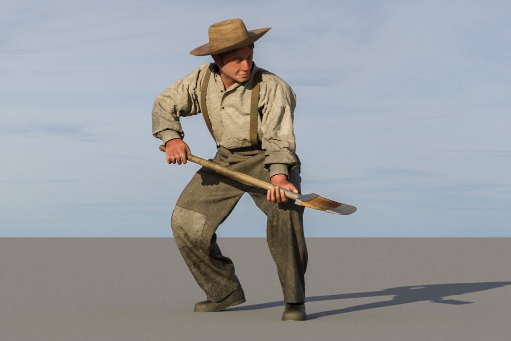
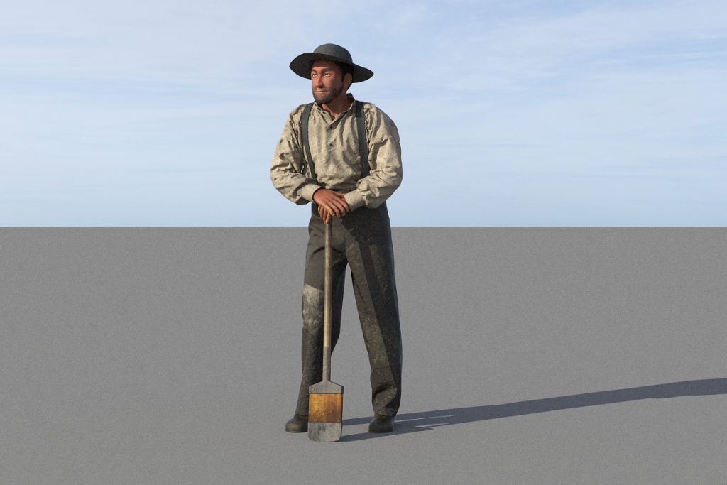
A worker takes a breather, leaning on a shovel modeled on one displayed at the Erie Canal Museum in Syracuse, New York.

Populating the scene

In his book, Stairway to Empire: Lockport, the Erie Canal, and the Shaping of America, historian Patrick McGreevy uses surviving expense vouchers to estimate the crew sizes for several contractors working in the Deep Cut. He calculates an average crew size of 94 men, yielding a total workforce of 2,068 for the 22 contracts that were active through July 1824.

This is a larger figure than the 1,500 men mentioned in Colden’s Memoir. Regardless, the size of the workforce was unprecedented in this country.

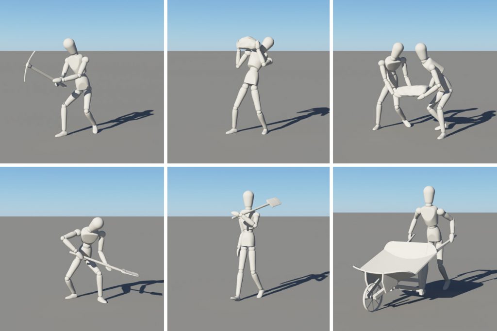
Mannequin poses
A simple mannequin model made it easy to try out different poses.

Because the excavation on the Mountain Ridge had been going so slowly, New York in 1822 assumed direct supervision of all of the contracts there, turning the contractors into middle managers paid by the state. More workers were recruited and others shifted to the summit from other sections of the canal to achieve this remarkable concentration of labor.

McGreevy’s estimate gives us a good idea of the number of workers that will be needed for the Deep Cut scene. It depicts a single contract, so we’ll need about 100 human models.

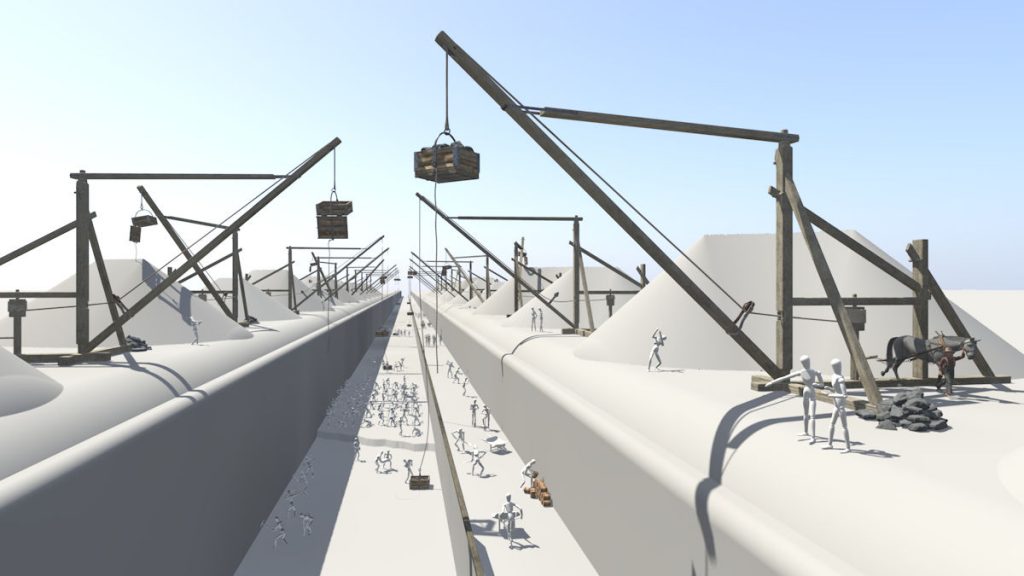
Placing the mannequins
The posed mannequins were placed in a simplified version of the scene.

Of course, we don’t need 100 unique models to accomplish this. Duplicates can represent groups of workers, especially in the distance. To figure out the number of models that would be needed, I put together a simple mannequin model and used it to quickly make a series of poses, eventually winnowing the number down to about 20.

The selected mannequins were placed in the scene. This eliminated a lot of guesswork and helped to create a list of figures needed, their poses, and locations. After that it just became a matter of setting up a pipeline to produce the actual human models. This post includes a test renderings of a few that have been completed, and more are on the way.

The Deep Cut: Finishing the terrain

Deep Cut terrain
Work in progress: The horse and driver models provide a sense of scale for the completed Deep Cut terrain in this Terragen rendering. Many more human figures will be added to the scene.

This is just a quick update, a pause to take stock before starting final work on the Deep Cut scene.

The terrain itself is complete, aside from a few minor adjustments and tweaks. The horse and driver models have been placed and provide a sense of scale. Other models will be added over the next few weeks — a few workers to man the cranes, and many more on the floor of the cut. Plus a contractor and perhaps a chief engineer.

I keep thinking of that description of the excavation in Cadwallader Colden’s Memoir, which reads in part:

“Each of these cranes formed a heap of rocks, . . . and when in full operation for three miles in length, and the work progressing under the hands of fifteen hundred men, under a continual cloud of smoke, and almost incessant explosion of rocks, produced a novel and interesting scene.”

When all is done — and there remains much to do — I hope that the finished picture will convey the same sense of scale and wonder.

Tools of the trade

Tools
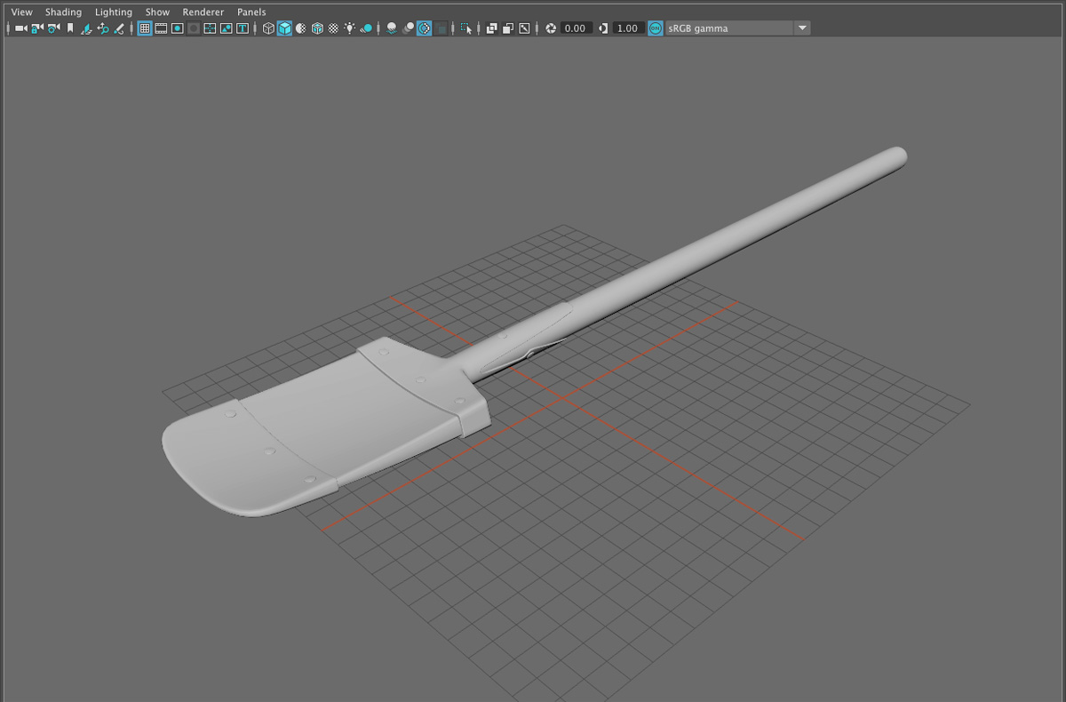
Rendering in a test environment to check shading of the new tool models, including a wheelbarrow, crowbar, sledgehammer, shovel, drill, pickax, and two 25-pound kegs of Du Pont blasting powder.

The workers who excavated the Erie Canal used primitive tools: picks, shovels, and bars – long crowbars used to pry loose layers of rock. A laborer from the Middle Ages or even ancient Rome would not have felt much out of place in the Deep Cut in 1824.

They would have noticed one change, however, which was the use of black powder to blast through the solid rock. Black powder had been used for mining since the early 17th century. However, blasting – or “blowing,” as it was commonly called then – was haphazard and extremely dangerous despite nearly two hundred years of practical experience.

Powder keg
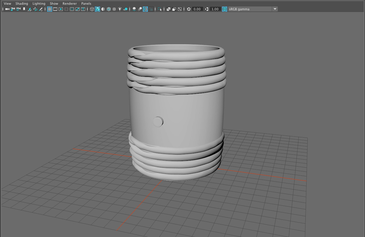
Unshaded 25-pound powder keg model.

Many Erie Canal contractor receipts preserved in the New York State Archives include entries for powder, which would have been purchased from nearby wholesalers in 12 ½ or 25-pound kegs. “To 9 cages [kegs] of Powder for blasting out Lock bottomes on Erie Canal at four dollars and fifty cents per Cag,” reads one dated May 22, 1824, while another enumerates “116 Kegs Powder of Hubbard and Parsons at $4.50 pr k.” Along with labor and whiskey, it seems, powder was one of the contractor’s most significant expenses.

The powder used at Lockport was manufactured by Éleuthère Irénée du Pont at his gunpowder mill near Wilmington, Delaware, and was formulated specifically for blasting rocks.

Sledgehammer
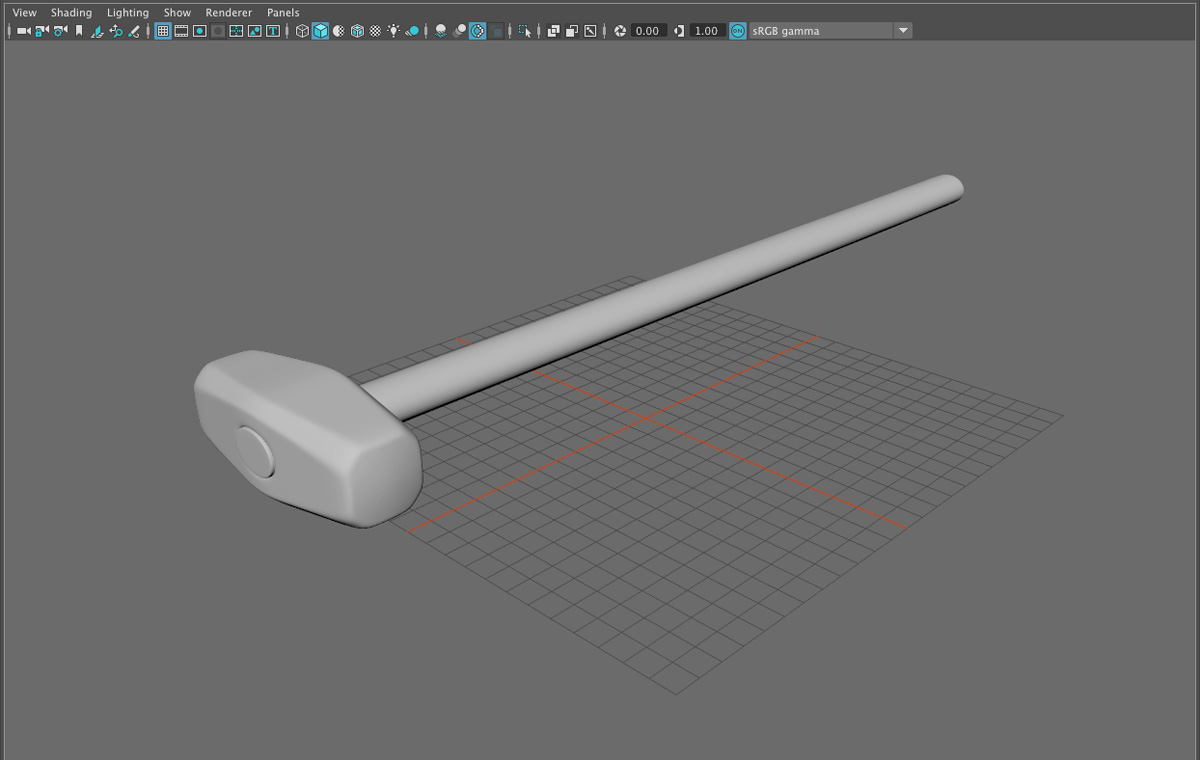
Unshaded sledgehammer model.

Black powder was used because the excavation of the Deep Cut preceded the invention of dynamite. It also preceded (by many decades) the invention of pneumatic power drills. Instead, a forged steel drill was held in place by one man while another pounded it with a sledgehammer, rotating it a quarter turn between each blow. If this sounds tedious, it was – as well as dangerous for the fellow holding the drill, who risked getting his arm smashed if the hammer missed its mark. Probably not an uncommon occurrence given the amount of whiskey the workers would have consumed in any given day.

Legend has it that workers were stymied by the hard rock of the Deep Cut, which blunted their drills, until a local blacksmith named Botsford stepped forward with an improved process for forging hardened steel. His drills, which featured a diamond-shaped tip, enabled the work to go forward.

I haven’t been able to confirm this account. It appears in newspaper columns and several popular histories, but none cites a source. Botsford, who never seems to possess a first name, is variously described as being from Niagara Falls, Buffalo, or Lockport. But he is mentioned in none of the primary documents that I’ve checked, and there are no patents attributed to him. So either the story’s details have been lost to history or, at some point, it was simply made up.

Drill
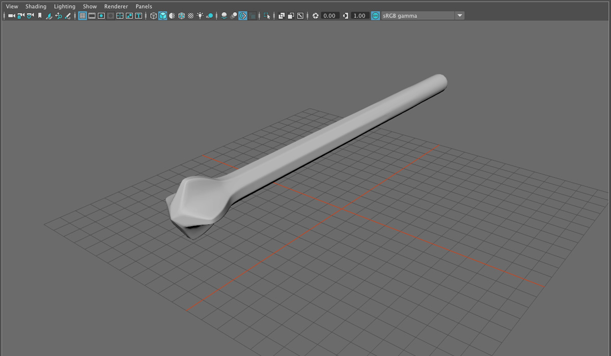
Unshaded drill model.

Or maybe not. The Erie Canal Discovery Center in Lockport has a Botsford drill in its collection. Its provenance has never been documented, but it fits the historical description. Even if it isn’t actually from the period, it most likely is similar to the drills that would have been used. The drill model I’ve made is based on it.

The drills would have been used to create holes about two feet deep in which a quantity of powder would have been placed and fused. The process was carried out by “blowers” – often inexperienced and untrained workers. As part of the masculine culture of the canal workforce, these men took pride in exposing themselves to danger and (it’s worth noting again) consumed large quantities of whiskey on the job. It was an unfortunate combination, and the result was entirely predictable.

Many years later “Aunt Edna” Smith, one of the original inhabitants of Lockport, recorded her memories in the “Recollections of an Early Settler,” which was published in five parts in the Lockport Daily Union. In one installment she described the process of blowing rock:

“Many accidents occurred from the carelessness of the man in the use of powder, such as staying too near the blast at the time of the explosion, &c. If the fuse went out or burned slowly, they would rush back recklessly, to see what was the matter, often blowing them to revive the dying fire. Many a poor fellow was blown into fragments in this way. On some days the list of killed and wounded would be almost like that of a battle field.”

And the hazard wasn’t confined to workers:

“The blasting of the rocks for the foundation of the Locks, and the canal above, was a constant source of danger and annoyance to the inhabitants.

“Stones several inches in diameter were daily thrown over into Main street. When the warning cry of “Look Out!” was sounded for a blast, every one within range flew to a place of shelter. The small stones would rattle down like hail, and were anything but pleasant, particularly when one was caught with uncovered head. One stone weighing eighteen pounds was thrown over our house, and buried itself in the front yard.”

As historian Patrick McGreevy points out in Stairway to Empire: Lockport, the Erie Canal, and the Shaping of America, “Mrs. Smith’s home was more than seven hundred feet east of the Deep Cut.”

Shovel
Unshaded shovel model.

The shovel model for the scene is based on a shovel on display at the Erie Canal Museum in Syracuse, New York. The museum’s example dates from the 1830s and is clearly a frontier artifact, with a composite blade made from hardwood and forged iron. It’s not easy to imagine someone laboring 12 to 14 hours a day, excavating hard soil and broken rock, with this primitive tool.

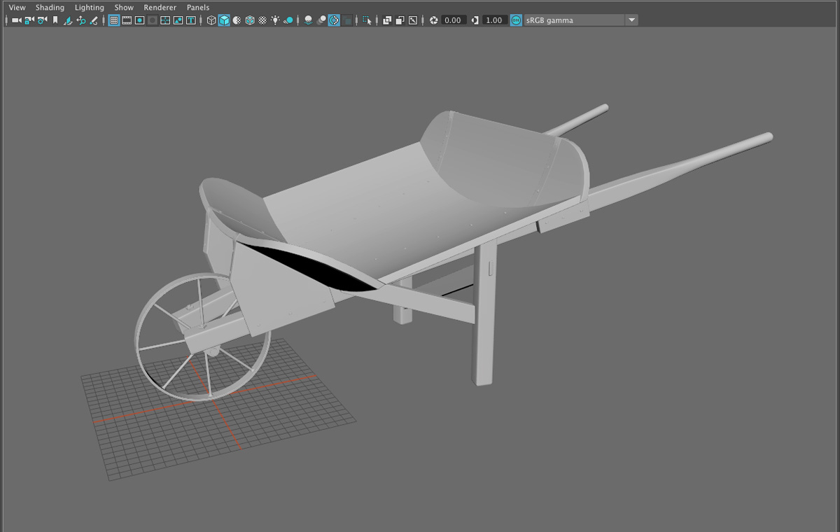
Wheelbarrow
Unshaded wheelbarrow model.

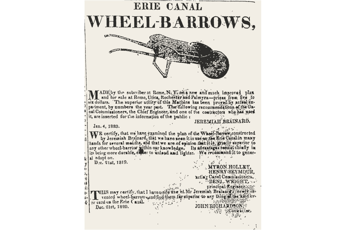
Workers at the Deep Cut and elsewhere on the canal would have hauled excavated rock and soil with the Brainard wheelbarrow, a revolutionary new design patented in 1819. The wheelbarrow, which used curved planks of wood for the tray, was significant enough to warrant a mention in the canal commissioners’ 1820 annual report: “Mr. Jeremiah Brainard of Rome, has invented a wheel barrow, which, without being more expensive than those in common use, is acknowledged by all who have seen it to be greatly superior to them. Its advantages consist in its being lighter, more durable, and much easier to unload.”

My wheelbarrow model is based on a surviving example from the 1830s on display at the Erie Canal Park museum in Camillus, New York.

Wheelbarrow Ad
A newspaper ad for Jeremiah Brainard’s new wheelbarrow included testimonials from two canal commissioners, the canal’s principal engineer, and a contractor. The wheelbarrow was priced “from five to six dollars.” The ad appeared in the February 2, 1820 issue of the Palmyra Register. (NYS Historic Newspapers)

Making the cut

Enlarged Deep Cut
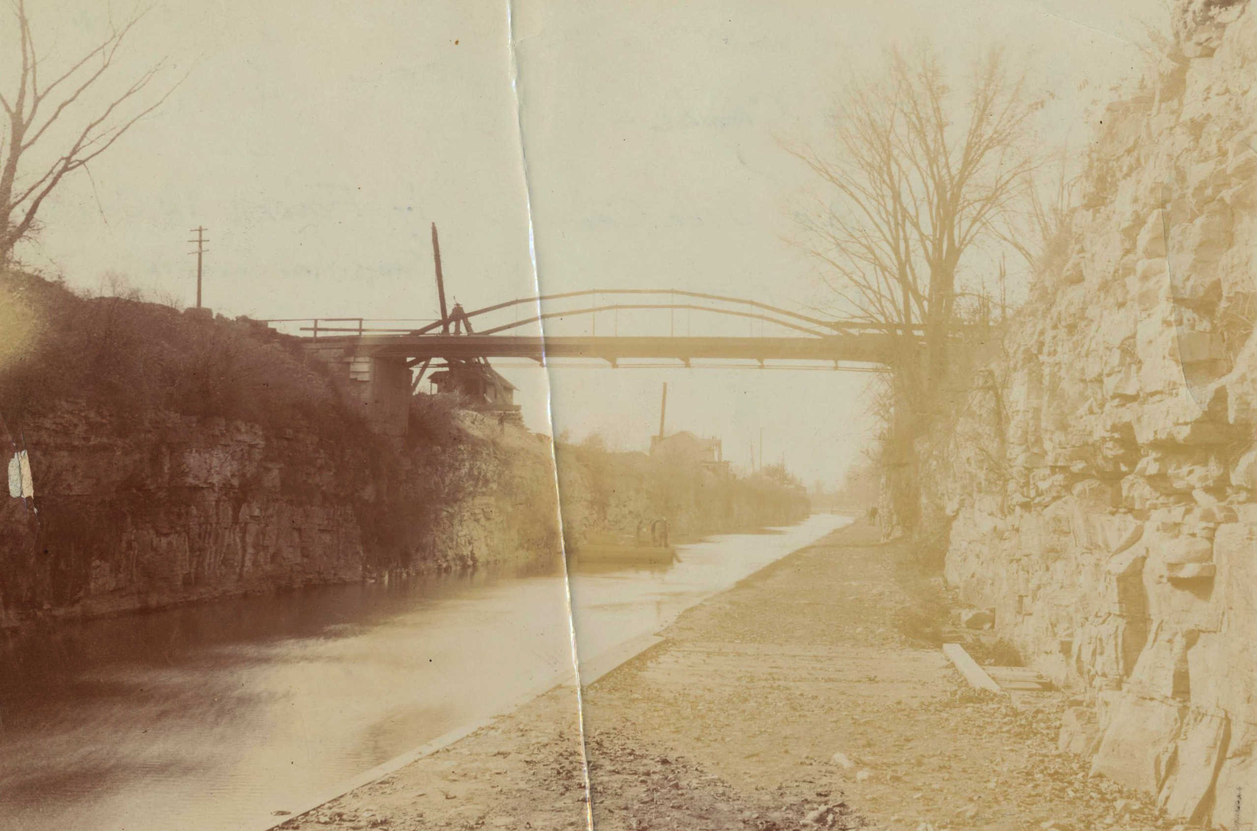
A Whipple iron arch bridge crosses the Deep Cut west of Lockport some time in the late 19th or very early 20th century. The rock walls and towpath surface are plainly visible. Photographs like this give us a good idea of what the original Deep Cut might have looked like. (Niagara County Historical Society)

The Deep Cut was a man-made artifact that sliced across the landscape of western New York. At the time, many people saw it as a work of “art” that improved Nature for the benefit of all.

But even though Nature was “improved,” it wasn’t completely overcome. The waterlogged terrain that constantly threatened to flood the work, the dense forest, and most of all the layer upon layer of tough dolomite resisted the incursion and made life miserable for the engineers and workers struggling to execute the great work.

Little was spared in the effort. Great quantities of black powder and whiskey – and an untold number of lives – were consumed as the cut inched forward.

The result was a pre-industrial industrial landscape.

Orsamus Turner, an early settler and newspaper editor, recalled the scene in his Pioneer History of the Holland Purchase of Western New York:

“The dense forest between Lockport and Tonawanda creek looked as if a hurricane had passed through it, leaving a narrow belt of fallen timber, excavated stone and earth . . . The blasting of rocks was going on briskly, on that part of the canal located upon the village site; rocks were flying in all directions . . . and huge piles of stone lay upon both banks of the canal . . .”

This would have been 1822 as work was just beginning. The blasting and huge piles of stone would extend along the entire length of the cut as work continued through 1825.

Digging up the dimensions

As I began to put together the landscape for this scene, my first question was pretty basic: What were the dimensions of the cut?

Surviving records from the original construction period are sparse. We have the annual reports of the canal commissioners, letters from them and the supervising engineers, some early surveys, and some contracts and receipts. To the best of my knowledge there are no engineering plans as we understand them today.

This was art, after all, created by artisans. In the pre-industrial era masons and carpenters drew upon their visual imaginations and years of experience and not much else. Locks, dams, weirs, and so forth were built from memory or perhaps by referring to sketches that were quickly discarded. It was an effective way to work, and the structures that remain attest to the care and pride they took in it.

This soon changed. The industrial era – introduced to some extent by the canal itself – required bureaucracies, trained engineers, and armies of surveyors, clerks and draftsmen. As planning for the first canal enlargement began, they got to work.

Deep Cut Profile
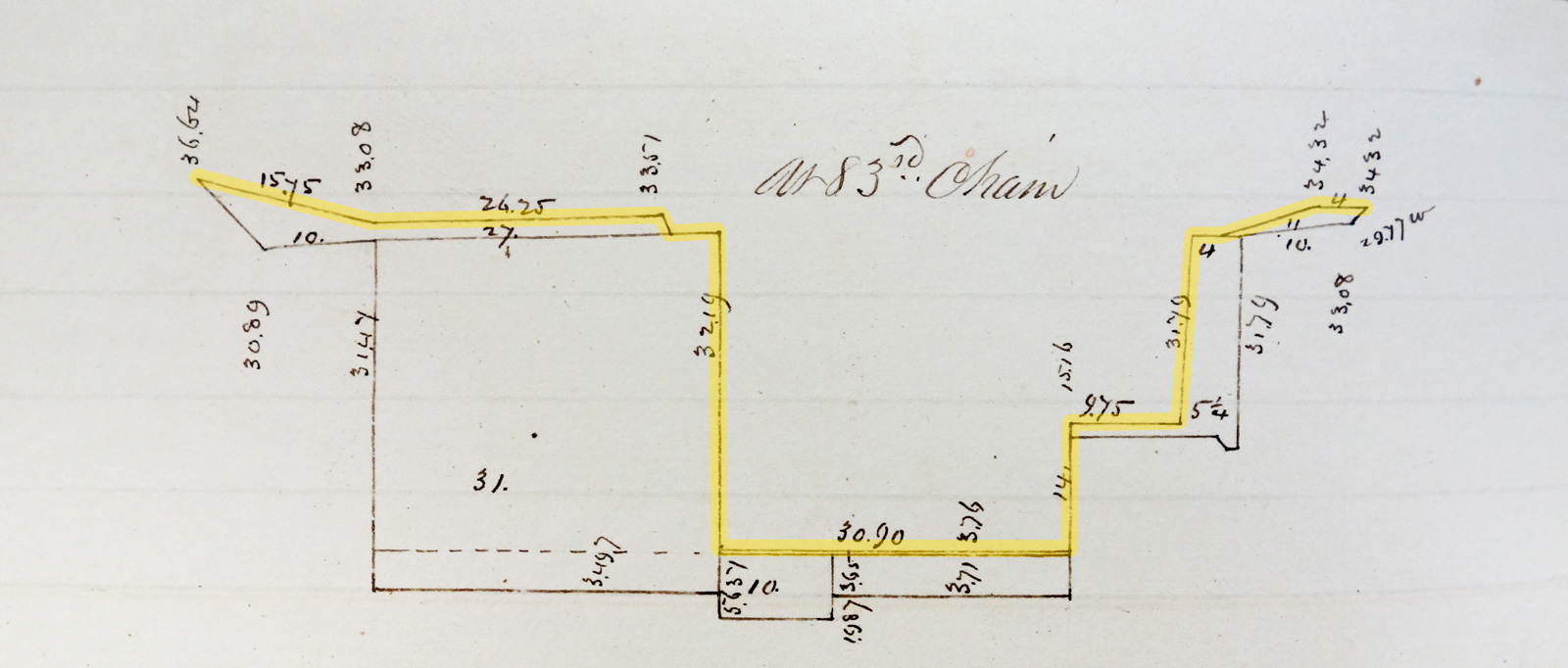
Survey profile of the Deep Cut, 83 chains (slightly more than one mile) west of Lockport. The drawing was made around 1839 to estimate additional excavation work for the First Enlargement of the canal. A yellow highlight is added to show the dimensions of the original 1825 canal. (Author photo from the New York State Archives)

The New York State Archives in Albany has several volumes of contracts and estimates, one of which was completed in the late 1830s for enlargement work along the Deep Cut. I’m grateful for the help provided by the archivists who tracked this down.

The volume contains hundreds of precise cross sections used to calculate the exact amount of soil and rock to be removed for the enlargement. To make them, surveyors measured the prism at intervals of 66 feet (one chain) all the way from Lockport to Tonawanda Creek.

The measurements confirm the maximum depth of the original profile, about 32 feet, mentioned in the canal commissioners’ annual reports. They also include the channel width and the size of the ledge for the towpath. The channel is narrow, about 31 feet, just wide enough to allow two canal boats to pass. The towpath is 10–12 feet wide, just wide enough to allow two teams of mules or horses to pass.

Apparently, the original engineers did not want to blast a single unnecessary cubic yard of rock.

Constructing the surface

The depth of the cut, the vertical walls, and the number of lateral (sideways) displacements make this a difficult landscape to model. After a couple of false starts I used an approach suggested by Ulco Glimmerveen on the Terragen user forum. This approach uses a few large primitive shapes – three cubes and a plane – to set up the basic surface, along with the rock pile shapes described in an earlier post.

Deep Cut Structure
The underlying structure of the Terragen scene is made from primitive shapes and the rock piles created earlier.

The rock walls required more experimentation. Excavated dolomite resembles shale but has thicker layers. Later historical photos (like the one included at the top of this post) were a big help here. (Photos of the original excavation, of course, are nonexistent – photography hadn’t been invented yet.)

Deep Cut Rendering
Terragen rendering of the Deep Cut scene shows the finished rock piles and surfaces.

The rock wall was the biggest challenge, and was finished first. The floor of the cut and towpath, both partly flooded, came next, and layers of rubble were scattered pretty much everywhere. A few variations of the Dibble crane were included as placeholders (more will be added later). Thick, turbulent clouds convey an ominous mood (and help scatter the light into the shadows). A plume of dense smoke from blasting can be seen in the distance.

Despite some natural relief provided by the edges of the forest on either side, the picture so far has a dark, gritty look that seems appropriate.

Mr. Dibble’s machine

Finished Machine Model
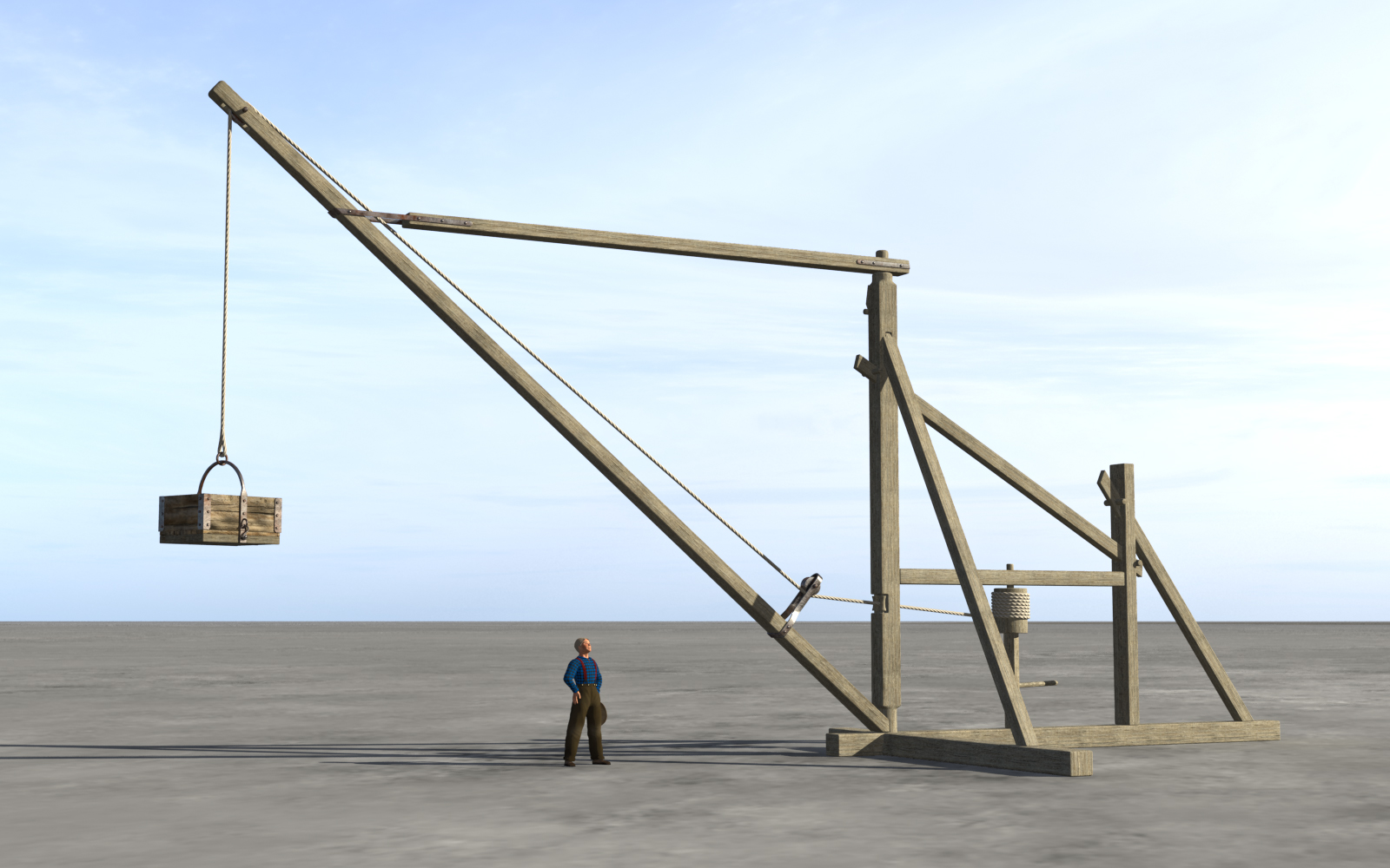
The completed model of Orange H. Dibble’s machine, shaded and rendered in Terragen, with a human figure alongside for scale.

The most striking objects in George Catlin’s lithograph of the Deep Cut excavation are, of course, the horse-powered cranes. Arranged on each side of the cut, the repeating, angular shapes make a dramatic pattern against the sky.

The lithograph, along with additional scenes of the canal by Catlin and other artists, was printed in Cadwallader Colden’s Memoir, published in 1825 to commemorate the opening of the canal. The image and its descriptive text, included in an appendix, are our primary source of information about the machines.

“The cranes,” the writer reports, “are an ingenious application of mechanics to a horse power, enabling him to raise a ton weight or more from the bottom of the Canal, and discharge it in huge piles at a distance of sixty or seventy feet from the excavation, and fifty feet above its banks. They were generally set at regular distances from each other, (sixty or seventy feet) and fifteen or twenty feet from the Canal, allowing the extremity of their gibs to describe about to the middle of the chasm.”

After spending another paragraph or two describing how they worked, the writer adds (with some degree of understatement) that the cranes, “when in full operation for three miles in length, and the work progressing under the hands of fifteen hundred men, under a continual cloud of smoke, and almost incessant explosion of rocks, produced a novel and interesting scene.”

The machines were the brainchild of Lockport contractor Orange Hezekiah Dibble. Aside from the text in the Memoir, detailed information about his invention is hard to come by.

The canal commissioners’ annual reports to the state legislature – generally expansive when describing new technology, especially when it was inspired by the canal – are silent about the cranes, though Orange Dibble is listed as a contractor.

There is no patent application or drawing. Any that existed would have been destroyed in the fire that swept through the patent office in December 1836. But we know that a patent was issued. A list published in 1840 includes one for an “Earth, removing” machine awarded to Orange H. Dibble of Niagara County, N.Y. on February 20, 1824.

Two months later – April 1824 – this notice appeared in the Lewiston Niagara Sentinel:

“Fatal accident — David Gilroy, a laborer on the canal, was killed near this village on Friday last. He was engaged with a number more in excavating rock with a machine which is worked by horsepower. The box appertaining to the machine had been filled with stone amounting probably to 1,000 pounds, when after being raised to the height of 30 feet directly over the head of the unfortunate man the chain by which it was suspended broke and the box and contents fell upon him and killed him instantly.”

Apart from reminding us just how very dangerous canal work could be, this brief item confirms that at least one of Dibble’s machines was on the line early in the 1824 construction season.

Finally, there is one more very reliable source.

“Of the crane I enclose a figure”

Mr. Dibble's Machine
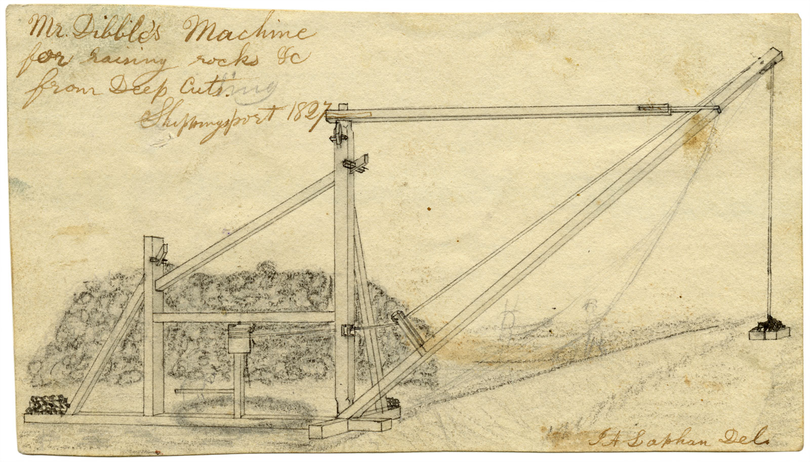
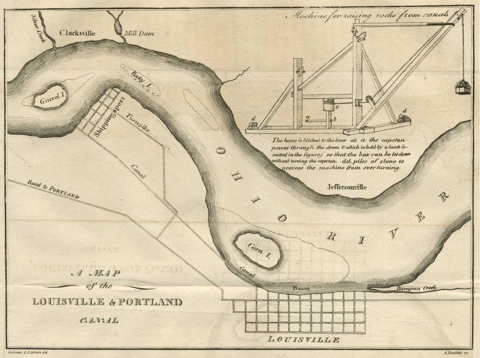
Increase Lapham’s 1827 drawing of Orange Dibble’s “Machine for raising rocks &c. from Deep Cuts.” A notation indicates the sketch was made in Shippingport, Kentucky, where, at the age of 16, Lapham was working as an assistant engineer on the Louisville and Portland Canal. The sketch is signed “I A Lapham Del.”, for “delineator” or draftsman. (Wisconsin Historical Society)

Increase Allen Lapham was born in 1811 to Seneca and Rachel Allen Lapham of Palmyra, New York – a backwoods village that later would become a stop on the Erie Canal. His father was a contractor who specialized in canal construction. His family followed work as it became available and was constantly on the move. 

In 1818 they relocated to the Schuylkill River in southeastern Pennsylvania. Two years later they returned to the town of Galen in western New York, just a few miles away from the Erie Canal, then under construction. In 1822 they moved on to Rochester. Increase and his older brother, Darius, covered the 30-mile distance on foot, driving “a cow & calf,” as Increase later noted in his diary. In Rochester, Seneca Lapham worked on the aqueduct that would carry the canal over the Genesee River.

In 1824 the family was in Lockport, where Seneca built lock gates and bridges. Young Increase labored on the canal as well, writing that he “cut stone for the locks sometimes & earned $1 per day.” But he and his brother were soon moving up. “We have got acquainted with Mr. Alfred Barret the Engineer of the canal & Darius got employment under him — Soon after I was also employed at $10 pr month & $.50 per day for subsistence.”

Increase was extremely bright and quickly began to soak up the basics of surveying and canal engineering. He was also observant and took note of everything having to do with canal construction on the Mountain Ridge, including Orange Dibble’s cranes.

By 1827 the family had moved yet again, this time to Shippingport, Kentucky, where the Louisville and Portland Canal was being constructed around the Falls of the Ohio River. It wasn’t long before Increase was handling much of the company’s bookkeeping.

The Louisville canal included a difficult rock cut much like the one at Lockport. Cranes like those used on the Mountain Ridge were being built and pressed into service. Sixteen-year-old Increase, now an assistant engineer and an accomplished draftsman, made a drawing of one of them. He sent the drawing, along with an article that he had written about the construction of the Louisville canal, to Professor Benjamin Silliman of Yale University for publication in the American Journal of Science and Arts.

A Map of the Louisville & Portland Canal
Increase Lapham’s map of the Louisville & Portland Canal as it appeared in the July 1828 issue of the American Journal of Science and Arts. The map includes an inset diagram of Orange Dibble’s crane, based on Lapham’s sketch. (Wisconsin Historical Society)

“The excavation of rock is done by drilling, and blasting,” Increase wrote in the article, “and is afterwards removed from the canal, by the use of a crane of the same construction as those used on the mountain ridge in New York, invented by Mr. Orange Dibble. Of the crane I enclose a figure.”

Increase Lapham stayed with the Louisville canal until 1829. Eventually he made his way to Wisconsin, where he became a naturalist and cartographer. He died in 1875 and today is revered as the state’s first great scientist.
Orange H. Dibble continued to do contract work for a few more years and became postmaster of Buffalo, by then a boomtown because of the Erie Canal. Eventually he, like so many others, was swept up by the Gold Rush and moved his family west. He became one of the original pioneers of Grass Valley, California, and operated a sawmill in nearby Gold Flat. He figured prominently in the state’s Masonic organizations until his death in 1864.

George Catlin went on to fulfill his dream of painting Native Americans, and spent most of the 1830s traveling throughout the American West. Later he took his “Indian Gallery” on tour in the eastern U.S. and Europe, where he turned out to be as much of a showman as an artist. After returning to the states he was forced to sell the gallery to pay off personal debts. Today the collection – more than 600 works – is part of the Smithsonian American Art Museum. Catlin died in 1872.

The cranes themselves, thanks to Catlin, have achieved a permanent place in our imagination and the mythos of the canal’s construction.

At the time, they were a rough-and-ready solution to a simple problem: How to get rid of the broken rock from the bottom of the ever-deepening Deep Cut. Lockport was an isolated outpost surrounded by forests and swamps. The pioneer contractors working there had to make do with local materials, and timber was plentiful. 

The resulting machines were primitive and dangerous, but apparently they did the job. It’s been said that they speeded up completion of the Deep Cut and the canal. Perhaps. But by the time they appeared on the line in 1824, perhaps late 1823, much of the excavation was already done. Maybe the problem wasn’t one of time, but space: Once the channel reached a certain depth, wheelbarrows and ramps became impractical and another solution was called for. 

Modeling the machine

Catlin’s cranes are the work of an artist: fleeting, energetic and alive, they nevertheless contain very little practical detail. Which is why I’m so grateful to have found Lapham’s drawing, which was the work of a budding engineer. All of the details that we need to know about the machine are there with one exception: scale.
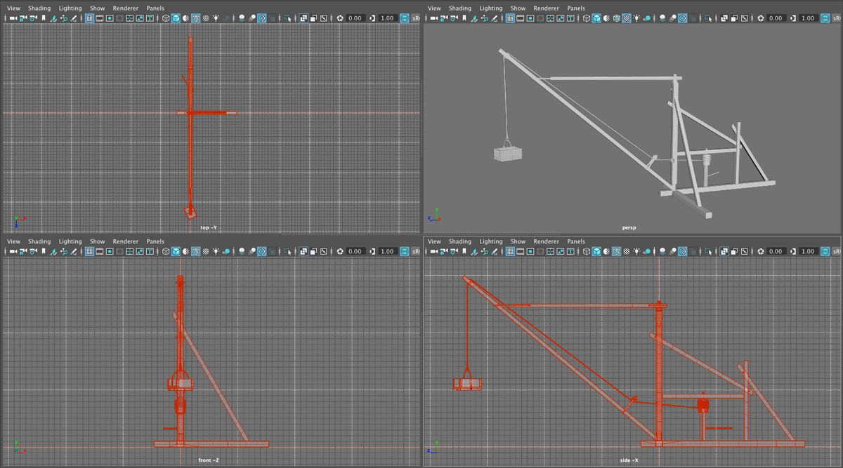
The ghostly, pencilled human and horse figures in Lapham’s drawing give us some idea of how big the cranes were, but determining a reasonable scale still took some experimentation. The placement of the cranes at intervals of 65–70 feet – as specified in the Memoir – was one factor, as was the need to provide enough room for the piles of stones.

Dibble Machine 4view
Four-view of Orange Dibble’s crane modeled in Maya. The scale model is 30 feet high with a reach of about 34 feet.

For now, I’ve settled on a machine that’s 30 feet high, with a mast of 25 feet and a horizontal reach of 34 feet. The diagonal jib is about 45 feet long. The contractors who built the machines would have been felling a forest of old-growth trees – sugar maple, beech, oak, ash, and elm – so obtaining beams this size should not have been a problem.

It’s a simple machine and the model comes together quickly. We’ll make many variations to insert along the cut in the scene. Final details – including horses to provide power and teams of workers – will be added once the cranes are all in place.

Rocks, and more rocks

Rock Pile
Test rendering of a rock pile in Terragen. The height and size of the pile were calculated based on the volume of rock that would have been excavated from the cut.

A few details need to be nailed down before we can set up the Deep Cut scene. Some, such as the width of the cut, should be recorded somewhere in the historical record. Other details, like the size of the rock piles, can be calculated.

I’m still looking for a source on the dimensions of the cut. In the meantime we can start on the rock piles.

How tall were they? Contemporary sources describe them as “huge,” achieving heights of up to 50 feet.

Perhaps, but let’s see what a little math tells us.

When it comes to excavating stone, there are two important numbers: angle of repose and swell factor.
Angle of repose is the slope at which a pile of stone (or any material) remains stable. At a greater angle, gravity will overcome friction and the material will slide down the slope. For dolomite and broken rock, the angle of repose varies between 35 to 40 degrees. For now I will use the minimum angle of 35 degrees.
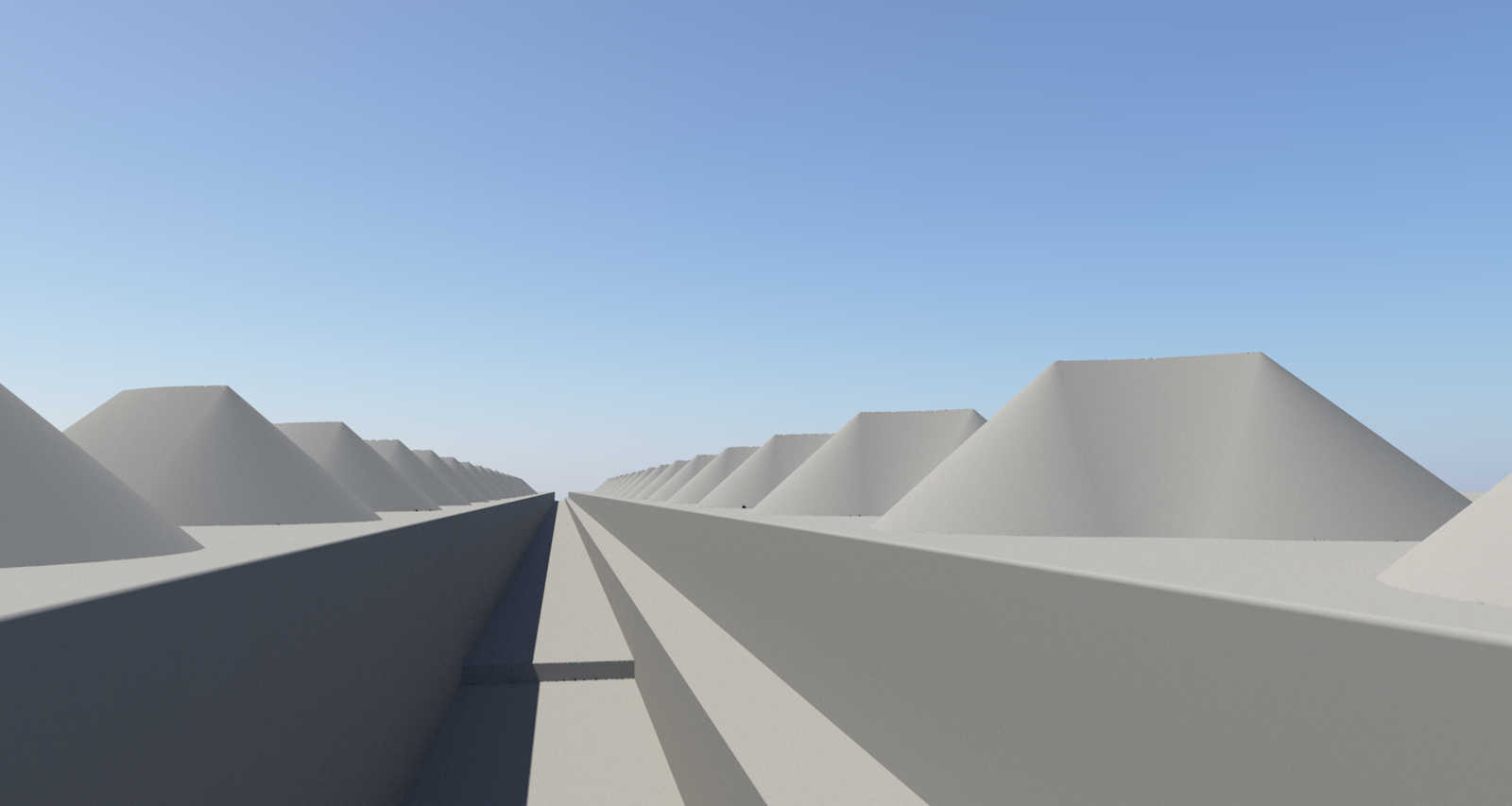
This makes it simple to calculate the size of a cone of broken stone 50 feet high. A 35-degree angle of repose yields a base diameter of about 143 feet.

As the tiny human figure standing next to the cone shows, this is a very large pile of rocks. Much too large based on the size of the canal cut shown in the adjacent profile. In fact, a cone this size would contain more than five times the amount of rubble that would be excavated from the cut. The crane needed to build this pile would also have to be a huge – at least 55 feet tall with a jib of about 90 feet.

Let’s approach the problem properly by starting with the volume of rock to be excavated. For this we need the second important number: swell factor.

Swell factor is the increase in volume that occurs when you break up solid material into smaller, irregular pieces. For dolomite, the factors that I’ve found vary between 50 and 67 percent, with a median of 66. We’ll use the median, which means that every 100 cubic feet of solid dolomite excavated yields 166 cubic feet of broken stone that must be piled up somewhere.

We don’t know the width of the cut yet, so for now I’ll assume a base width of 28 feet plus a 6-foot recess in one wall for the towpath. The maximum depth – which we do know – was 31.5 feet.

The cranes were placed between 60 and 70 feet apart along both sides of the canal. This means, on average, each crane handled a 32.5-foot-long section (the average distance of 65 feet divided by 2). Taking the swell factor into account, this means 50,766 cubic feet of broken stone would be lifted out of the cut by each crane.

This results in a more reasonable-looking pile. The cone would be about 29 feet high and 82 feet in diameter. This represents the maximum pile size at the deepest part of the cut. Elsewhere, the piles would be relatively smaller.

Of course, the rubble pile would not be a cone. The crane would distribute the rubble in an arc described by the tip of the jib. This would reduce the height and width somewhat, depending on the size of the arc and the length of the jib.

Rubble pile base
Plugging the results of our calculations into a set of Terragen functions produces the basic shape of a rubble pile distributed over a 50-degree arc. It’s about 23 feet high.

The math gets a little dicier now, but an equation can be plugged into Excel to test different volumes and slopes. Then functions can be used to generate the basic shape in Terragen.

Modeling a rock
How to model a rock: Basic box in Maya; subdivided, sculpted, and surfaced in Mudbox; shaded and rendered in Terragen.

After adding a few random displacements, the shape is covered with thousands of rocks. The result is shown at the top of this post. Many variations can be made and placed in the scene.

It may not be 50 feet tall, but it’s still an impressive pile of rocks.