
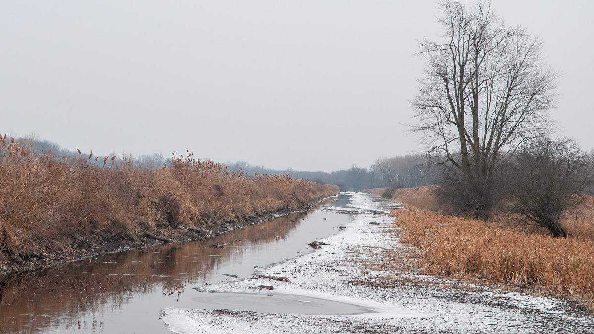
The view is nondescript, especially on this dreary midwinter day. The partly frozen waterway extends across the flat landscape as far as the eye can see. But the berms on either side still hold their shape. Two hundred years after it was constructed, the prism of this artificial channel is clearly visible.
This is one of few surviving sections of the original Erie Canal – Clinton’s Ditch. How it got here is a story of perseverance and grit.
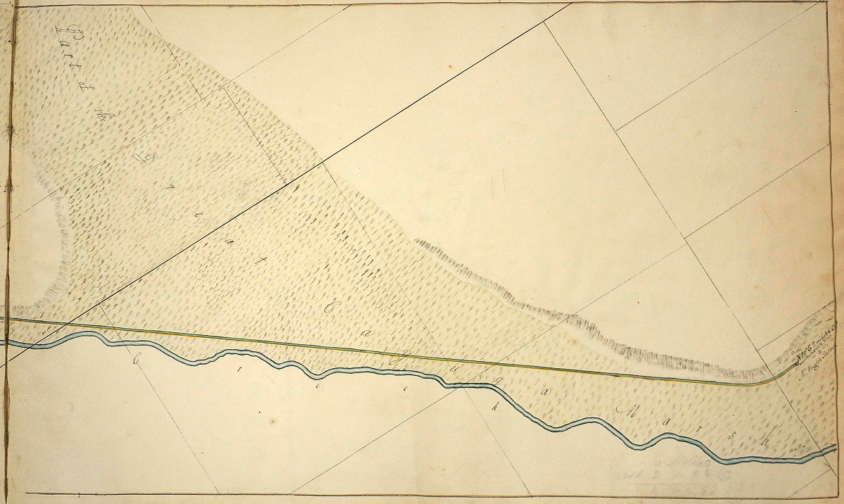
Two hundred years ago this area was known as the Great Cayuga Marsh, a notorious expanse of scattered forest, shallow pools, quicksand, and tall grass. The few roads that existed skirted its margins. Early settlers avoided it. They believed that the air itself was unhealthy and the cause of the deadly fever that seemed to strike out of nowhere each summer.
The marsh lay at the bottom of a large, shallow bowl with summits to the east and west. After the canal’s completion, boats arriving from either direction would lock down to this level, cross the Seneca River and the marsh, and then lock back up.
There was no way planners could avoid it, and they knew the crossing would not be easy.
In their 1822 report to the state legislature, the canal commissioners wrote that they regarded this section “with much solicitude” and continued: “It cannot be drained at all; the excavation is from five, to nearly eight feet deep: and it was doubted, whether the earth had such a consistence . . . to keep its place in the banks, after the excavation should be effected. The whole level is, besides, subject to be overflowed by the waters of the Seneca river, and the Canandaigua outlet, to the depth of three of four feet, and is actually overflowed for a considerable part of every year.”
In the spring of 1821, the section was contracted out to Alfred Hovey and Abel Wethey Jr. of Montezuma. They in turn divided the work among several subcontractors. Everything was to be completed by mid-October. But work soon ground to a halt, plagued by a series of misfortunes described a few years later by a legislative committee:
“The contract was entered upon by Hovey & Wethey, in June or July, 1821 – they sub-contracted several miles of the marsh job, at various prices per cubic yard . . . In July these sub-contractors were driven off by floods, and the portions partly excavated were filled with water . . . When the marsh became in some measure dry again, an unprecedented sickness prevailed, which rendered it not only very expensive, but almost impossible to get men to work upon the marsh. Under all these embarrassments, the sub-contractors, without an exception, abandoned their jobs in the fall of 1821.”
Somehow Hovey and Wethey carried on and, with the arrival of winter and firmer ground, continued the work “with great energy.”
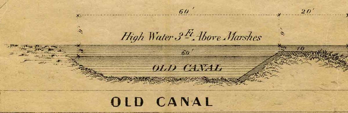
The first boat passed through on July 30, 1822. But quicksand, which oozed into the channel from the bottom up, and unpredictable water levels continued to cause problems. This section would remain the weakest link along the entire line until the 1850s, when the canal was finally elevated and widened, and an aqueduct was built to replace the water-level Seneca River crossing.
Missing from the contracts and official reports are the stories of the men who did the digging. We know that sickness – probably malaria – disabled many and discouraged others from taking work there, emptying the line of workers for weeks at a time. We don’t know how many – if any – died from the fever. But for those who stuck it out, we can only imagine what it must have been like to dig, knee- or waist-deep, in quicksand and muck through the winter of 1822 so the line could be opened the following summer.
Tracing the canal
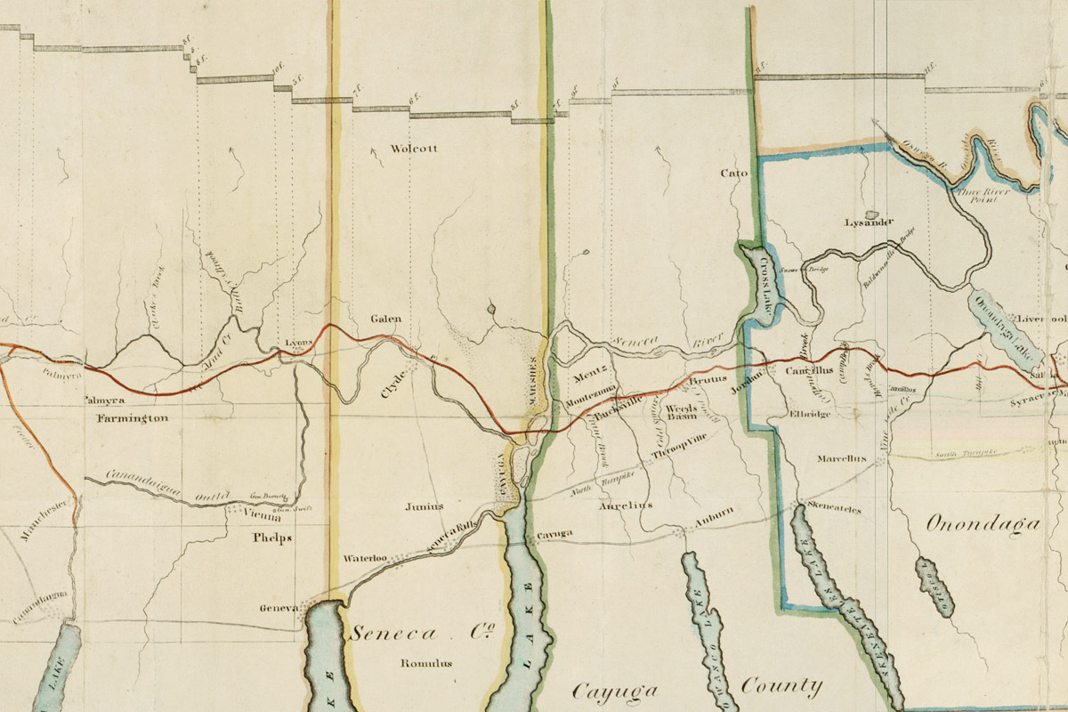
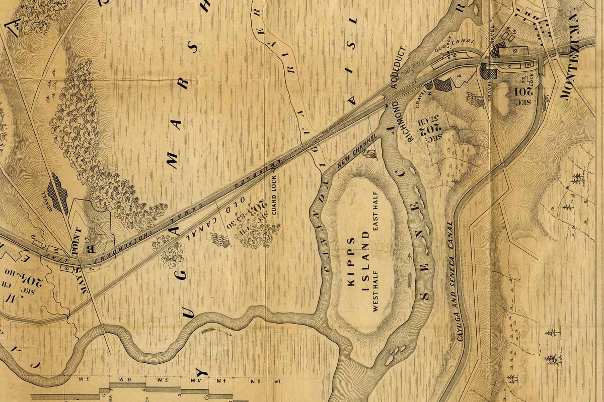
The Great Cayuga Marsh was drained long ago. Today the area is mostly farmland. A few enclaves form the Montezuma National Wildlife Refuge and provide a home or way station for many species of migratory birds. The area is unique because it encompasses tangible remains of all three generations of the Erie Canal – the original Erie (“Clinton’s Ditch”), the Enlarged Erie, and the New York State Barge Canal – all within a few steps of each other.
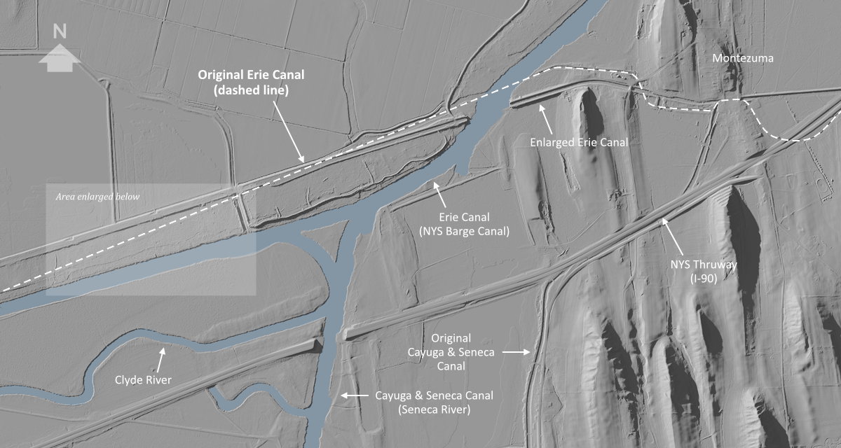
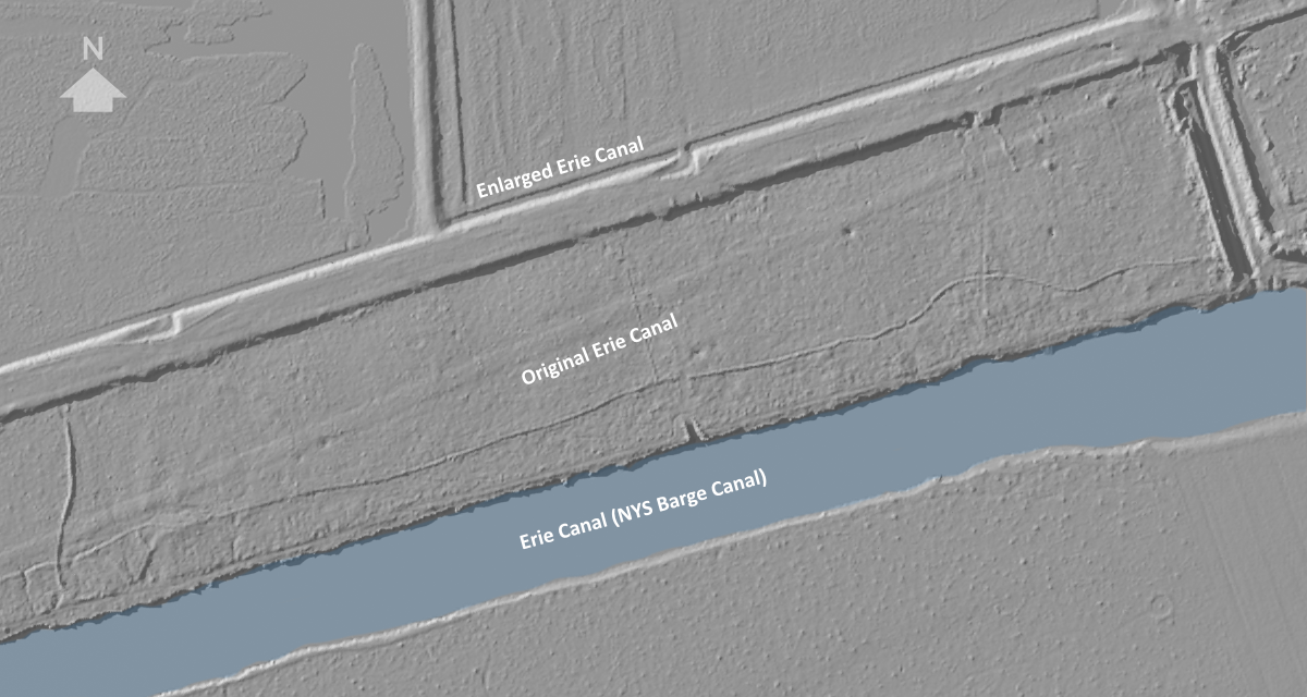
To reveal signs of early development, we can use digital elevation data from New York state and the United States Geological Survey. Three-dimensional renderings made with this data show the Earth’s surface stripped of all foliage, buildings, and bridges.
For example, this image includes the faint outline of the original Erie Canal (completed 1825), as well as the original Cayuga & Seneca Canal (completed 1828). Remains of the Enlarged Erie Canal (completed 1862) are more prominent, as are the environmental-scale alterations of the New York State Barge Canal (completed 1918), which reconfigured the courses of the Clyde and Seneca Rivers.
The Cayuga Marsh crossing will be the subject of the next scene, and this real-world elevation data will be used to form the underlying terrain. As with previous scenes, digital landscaping will be employed to erase the marks of human development and to turn back the clock two hundred years.