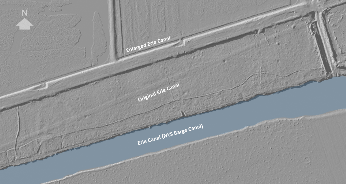
Detail of the digital elevation map (above) shows the juxtaposition of the three generations of Erie Canal engineering. The ghostly image of the original canal (which is mostly filled in along this section) in the center, flanked by the Enlarged Erie (top) and the New York State Barge Canal (bottom).