
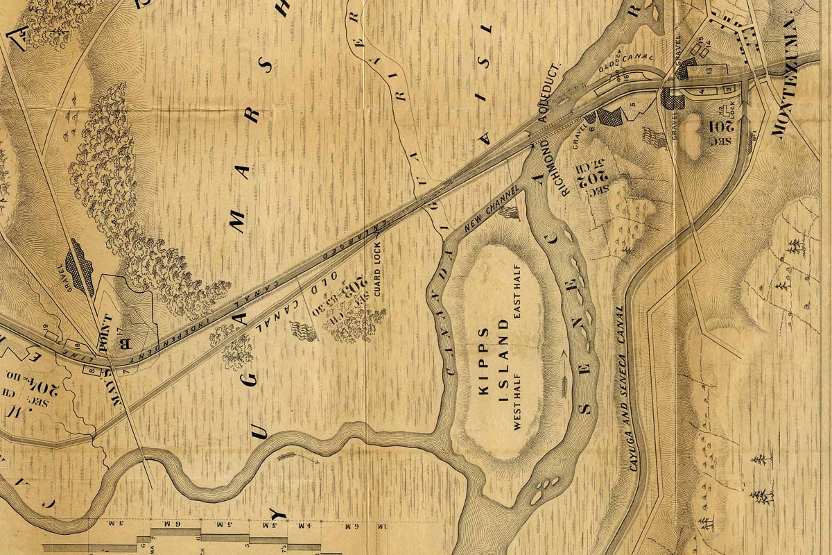
Detail of an 1862 map drawn by David Vaughan shows the eastern section of Cayuga Marsh shortly after the completion of the Enlarged Erie Canal. It shows the line of the original Erie Canal as well as a channel of the Canandaigua River north of Kipp’s Island that was abandoned when that waterway was diverted into the Seneca River. The hamlet of Montezuma is at upper right; May’s Point is at the lower left.