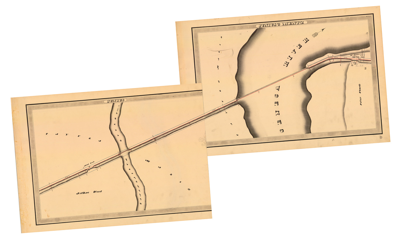
State surveyors depicted the elevated towpath bridges across the Seneca River and Canandaigua Outlet in these maps, prepared during an extensive survey of New York’s canal system in the 1830s and 1840s. (New York State Archives, A0848-77, Canal System Survey Maps, 1832-1843, Map nos. E5-19, E5-20.)
Can you send me the Holmes Hutchinson map for the sections along Rotterdam NY?
Hi Jason — Good question. All of the Holmes Hutchinson maps are available online from the New York State Archives. The collection is preserved in Series A0848.
The Archive’s digital collection search page is here: https://digitalcollections.archives.nysed.gov/
The Holmes Hutchinson map series can be found by searching for “a0848-77”: https://digitalcollections.archives.nysed.gov/index.php/Search/objects?search=a0848-77
You can search within these results for “rotterdam” to find what you need.
Here’s the finding aid for the series if you need it: https://iarchives.nysed.gov/xtf/view?docId=ead/findingaids/A0848.xml
Good luck!