
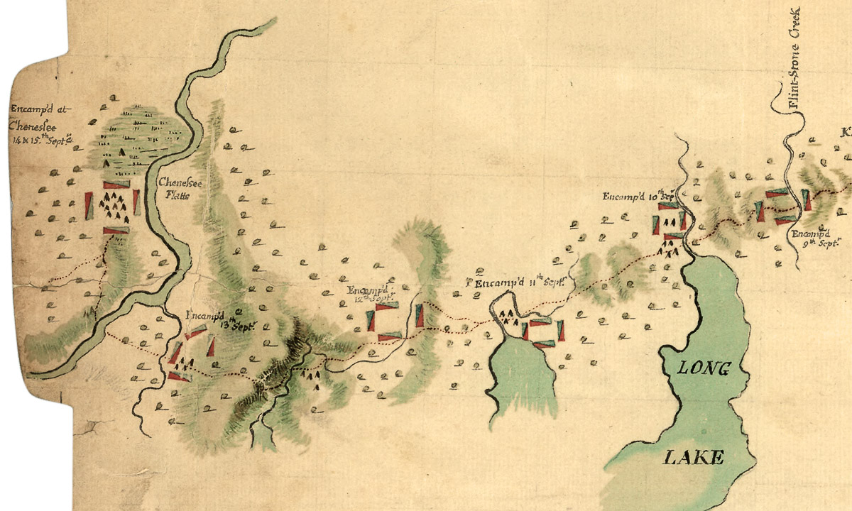
This section of a hand-drawn 1779 campaign map shows Sullivan’s march through the Genesee Valley from east to west in the vicinity of present-day Geneseo, New York. Five campsites are shown, dated Sept. 9 (right) through Sept. 14-15 (left). Sullivan’s forces suffered their worst setback of the expedition not far from here when a small detachment sent to reconnoiter a nearby Seneca town was surrounded and destroyed by a much larger force of native warriors and British Rangers. Undeterred, Sullivan’s main force loitered long enough to finish its grim mission before turning home. “The whole Army was immediately engaged in destroying the Crops,” Sullivan reported in a letter to Washington. “The Corn was gathered and burnt in Houses and in Kilns, that the Enemy might not reap the least advantage from it, which method we have pursued in every other place. . . . I am persuaded except one Town situated near the allegany about 57 Miles from Chenessee — there is not a single Town left in the Country of the five nations.” (Library of Congress/Geography and Map Division)