
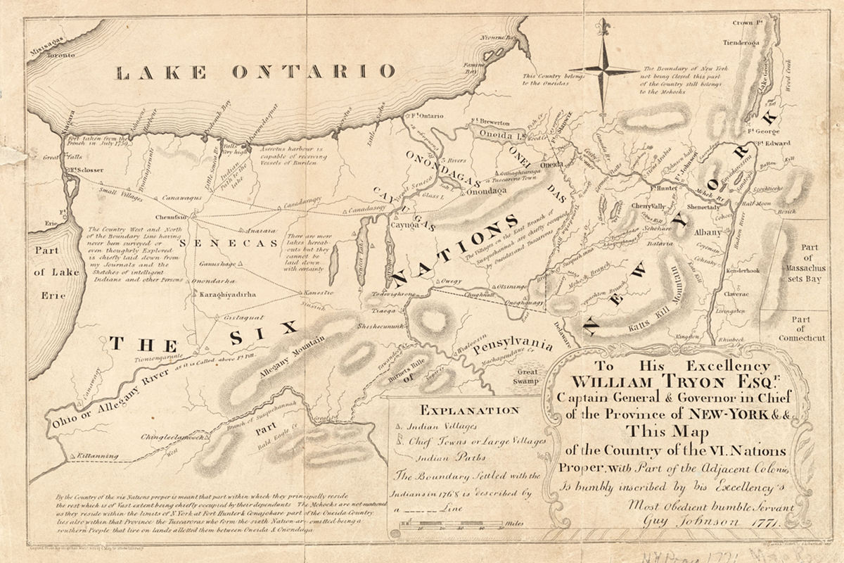
This 1851 facsimile map shows the territory of the Six Nations confederacy across present-day western New York state and northern Pennsylvania. The original was produced in 1771 by Guy Johnson for William Tryon, the governor of the colony of New York. The Six Nations or Haudenosaunee — known by the French as the Iroquois — were allies of the British throughout their colonial wars with France in the 17th and early 18th centuries. At the start of the American Revolution the confederacy split, with the Oneidas and Tuscaroras siding with the colonists and the Mohawks, Onondagas, Cayugas, and Senecas fighting for the British. (The New York Public Library)