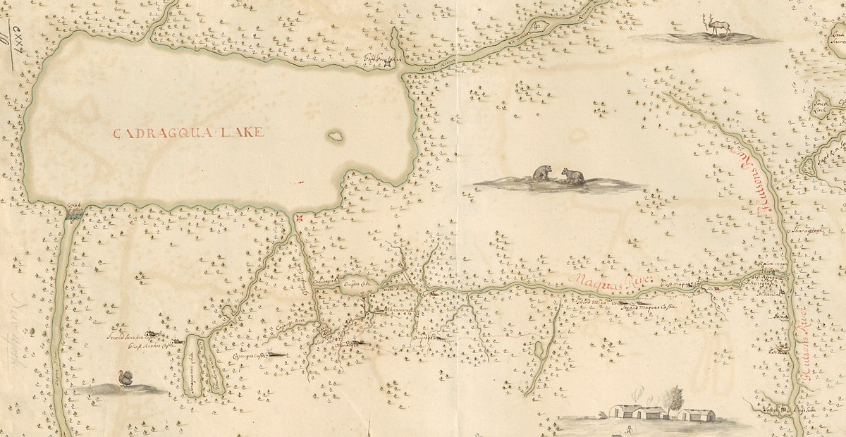
Military engineer Wolfgang William Römer in 1700 explored the territories of the Six Nations and produced a “Mappe of Colonel Römers Voyage to Ye 5 Indian Nations” for Lord Bellomont, the governor of the colony of New York. This section of a later copy of the map shows the area between the Niagara River (left) and the Hudson (right). Cadragqua Lake (Lake Ontario) dominates the top. Several smaller lakes — Seneca, Cayuga, Oneida — are clearly depicted along with the Seneca, Oswego, Onondaga, and Mohawk rivers. Colonel Römer made it only as far as the Onondaga River, and as a result the Genesee River and other details further west are missing. (Courtesy of the Norman B. Leventhal Map & Education Center at the Boston Public Library)