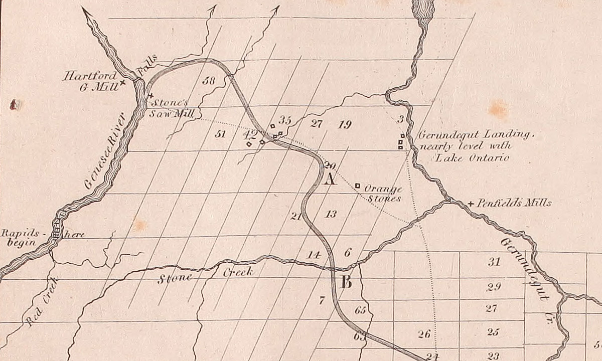
Section of a map by James Geddes shows the proposed route of the Erie Canal from Gerundegut (Irondequoit) Creek (right) to the Genesee River (left). The map, which was included in the 1825 Laws of the State of New York, in Relation to the Erie and Champlain Canals, is undated. But the presence of Charles Harford’s gristmill and Enos Stone’s sawmill near the Genesee Falls place it sometime between 1807 and 1810, probably during Geddes’ 1809 survey for State Surveyor General Simeon De Witt. There is no sign of Rochester or even Rochesterville — Nathaniel Rochester and his partners would not subdivide their property and begin selling lots until 1811. (Columbia University Libraries via Internet Archive)