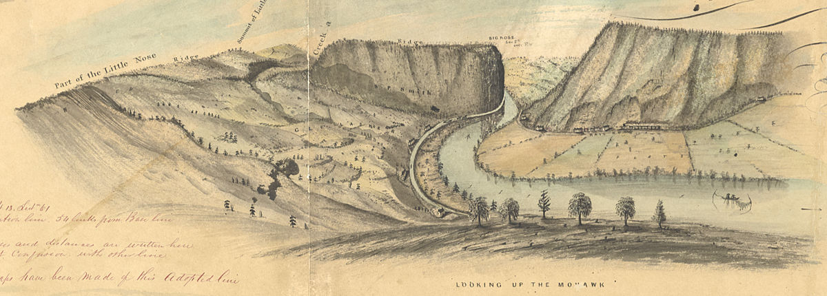
Another detail from David Vaughan’s 1851 map shows a view of the Noses looking west. The point of view matches that used by photographer Phil Scalia. Hillsides that today are heavily wooded were clearcut for agriculture in the 19th Century. Again, there seems to be some confusion over the names of the cliffs. Today, Big Nose is the cliff on the north (right) side of the Mohawk, and Little Nose is on the south. This map appears to place both on the south side. (New York State Archives)