
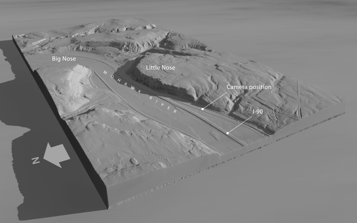
This high-altitude, oblique rendering of area around the Noses was created in Terragen with digital elevation data available from New York State. The view faces southeast and shows the course of the Mohawk River, the New York State Thruway (I-90), and the location of the camera that will be used to capture our scene.