
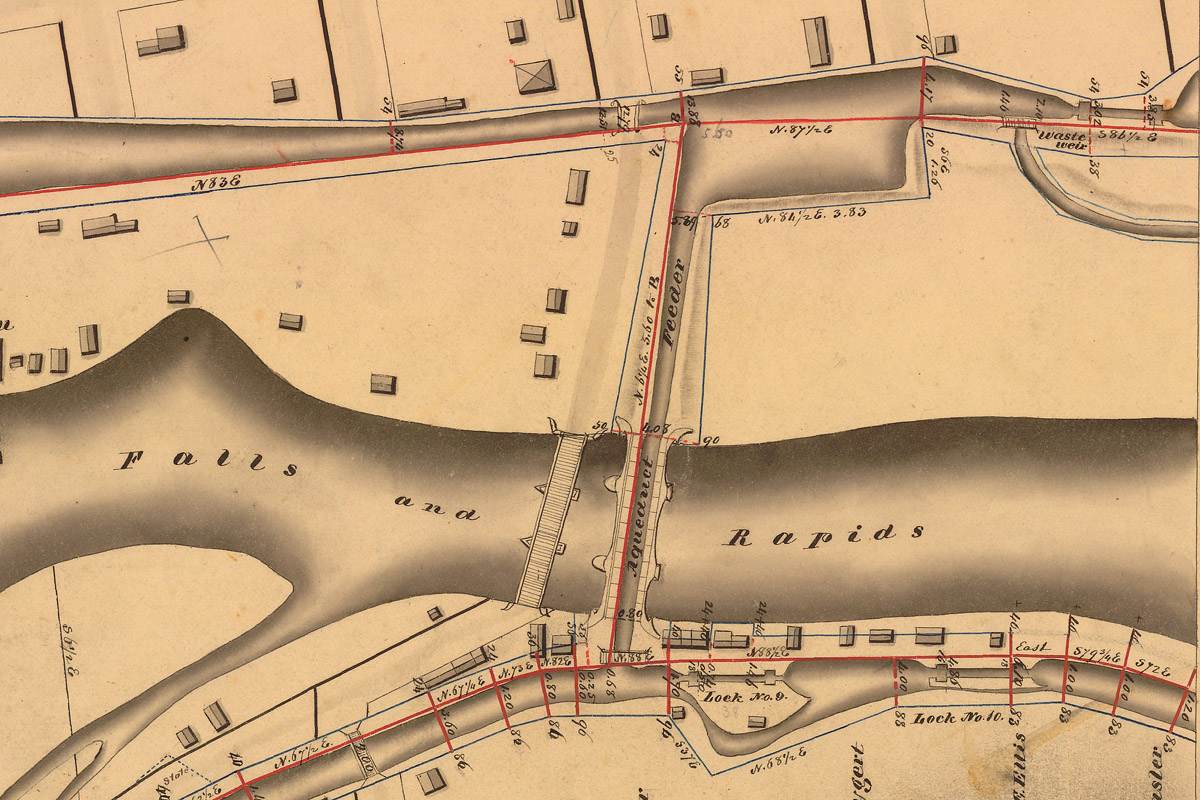
A detail from the Holmes Hutchinson map of Little Falls, surveyed around 1830, shows the parallel channels of the Western Inland Lock Navigation Company canal (top), the Mohawk River, and the Erie Canal (bottom). The aqueduct allowed Erie Canal planners to use the old canal as a water source – a “feeder” – and mollified the citizens of Little Falls by connecting their existing basin and waterfront to the new canal. (New York State Archives)