
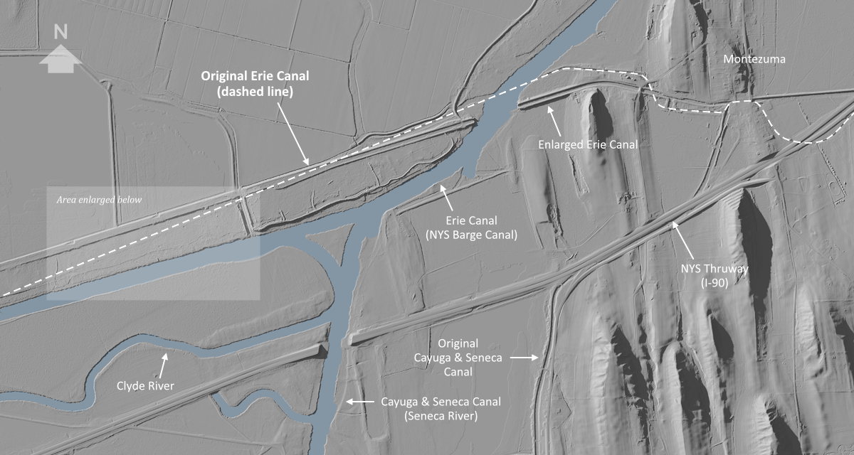
Digital elevation data, imported into and rendered by Terragen, yields a three-dimensional map of the Earth’s surface without structures or vegetation. This top-down view depicts the eastern section of the Cayuga Marsh from May’s Point (located just outside the western edge) to the hamlet of Montezuma (upper right). Evidence of the original Erie Canal and the Enlarged Erie Canal are clearly visible. The Clyde and Seneca rivers, dredged and straightened, were incorporated into the New York State Barge Canal in 1918.