Durhams, freighters, scows, and packets

Canal Boat Alexander
A classic Erie Canal freighter named the Alexander appears in this tintype, made around 1860. At left the mule team waits patiently on the towpath, while on the boat the owner, family, and crew pose, dressed in their Sunday best and looking for all the world as though they own the canal as well. The hand-tinted image is reversed because no negative was used in the tintype process; the metal plate itself was exposed to light in the camera. (Courtesy of the George Eastman Museum)

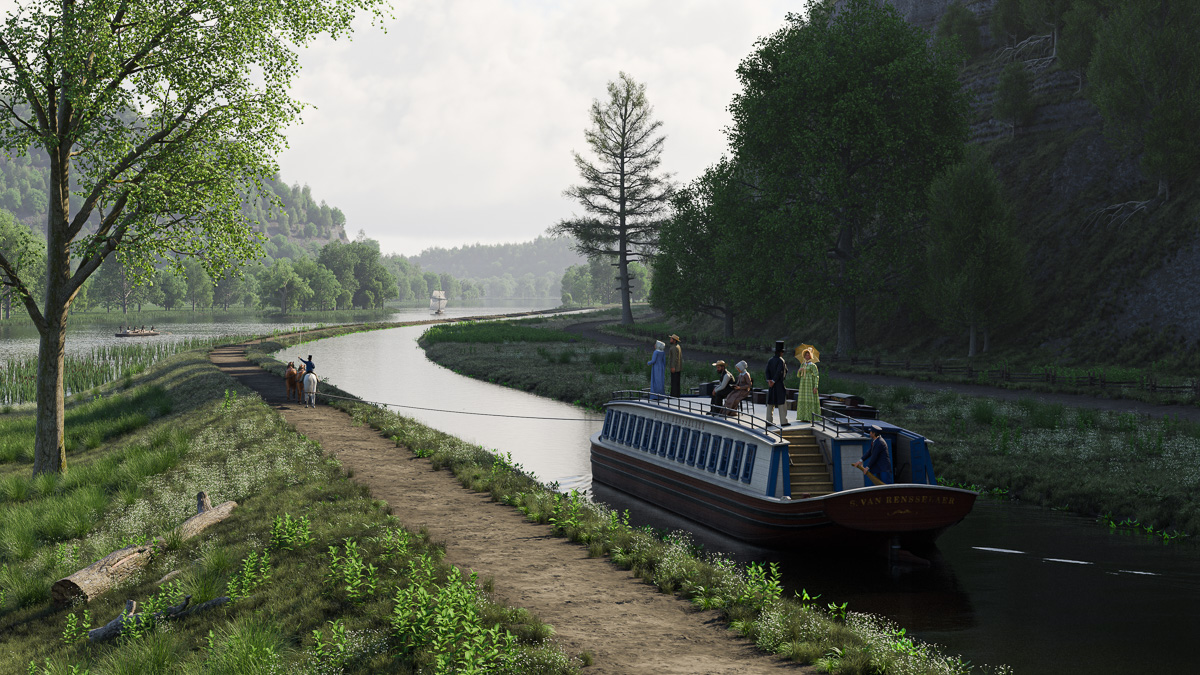
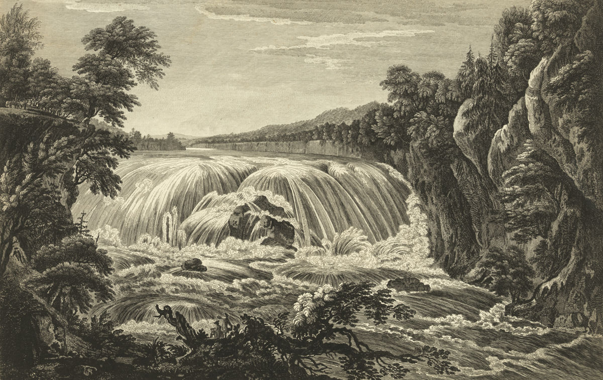
“Before me the stupendous prospect charms the eye. Forty feet from bank to bank the canal spreads. Its depth of four feet can support the mightiest bottom afloat. The hand-built towpath is three hundred and sixty-five miles long. As for the traffic, surely not all the argosies of Greece could equal this spectacle. There are lineboats, packet boats, ballheads, Durhams, gala boats, counter-sterns, toothpick scows, dugouts, arks, flats and periaugers, and always the slow rafts, all transporting such cargoes as were never before conceived of.”—Samuel Hopkins Adams, Canal Bride

From the very beginning, as soon as individual sections were finished and opened, the Erie Canal became jammed with all sorts of vessels. Many were barely seaworthy, rough rafts poled along by owners eager to cash in on the novelty and ease of this new mode of conveyance. Because the canal was built at taxpayer expense, it belonged to every citizen. Anyone who could pony up the toll could use it. And they did.

View on the Canal
An open, square-ended scow hauling stone passes a fancy passenger packet in this detail from “View on the Erie Canal,” painted by John William Hill in 1829. (The New York Public Library)

As with many things concerning the early Erie Canal, details of the boats first used on it are now obscure. Mostly we are left with vague, second-hand accounts that don’t go into much detail.

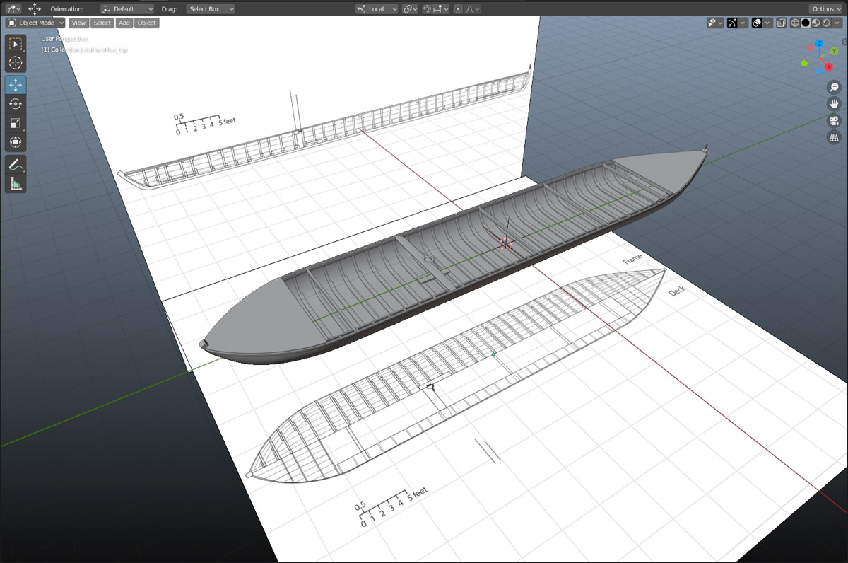
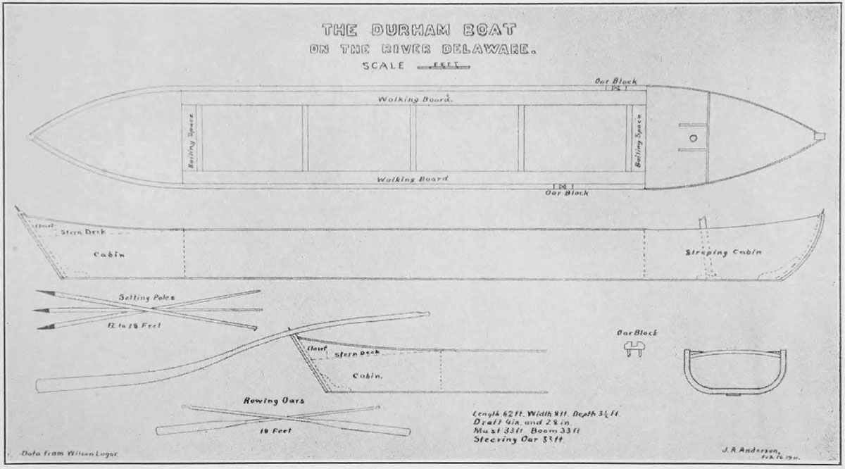
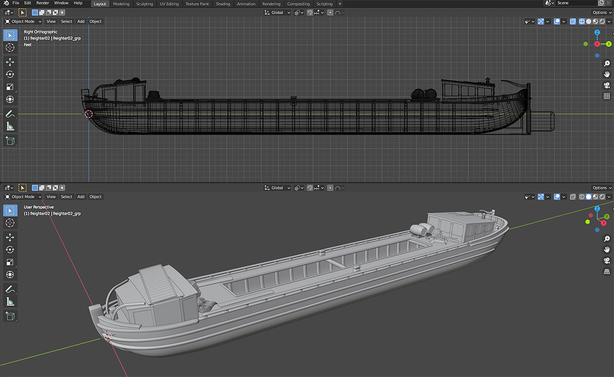
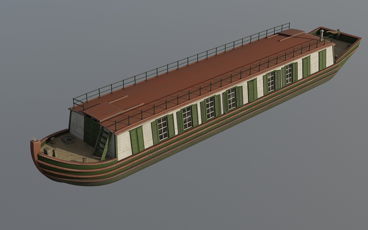
These report that early freighters were small, 60 or 70 feet long, 7 feet in the beam, and could haul about 30 tons of cargo. By 1830 boats reached their maximum size, 75 feet long, about 14 feet in the beam, and could carry up to 75 tons.

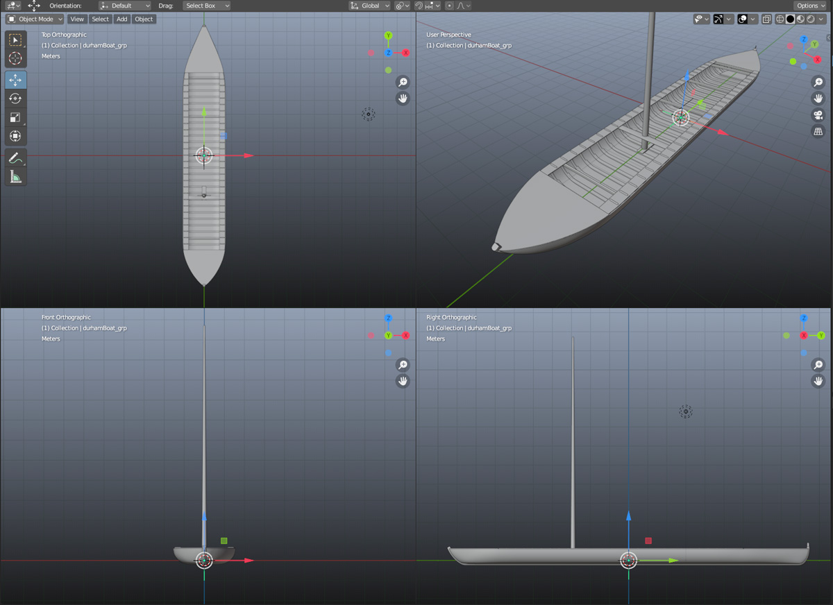
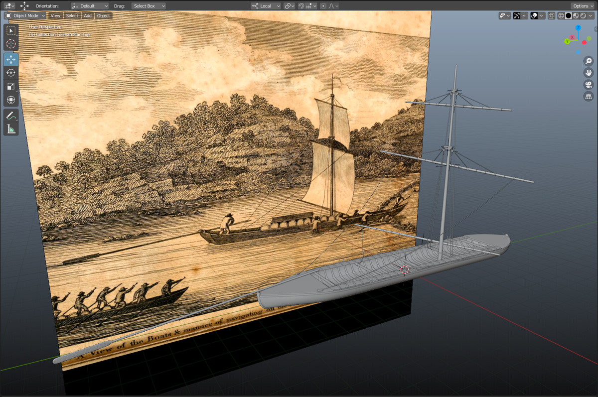
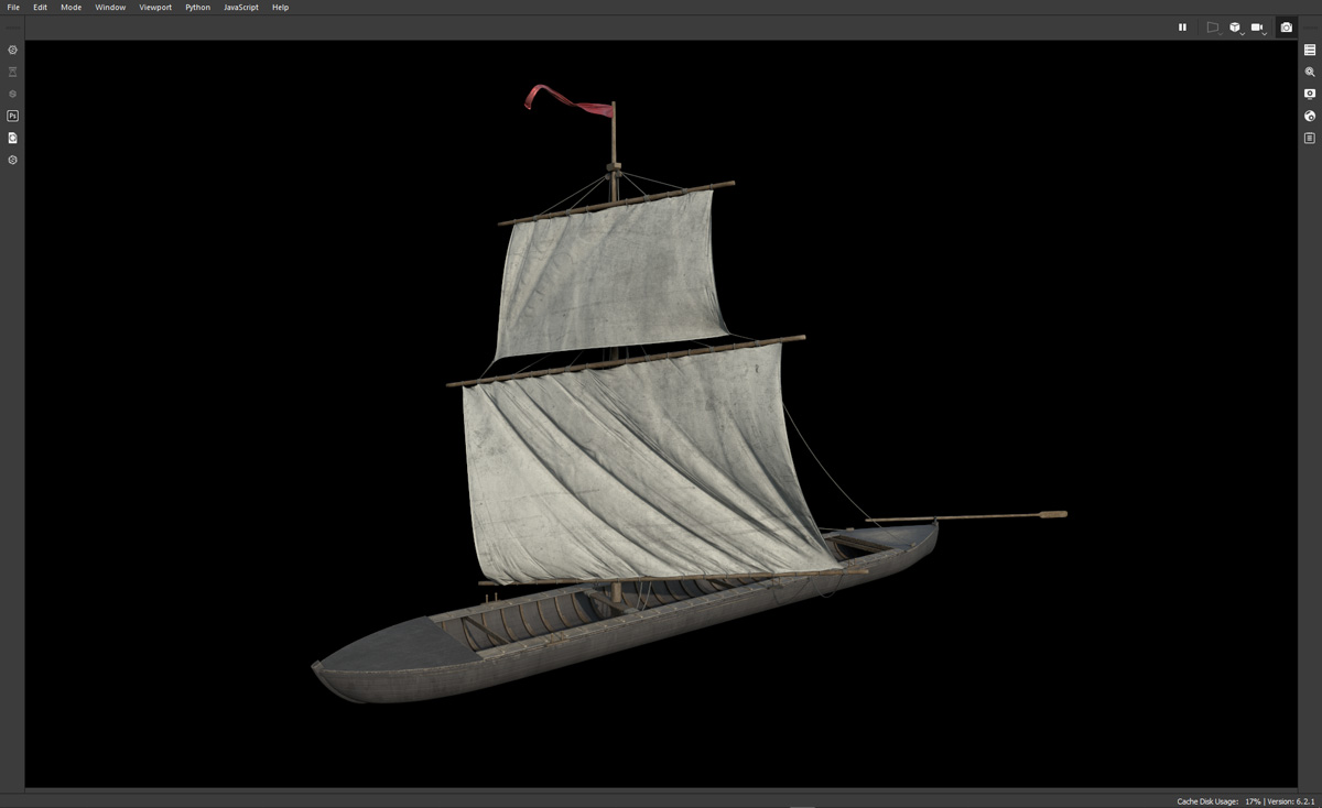
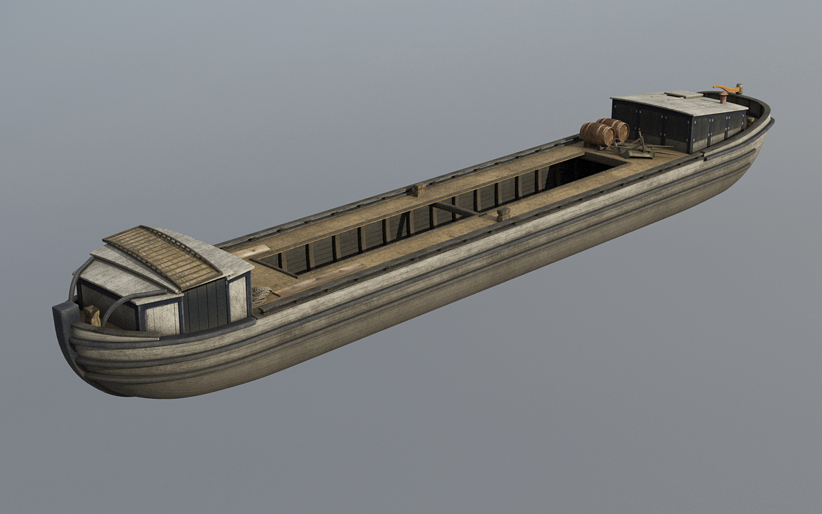
The first set of dimensions are similar to those of a Durham boat, which suggests that some of those Mohawk River watercraft were being diverted to the canal to help fill a sudden demand for boats. Contemporary newspaper reports confirm this.

Geneva Palladium 1823
Boatbuilders began constructing vessels designed for the Erie Canal even before it was completely open. This item, reprinted from Niles Weekly Register in the Feb. 26, 1823 edition of the Geneva Palladium, describes how Durham boats were being replaced by those “built specially for the canal.” (New York Historic Newspapers)

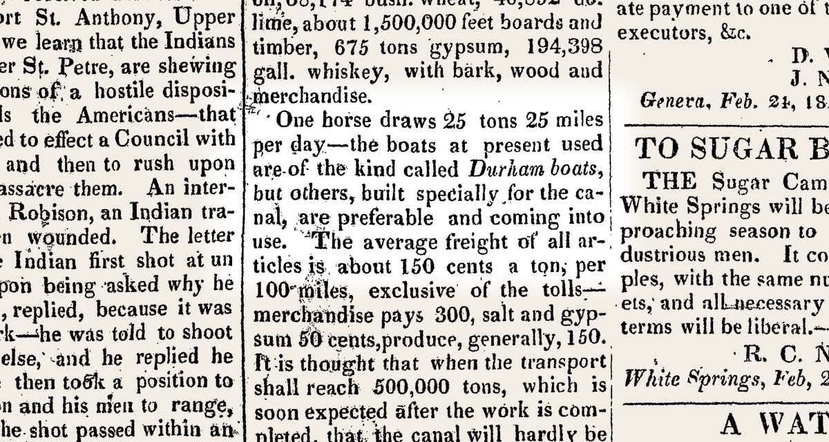
At the time boatbuilding was a traditional occupation in which the master builders did not work from blueprints but from experience and memory. That sort of industry does not turn on a dime. It may be that existing boatyards continued to turn out boats modeled on the Durham long after the first sections of the canal were opened.

New boatyards eager to cash in soon sprang up, particularly in new canal boomtowns such as Utica, Rochester, and Buffalo. They would have built boats designed for maximum profit, as large as the canal’s 15-by-90-foot lock chambers would allow. I suspect that 14-by-75-foot boats would have been common well before 1830.

The canal commissioners allude to this in their 1825 report. “Two boats cannot pass each other upon any of the aqueducts,” they wrote, “and the canals being but 40 feet wide on the surface, and 28 at the bottom, and the boats 14 feet wide, only two can pass each other on the canal . . .”

Target No. 16
Drawing by Tim Caza depicts the wreck of one of the canal boats discovered in 2019 on the floor of Seneca Lake. (Seneca Lake Archaeological & Bathymetric Survey)

Finger Lakes time capsule

Fortunately for us, working Erie Canal boats have been preserved at the bottom of a lake in central New York.

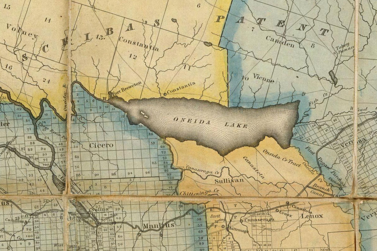
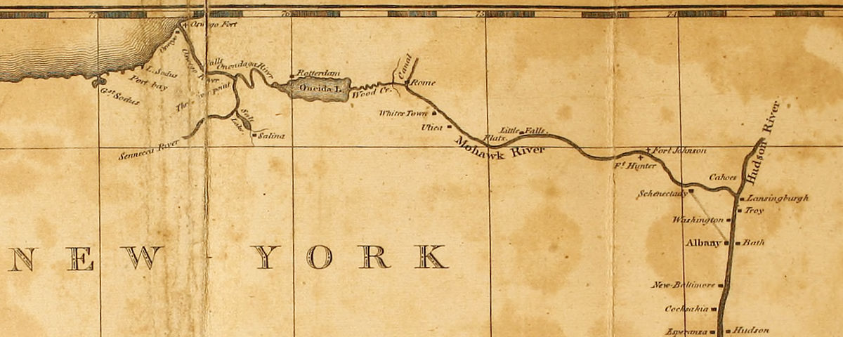
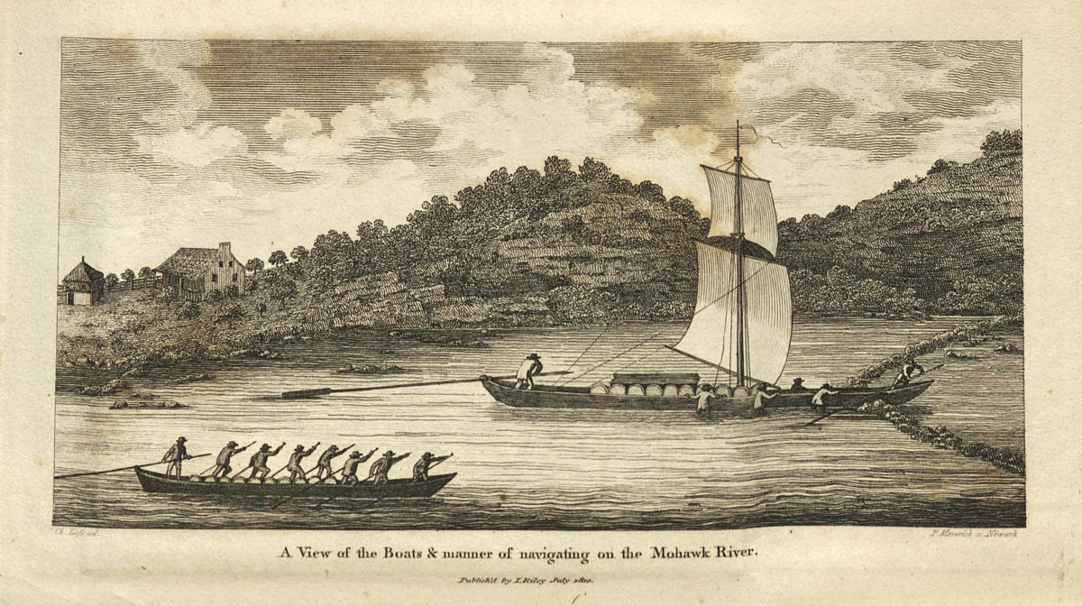
Seneca Lake, one of New York’s Finger Lakes, in 1828 was connected to the Erie Canal by the Cayuga and Seneca Canal. In 1834 a second lateral canal connected Watkins Glen, at the lake’s southern tip, to the Chemung River at Elmira. Canal boats, pulled by horse or mule teams along the laterals, were towed by steamships across the lake. The boats mostly carried Pennsylvania coal, but the Elmira, Corning, and Buffalo Line also advertised a weekly passenger run from Elmira to Buffalo.

View of freighter model in Blender
A model of an Erie Canal freighter based on the one discovered in Seneca Lake, in Blender. The graceful shape of the freighter’s hull becomes apparent in these orthogonal and perspective views. (Model by Steve Boerner)

Canal boats would be towed across the lake until 1878, when the Chemung Canal was abandoned. Not all of them made it. Seneca Lake, very deep and subject to sudden squalls, would claim a few.

An underwater survey using side-scan and multibeam sonar would begin to find them in 2018 and 2019. The Seneca Lake Archaeological & Bathymetric Survey was led by researchers from the Lake Champlain Maritime Museum with the support of New York state and several private organizations, and included members of the team that had discovered an early 19th-century Durham boat in Oneida Lake.

Erie Canal Freighter
Freighter model, shaded and rendered in Terragen, includes a horse bridge stowed on top of the forward cabin, the “bow stable” where the boat’s off-duty team of horses or mules were sheltered. (Model by Steve Boerner)

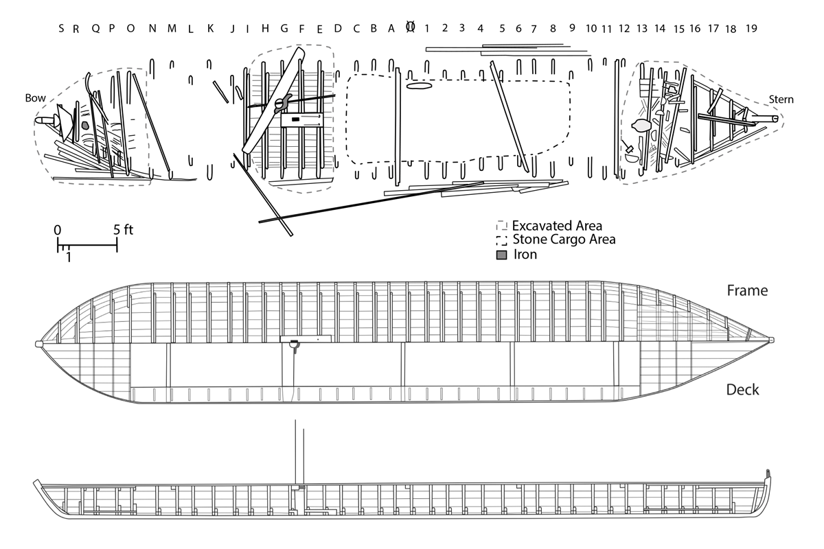
Promising targets were visited and photographed by an underwater, remotely operated vehicle. The result is a catalog of 19th-century canal vessels, from scows and freighters to, incredibly, what looks to be a passenger packet. (You can support one of the survey sponsors, the Finger Lakes Boating Museum, by purchasing a printed copy of the survey report from their online shop.) Allowing for the fact that all of the wrecks are encrusted with invasive quagga mussels, many are in remarkable condition.

Several of the wrecks have been identified as original Erie Canal-era boats. In the late 19th century the average lifespan of a canal boat was 10 years. If this held true earlier in the century, then some of these boats, which date from the mid-1830s, may have been built in the 1820s.

Erie Canal Scow
Model of an original Erie Cana-era scow, based on one of the wrecks discovered in Seneca Lake. (Model by Steve Boerner)

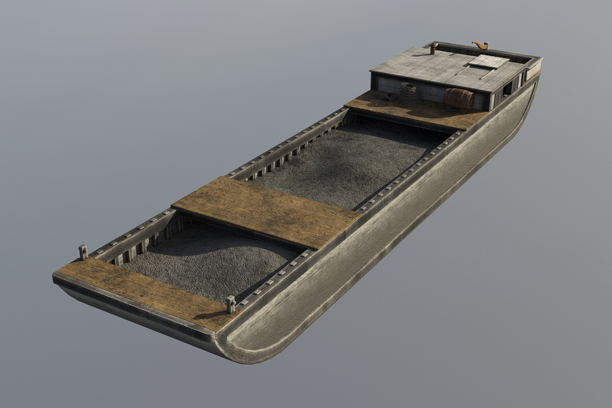
One of the wrecks was a scow, a open, square-ended design that was outlawed in the 1840s because of the damage its sharp corners caused to canal structures and other boats. But the hulls of the other original Erie-era wrecks have more graceful lines.

Packet Boat
Model based on Target 7, a wreck that appears to be an original Erie Canal-era packet boat.

These shapes seem to differ from what would come later. The boxy lakers of the late 19th century and industrial steel barges of the 20th were, above all, utilitarian. But these were boats. It’s almost as if their builders, faced with the new challenge of crafting vessels for the placid waters of the Erie Canal, still had the unpredictable Mohawk River very much in mind.

Boat test rendering
A scene put together to test some of the new boat models includes the packet (left), freighter (right, rear), and an existing model of a Mohawk River Durham boat (right, front) for comparison. (Rendering by Steve Boerner)

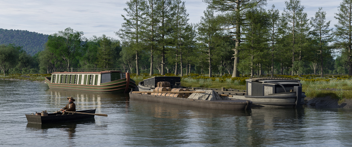
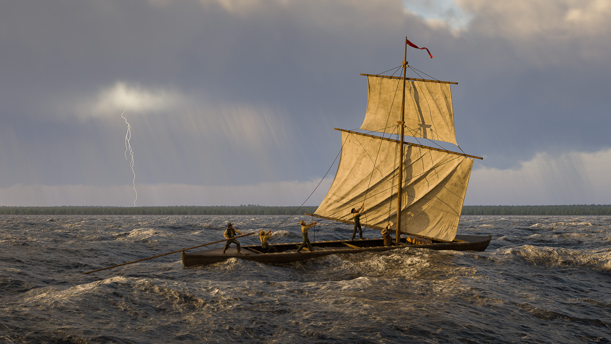
The expanded fleet of models will eventually find its way into new scenes as they are created. Next up will be adding some less-conventional vessels, like the log rafts (which were actually very common) used to transport timber to market, a line boat, and maybe even a periauger.

Without a doubt, the early canal years featured a more diverse and colorful array of watercraft than we can imagine today. For the wide-eyed Yorkers along the canal route, astounded by the sight of boats floating one after another through the landscape, it really must have been quite a spectacle.

Finishing the Noses

Navigating the Noses
Passengers on the eastbound packet Stephen van Rensselaer take in the early-morning scenery along the Mohawk River in September 1825.

The Mohawk River scene set at the Noses is finally finished. Besides the packet boat passengers, it now includes the tandem rig of three horses and driver. Two Durham boats navigate along the river in the background.

The scene is set at 8:55 a.m. September 15, 1825. The canal will officially open within a few weeks, but already a collaboration of three packet lines provides passenger service between Schenectady and Lockport. Boats running in both directions depart Utica every evening. If my math is right the eastbound boat should be in the vicinity of the Noses by the following morning.

In those days the Mohawk Valley was considered to be one of the most scenic areas of the country. Harriet Martineau, the English sociologist, feminist, and writer who passed through twice in the 1830s – once by packet and once by rail – perhaps described it best in her book Society in America:

“The aspect of the valley was really beautiful last June. It must have made the Mohawk Indians heart-sore to part with it in its former quiet state; but now there is more beauty, as well as more life. There are farms, in every stage of advancement, with all the stir of life about them; and the still, green graveyard belonging to each, showing its white palings and tombstones on the hill-side, near at hand. Sometimes a small space in the orchard is railed in for this purpose. In a shallow reach of the river there was a line of cows wading through, to bury themselves in the luxuriant pasture of the islands in the midst of the Mohawk. In a deeper part, the chain ferry-boat slowly conveyed its passengers across. The soil of the valley is remarkably rich, and the trees and verdure unusually fine. The hanging oak-woods on the ridge were beautiful; and the knolls, tilled or untilled; and the little waterfalls trickling or leaping down, to join the rushing river. Little knots of houses were clustered about the locks and bridges of the canal; and here and there a village, with its white church conspicuous, spread away into the middle of the narrow valley. The green and white canal boats might be seen stealing along under the opposite ridge, or issuing from behind a clump of elms or birches, or gliding along a graceful aqueduct, with the diminished figures of the walking passengers seen moving along the bank. On the other hand, the rail-road skirted the base of the ridge, and the shanties of the Irish labourers, roofed with turf, and the smoke issuing from a barrel at one corner, were so grouped as to look picturesque, however little comfortable. In some of the narrowest passes of the valley, the high road, the rail-road, the canal, and the river, are all brought close together, and look as if they were trying which could escape first into a larger space.”

The crossing

The Crossing
The five-man crew of the Oneida Lake Durham boat scrambles to lower the sails in the face of a storm approaching from the northwest. (Digital image copyright 2020 by Steve Boerner)

In her lively and informative introduction to the 1876 edition of The Pathfinder, Susan Fenimore Cooper describes (among many other things) her father’s ascent of the Mohawk Valley in 1808 en route to a naval posting in Oswego.

James Fenimore Cooper would have followed watercourses recently improved by the Western Inland Lock Navigation Company, taking advantage of locks and canals to bypass the Little Falls of the Mohawk River and to cross into Wood Creek. After pushing westward along this narrow channel for two days “they reached Oneida Lake, a broad sheet of dark-colored water . . . It was a day’s voyage, with the oars and poles, across the lake, against a head wind.”

Oneida Lake was an important crossroads for early travelers on New York’s inland waterways. Voyagers crossing it could head east to the Hudson Valley, west to the Finger Lakes, or north to Lake Ontario. It was small, just 21 miles long and 5 miles wide, and shallow. Even so it could appear daunting to boat crews accustomed to navigating along narrow streams.

Lake Oneida’s east-west alignment exposed it to the full fury of storms arriving from the north and northwest, and its normally placid surface could, in a matter of moments, be churned into a deadly maelstrom of four- to six-foot waves.

When that happened, the very features that made Durham boats so practical for river navigation – narrow beam, flat bottom, no keel, square rig – could quickly become liabilities. Hence most boats traveling east or west hugged the northern edge of the lake, where the heavily wooded lee shore offered some protection.

But the crew of the Durham boat discovered on the bottom of Oneida Lake, it seems, had set off on a different course.

Map of Oneida Lake
Oneida Lake shown in a detail from an 1824 map of New York state. The fledgling community of Syracuse lies to the southwest, and the line of the newly constructed Erie Canal bypasses the lake to the south. (David Rumsey Map Colllection)

Along with the remains of the boat, the underwater archeology team uncovered its cargo, more than five tons of silty dolostone rock.

Dolostone is also known as dolomite and, as you might recall, it forms the Mountain Ridge west of Lockport. It occurs in various forms in a broad swath across New York state, and there is an outcropping of silty dolostone just south of Oneida Lake.

Members of the team suggest that the crew loaded their boat with the dolostone and planned to transport it to the north shore. As they wrote in their paper, Durham Boat – Defining a Vernacular Watercraft Type: “Attempting to sail across the short dimension of the lake would explain why the boat sank in the middle of the lake, when staying closer to the shore would have been safer.”

“Wherever the destination,” they continue, “the crew made it to the center of the lake before the vessel sank. . . . If the vessel was sunk in a storm, it is unclear why the captain risked his life for the relatively worthless cargo found on the site. It may have been that the light load and increasing breeze led him to believe that he could beat the storm across the lake. Whatever the circumstances, it would seem that the captain misjudged Oneida Lake, his boat, his skills, or some combination of these factors.”

No mention of the boat has been found in contemporary sources, and none of the artifacts found on the site can be precisely dated. The boat could have been lost, the team writes, any time between 1803 and 1840.

To depict the last crossing of the Oneida Lake Durham boat, I’ve chosen a date in the middle, September 1821.

There is some educated guesswork in this scene: Not only the date and situation, but also the method the crew might have used in their effort to beat the storm. Instead of rigging the square and topsail, they may have opted to leave them stowed and row across the lake. And the boat has been given the usual Durham complement of five, a steersman and four crew, though perhaps there were fewer on board when it foundered.

Their fate is anyone’s guess. The watercraft, loaded with rocks, would have gone straight to the bottom, but pieces of it may have been left behind on the surface. (Mast, spars and possibly the walking boards are missing from the excavation site.) The shore would have been in sight; perhaps some members of the crew, clinging to bits of flotsam, made it to safety.

September 1821 also falls in the middle of the Erie Canal construction period. By then the canal in this section, which bypassed Oneida Lake to the south, had been finished. The temperamental lake’s role in western navigation – along with the Durham boat – would soon come to an end.

Up from the depths

Durham boat plan
Drawings by Ben Ford show excavated sections of the Durham boat discovered on the floor of Oneida Lake and reconstructed plans of the hull. (Shipwrecks of Upstate NY)

By 1803 the Western Inland Lock Navigation Company had opened an unobstructed water route from Schenectady to Oneida Lake. Durham boats, because of their large cargo capacity, became the watercraft of choice for those who wanted to ship goods and raw materials between the interior and the eastern seaboard.

But there are clues that the Durham may have been introduced even earlier.

Historian Philip Lord Jr., in The Navigators: A Journal of Passage on the Inland Waterways of New York (1793), quotes a 1793 letter sent to Philip Schuyler, president of the Western Inland Lock Navigation Company, recommending a contractor named John Richardson for work on Wood Creek. The letter mentions that Richardson “has lately constructed a boat of thirteen tons burden on a plan which has never before been adopted in this State, and he has been so successful that we have no doubt but his improvement will prove extensively useful. He has brought this boat from the upper end of Cayuga Lake with a freight of six tons without the least inconvenience.”

While sailing his unusual vessel from Cayuga Lake to Wood Creek, Richardson would have crossed Oneida Lake, a key crossroads of the improved navigation system. For the next 50 years, generations of Durham boats would have followed across this shallow but often hazardous body of water. Inevitably, some would have been lost.

Sure enough, one was discovered in 2011 by Timothy Caza, who returned with a team in 2015 to do a partial excavation and document the site. You can read Caza’s account here.

Durham boat hull
The Durham boat hull is reconstructed as a 3D model in Blender, guided by Ben Ford’s drawings.

An academic paper (Durham Boat – Defining a Vernacular Watercraft Type) coauthored by Caza, Ben Ford, an anthropologist who advised the team and took part in the excavation, and other members of the team, documents the excavation in detail, including measurements of the boat, the materials from which it was constructed, and artifacts found on the site.

Because of their work, we no longer have to depend on vague second-hand descriptions and guesswork. We can digitally recreate this specific boat, which we know voyaged upon the inland waters of New York very early in the country’s history.

Durham boat quad view
Quad view of the completed Durham boat hull and mast.

The model is built in Blender, a free, open-source 3D modeling and animation software package that I’m trying for the first time. So far the experience has been very positive – the application is powerful, the documentation is fairly complete, and there is a base of devoted users online very willing to help. Blender may become my main modeling application going forward.

Durham boat mast
Peter Maverick’s 1810 engraving is used as a reference for the height and structure of the mast and spars.

If you compare the drawings of this boat to historical re-creations of Delaware River Durham boats, you will notice a few differences. This should come as no surprise. Besides regional variations, individual builders probably had their own ideas of how a Durham should be constructed. Add to that the availability of raw materials and various skill levels of the builders, and it would be surprising if they were all the same.

However, they were all built along the same basic plan: about 60 feet long, 8-10 feet wide, lightweight, flat bottom, no true keel, pointed fore and aft. Many Durhams included a removable mast and could be rigged when the wind was favorable. Usually they were propelled by men using set poles in shallow water, and oars in deeper water.

Durham boat sails
A wind simulation puffs out the square sail, topsail and pennant in Marvelous Designer.

This design meant they were most at home in shallow, swift streams, and their maneuverability and speed earned the admiration of the men who worked on them.

Wilson Lugar, who owned and operated a Durham on the Delaware River in the mid-19th century, was quoted by J. A. Anderson in Navigation of the Upper Delaware, published in 1913:

“The Durham boat was the most beautiful modeled boat I ever saw. Her lines were perfect and beautiful. Her movement through the water was so easy, with such a clean run aft, that she left the water almost as calm as she found it. . . . They could outsail any boat I ever saw sail, with a fair wind.”

Durham boat shading
Surface textures and colors are added in Substance Painter.

I am taking a few liberties. No mast or spars were found with the wreck, but it did include a step and brace for a removable mast. So a mast, spars, and rigging are added based on the engraving from Christian Schultz’s 1810 Travels on an Inland Voyage. In the same vein, I’ve added a gunwale (a thin strip of wood to protect the top edge of the hull) an inner gunwale (or inwale), and thole pins for bracing the oars. But those are the extent of my additions.

The model will be placed on the Mohawk River in the background of the scene set at The Noses. But after all this work I’ve decided take a brief detour and make another scene where it can play a more prominent role.

Into the west

Cohoes Falls
Cohoes Falls, on the Mohawk River above its junction with the Hudson, as depicted in an early engraving. The 90-foot cataract remained a serious impediment to western navigation until it was finally bypassed by the Erie Canal in 1825. (Library of Congress)

Before the Erie Canal, there was the Western Inland Lock Navigation Company.

A private corporation formed to improve the waterways of central New York, the company was chartered by the state in 1792 to open routes from the Hudson River to points west.

The idea was not to build a single canal from the Hudson to Lake Erie, or even to Lake Ontario. At the time, that would have been considered little short of madness. Instead, short canals would divert existing rivers around waterfalls and link them with other rivers and creeks, making them navigable to large boats.

The Mohawk River would be opened by removing boulders and building wing dams to eliminate its numerous rifts, or shallow rapids. Wood Creek, the timber-choked, serpentine link to Oneida Lake, would be cleared, straightened, and connected to the Mohawk. Further work on the Oswego, Seneca, and Onondaga (now Oneida) rivers would extend navigation to Lake Ontario and the Finger Lakes.

It was an ambitious plan. Legislators, recognizing this, granted the corporation a 15-year time frame to accomplish it.

Map of the Hudson and Mohawk Rivers
This map, published in Christian Schultz’s 1810 “Travelers on an Inland Voyage,” depicts the water routes improved by the Western Inland Lock Navigation Company. Though it failed to open a navigable route to Lake Ontario (upper left), the company opened the Seneca River and other rivers further west (not shown) to large-boat navigation into the Finger Lakes region of central New York. (University of Pittsburgh Library System via Internet Archive)

But the planner’s reach far exceeded their – and their young country’s – grasp. The vast scale of the project, with work sites scattered across thousands of square miles of wilderness, combined with primitive technology and poor management, doomed it from the start.

The planners’ lack of practical experience didn’t help.

Elkanah Watson, an early and vocal canal proponent and one of the directors of the corporation, made no secret of this a few years later when he described “borrowing” ideas from a similar project on the Potomac River:

“Indeed we were so extremely deficient in a knowledge of the science of constructing locks and canals, that we found it expedient to send a committee of respectable mechanics, to examine the imperfect works then constructing on the Potowmac, for the purpose of gaining information,—we had no other resource but from books.”

Old lock at Little Falls
A lock constructed by the Western Inland Lock Navigation Company in Little Falls, as it appeared in 1911. (New York State Archives)

The Western Inland Lock Navigation Company operated until 1820, when it was purchased by the state and absorbed into the Erie Canal. Financially, it had barely survived and is considered by many to be a failure. Two of its primary objectives – opening the Oswego River to Lake Ontario and bypassing Cohoes Falls near Albany – were never seriously addressed.

Even so, much had been accomplished. In 1818, Watson wrote from Seneca Falls:

“In 1791, I came in a batteau from Schenectady to this place. . . . At that period they could only transport from one and a half, to two tons, in a flat boat, at an expense of from seventy-five to one hundred dollars a ton, from Schenectady to this place.

“By the completion of the works along the Mohawk River, Wood creek, and down Onondaga and up Seneca Rivers, in 1796, boats of a different construction, carrying from fifteen to sixteen tons, were introduced, and the price of transportation was reduced to about thirty-two dollars per ton, from Schenectady to the Seneca falls, and half that sum on returned cargoes.”

Later planners of the Erie Canal learned three important lessons from the failure of the Western Inland Lock Navigation Company. First, the economic benefit of constructing a water route from the eastern seaboard to the interior could potentially far outweigh the cost. Second, the idea of digging an artificial channel across New York state – crazy as that seemed – was the only way this could be accomplished. Finally, the scale of such a project exceeded the capacity of private enterprise and meant it would have to be organized by the state.

Durham boat plan
This drawing of a Delaware River Durham boat, made by John Alexander Anderson and published in “Navigation on the Upper Delaware” in 1913, was based on the recollections of Wilson Lugar, who owned and operated a Durham boat in the 1860s. (Library of Congress)

The elusive Durham

The “boats of a different construction” that Watson mentioned were almost certainly Durham boats. These narrow craft, about 60 feet long and pointed on both ends, had been used since the early 18th century to haul grain and iron ore on the Delaware River. Fully loaded, a Durham boat could carry from 15 to 20 tons of cargo, and its shallow draft and flat bottom made it perfect for navigation on swift-flowing rivers.

Famously, Durham boats were used by George Washington to ferry his troops across the Delaware on their way to Trenton, and victory, in 1776.

By the late 18th century, Durham boats were plying the Susquehanna and Mohawk rivers in Pennsylvania and New York, the St. Lawrence River in Canada, and even the Fox River in modern-day Wisconsin.

Despite regional variations, the boats all shared the same basic design. In deep water they could be powered by oars or sails – though the lack of a keel made that last bit tricky. In shallow water they were driven forward by men who walked the length of the boat – two or three on each side – while bracing themselves against long, iron-tipped poles set into the riverbed.

In 1888, historians in Wisconsin interviewed Alexis Clermont, who had been born in 1808 and, in his early 20s, joined the crew of a Durham boat:

“There were generally seven men of us – six poles and a steersman; sometimes there was a cook, but the usual custom was to have a cook for a fleet of three boats. Traders were in the habit of running such a fleet; for when we came to rapids, the three crews together made up a crew big enough to take the boats and their lading through with ease. Each boat had a captain who was steersman. Durham boats were from sixty to seventy feet long, and carried from twelve to sixteen tons.”

Similar accounts are scattered throughout the historical record. We know that the boats often set out in fleets of 25 or more; in all probability, thousands of Durham boats were in service at any one time, hauling raw materials like potash, grain, and iron ore downstream, and finished goods back into the interior. For good reason, the Durham boat has been called the semi-tractor trailer of early America.

But the commencement of the canal era, and later the arrival of the railroad, quickly made the Durham boat obsolete. This once-ubiquitous watercraft was gone by the Civil War, without leaving a trace.

Durham boat on the Mohawk River
A Durham boat (right) navigates the narrow passage through a Mohawk River wing dam in this 1810 view, published in “Travels on an Inland Voyage” by Christian Schultz. A bateau powered by a crew using set poles follows. (New York State Library)

For a while, though, Mohawk River Durham boats and Erie Canal boats would have co-existed, with Durham boats carrying on as before on the river while newfangled packets, freighters and line boats crowded into the new canal. This would have been particularly true in 1825, the date of the scene I’m working on, when the canal was not yet open to through traffic. So I’d really like to include a Durham boat or two on the river.

But what did they look like? How were they built? We are left with a few fragmentary descriptions and a couple of contemporary images. The best, created by New York engraver Peter Maverick and reproduced in Christian Schultz’s “Travels on an Inland Voyage,” shows a crew, waist-deep in the Mohawk River, struggling to guide their boat through the narrow opening of a wing dam.

That 1810 engraving might have been our last eyewitness view of a Mohawk River Durham boat.

If not for the fact that one was discovered on the floor of Oneida Lake two centuries later.

But that will have to wait for the next post.