The crossing

The Crossing
The five-man crew of the Oneida Lake Durham boat scrambles to lower the sails in the face of a storm approaching from the northwest. (Digital image copyright 2020 by Steve Boerner)

In her lively and informative introduction to the 1876 edition of The Pathfinder, Susan Fenimore Cooper describes (among many other things) her father’s ascent of the Mohawk Valley in 1808 en route to a naval posting in Oswego.

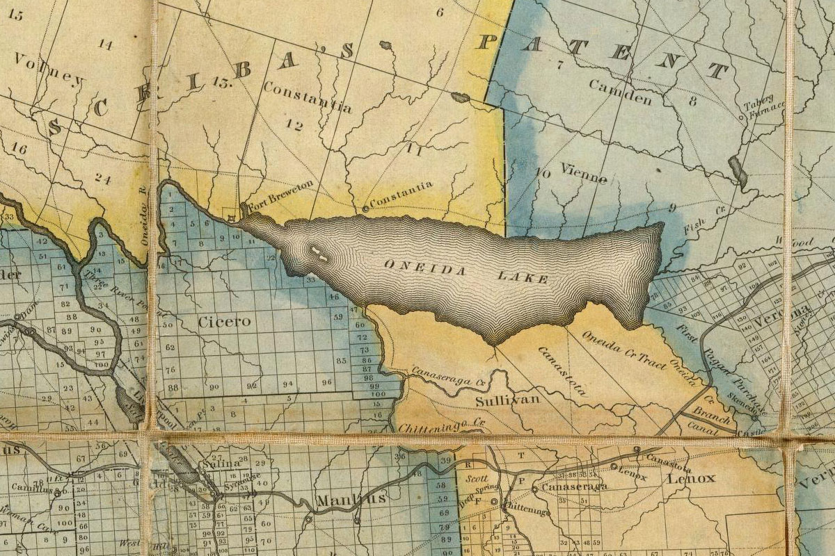
James Fenimore Cooper would have followed watercourses recently improved by the Western Inland Lock Navigation Company, taking advantage of locks and canals to bypass the Little Falls of the Mohawk River and to cross into Wood Creek. After pushing westward along this narrow channel for two days “they reached Oneida Lake, a broad sheet of dark-colored water . . . It was a day’s voyage, with the oars and poles, across the lake, against a head wind.”

Oneida Lake was an important crossroads for early travelers on New York’s inland waterways. Voyagers crossing it could head east to the Hudson Valley, west to the Finger Lakes, or north to Lake Ontario. It was small, just 21 miles long and 5 miles wide, and shallow. Even so it could appear daunting to boat crews accustomed to navigating along narrow streams.

Lake Oneida’s east-west alignment exposed it to the full fury of storms arriving from the north and northwest, and its normally placid surface could, in a matter of moments, be churned into a deadly maelstrom of four- to six-foot waves.

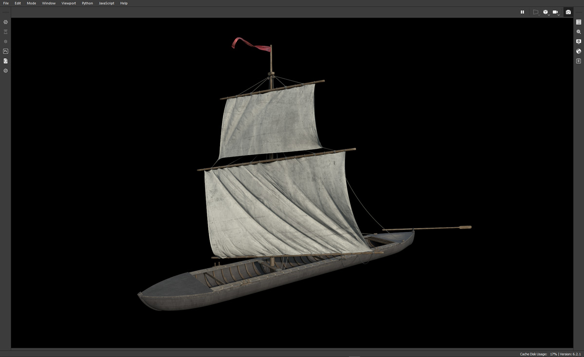
When that happened, the very features that made Durham boats so practical for river navigation – narrow beam, flat bottom, no keel, square rig – could quickly become liabilities. Hence most boats traveling east or west hugged the northern edge of the lake, where the heavily wooded lee shore offered some protection.

But the crew of the Durham boat discovered on the bottom of Oneida Lake, it seems, had set off on a different course.

Map of Oneida Lake
Oneida Lake shown in a detail from an 1824 map of New York state. The fledgling community of Syracuse lies to the southwest, and the line of the newly constructed Erie Canal bypasses the lake to the south. (David Rumsey Map Colllection)

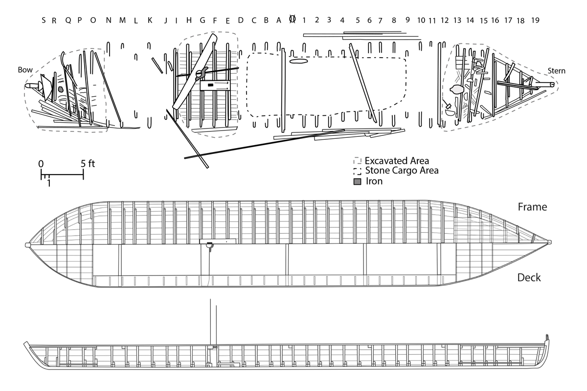
Along with the remains of the boat, the underwater archeology team uncovered its cargo, more than five tons of silty dolostone rock.

Dolostone is also known as dolomite and, as you might recall, it forms the Mountain Ridge west of Lockport. It occurs in various forms in a broad swath across New York state, and there is an outcropping of silty dolostone just south of Oneida Lake.

Members of the team suggest that the crew loaded their boat with the dolostone and planned to transport it to the north shore. As they wrote in their paper, Durham Boat – Defining a Vernacular Watercraft Type: “Attempting to sail across the short dimension of the lake would explain why the boat sank in the middle of the lake, when staying closer to the shore would have been safer.”

“Wherever the destination,” they continue, “the crew made it to the center of the lake before the vessel sank. . . . If the vessel was sunk in a storm, it is unclear why the captain risked his life for the relatively worthless cargo found on the site. It may have been that the light load and increasing breeze led him to believe that he could beat the storm across the lake. Whatever the circumstances, it would seem that the captain misjudged Oneida Lake, his boat, his skills, or some combination of these factors.”

No mention of the boat has been found in contemporary sources, and none of the artifacts found on the site can be precisely dated. The boat could have been lost, the team writes, any time between 1803 and 1840.

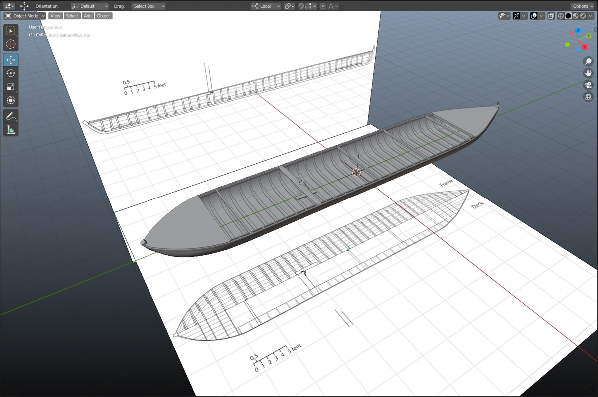
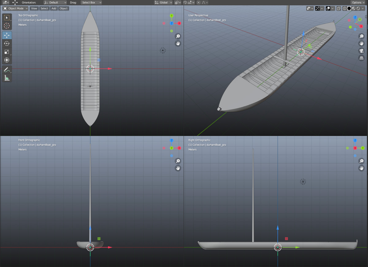
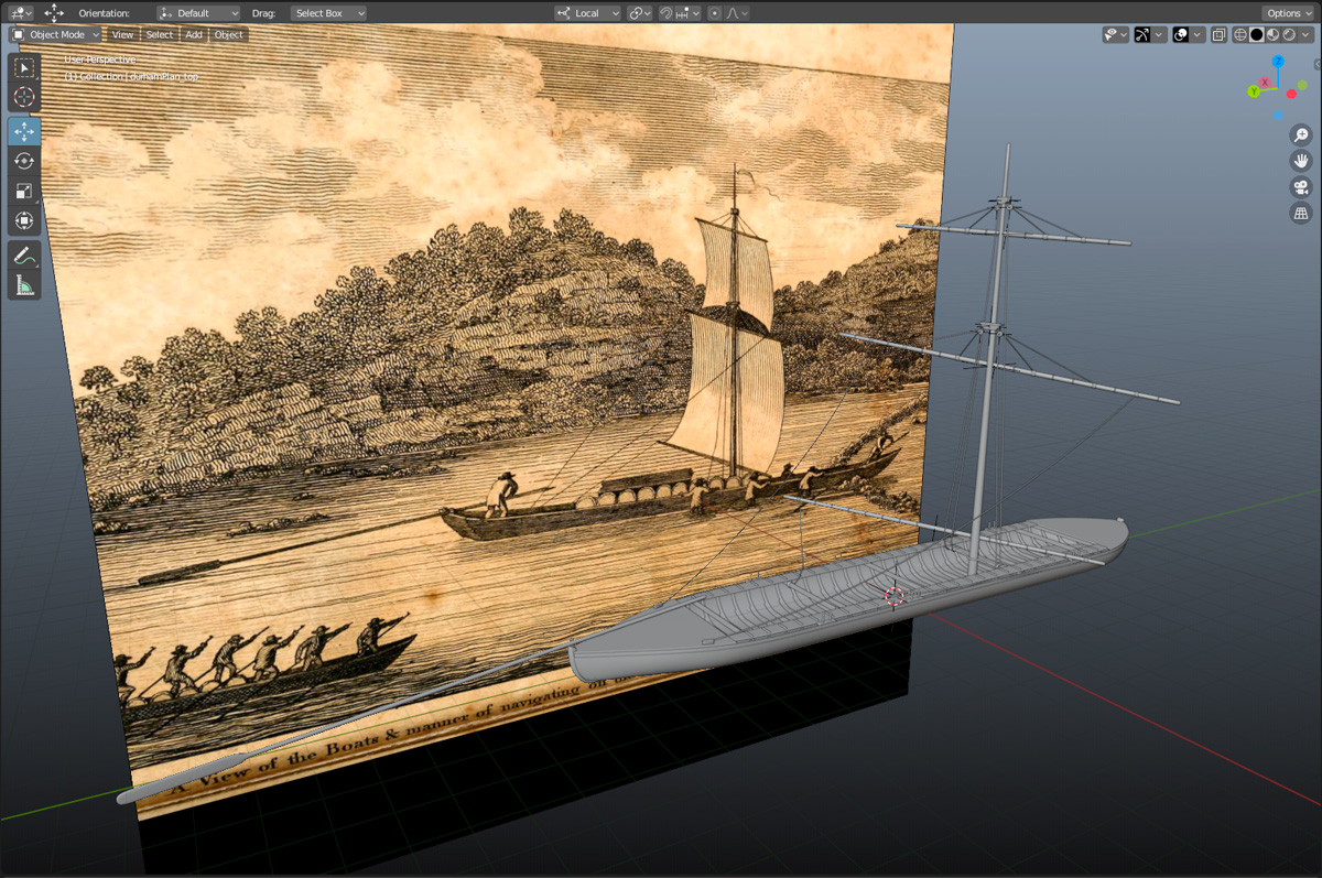
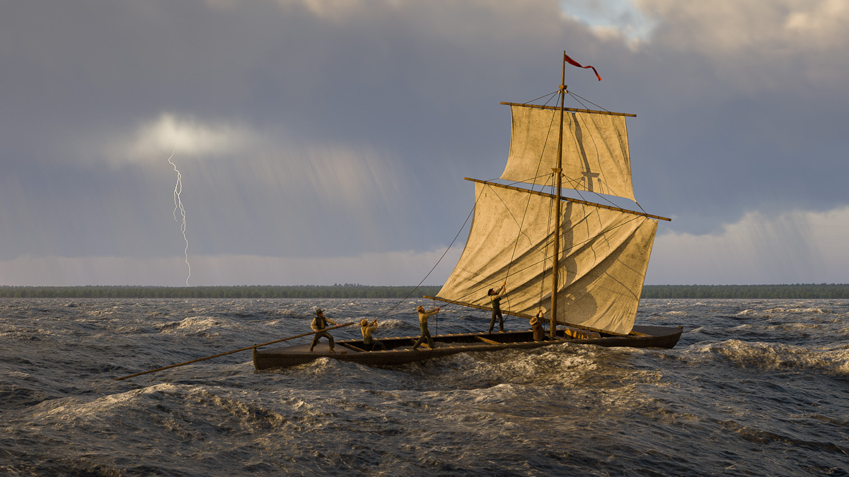
To depict the last crossing of the Oneida Lake Durham boat, I’ve chosen a date in the middle, September 1821.

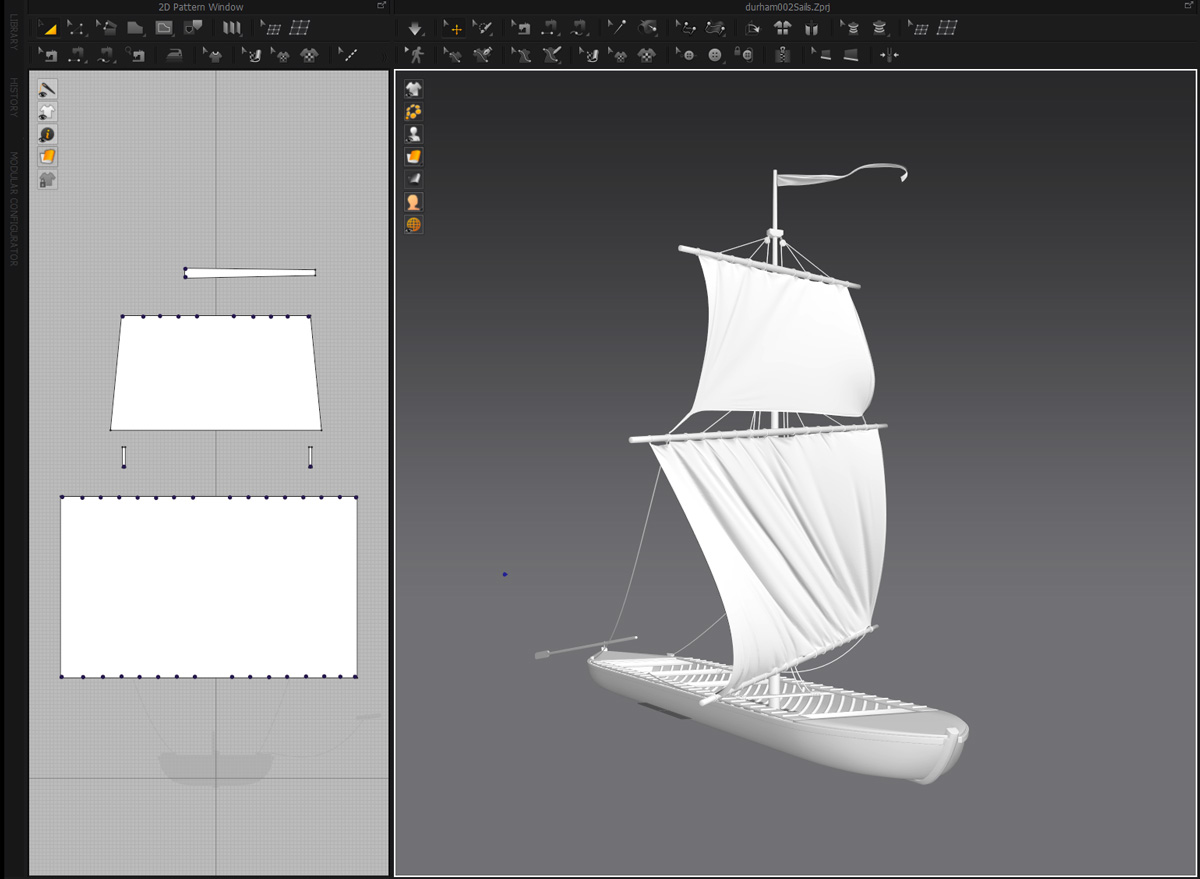
There is some educated guesswork in this scene: Not only the date and situation, but also the method the crew might have used in their effort to beat the storm. Instead of rigging the square and topsail, they may have opted to leave them stowed and row across the lake. And the boat has been given the usual Durham complement of five, a steersman and four crew, though perhaps there were fewer on board when it foundered.

Their fate is anyone’s guess. The watercraft, loaded with rocks, would have gone straight to the bottom, but pieces of it may have been left behind on the surface. (Mast, spars and possibly the walking boards are missing from the excavation site.) The shore would have been in sight; perhaps some members of the crew, clinging to bits of flotsam, made it to safety.

September 1821 also falls in the middle of the Erie Canal construction period. By then the canal in this section, which bypassed Oneida Lake to the south, had been finished. The temperamental lake’s role in western navigation – along with the Durham boat – would soon come to an end.

Up from the depths

Durham boat plan
Drawings by Ben Ford show excavated sections of the Durham boat discovered on the floor of Oneida Lake and reconstructed plans of the hull. (Shipwrecks of Upstate NY)

By 1803 the Western Inland Lock Navigation Company had opened an unobstructed water route from Schenectady to Oneida Lake. Durham boats, because of their large cargo capacity, became the watercraft of choice for those who wanted to ship goods and raw materials between the interior and the eastern seaboard.

But there are clues that the Durham may have been introduced even earlier.

Historian Philip Lord Jr., in The Navigators: A Journal of Passage on the Inland Waterways of New York (1793), quotes a 1793 letter sent to Philip Schuyler, president of the Western Inland Lock Navigation Company, recommending a contractor named John Richardson for work on Wood Creek. The letter mentions that Richardson “has lately constructed a boat of thirteen tons burden on a plan which has never before been adopted in this State, and he has been so successful that we have no doubt but his improvement will prove extensively useful. He has brought this boat from the upper end of Cayuga Lake with a freight of six tons without the least inconvenience.”

While sailing his unusual vessel from Cayuga Lake to Wood Creek, Richardson would have crossed Oneida Lake, a key crossroads of the improved navigation system. For the next 50 years, generations of Durham boats would have followed across this shallow but often hazardous body of water. Inevitably, some would have been lost.

Sure enough, one was discovered in 2011 by Timothy Caza, who returned with a team in 2015 to do a partial excavation and document the site. You can read Caza’s account here.

Durham boat hull
The Durham boat hull is reconstructed as a 3D model in Blender, guided by Ben Ford’s drawings.

An academic paper (Durham Boat – Defining a Vernacular Watercraft Type) coauthored by Caza, Ben Ford, an anthropologist who advised the team and took part in the excavation, and other members of the team, documents the excavation in detail, including measurements of the boat, the materials from which it was constructed, and artifacts found on the site.

Because of their work, we no longer have to depend on vague second-hand descriptions and guesswork. We can digitally recreate this specific boat, which we know voyaged upon the inland waters of New York very early in the country’s history.

Durham boat quad view
Quad view of the completed Durham boat hull and mast.

The model is built in Blender, a free, open-source 3D modeling and animation software package that I’m trying for the first time. So far the experience has been very positive – the application is powerful, the documentation is fairly complete, and there is a base of devoted users online very willing to help. Blender may become my main modeling application going forward.

Durham boat mast
Peter Maverick’s 1810 engraving is used as a reference for the height and structure of the mast and spars.

If you compare the drawings of this boat to historical re-creations of Delaware River Durham boats, you will notice a few differences. This should come as no surprise. Besides regional variations, individual builders probably had their own ideas of how a Durham should be constructed. Add to that the availability of raw materials and various skill levels of the builders, and it would be surprising if they were all the same.

However, they were all built along the same basic plan: about 60 feet long, 8-10 feet wide, lightweight, flat bottom, no true keel, pointed fore and aft. Many Durhams included a removable mast and could be rigged when the wind was favorable. Usually they were propelled by men using set poles in shallow water, and oars in deeper water.

Durham boat sails
A wind simulation puffs out the square sail, topsail and pennant in Marvelous Designer.

This design meant they were most at home in shallow, swift streams, and their maneuverability and speed earned the admiration of the men who worked on them.

Wilson Lugar, who owned and operated a Durham on the Delaware River in the mid-19th century, was quoted by J. A. Anderson in Navigation of the Upper Delaware, published in 1913:

“The Durham boat was the most beautiful modeled boat I ever saw. Her lines were perfect and beautiful. Her movement through the water was so easy, with such a clean run aft, that she left the water almost as calm as she found it. . . . They could outsail any boat I ever saw sail, with a fair wind.”

Durham boat shading
Surface textures and colors are added in Substance Painter.

I am taking a few liberties. No mast or spars were found with the wreck, but it did include a step and brace for a removable mast. So a mast, spars, and rigging are added based on the engraving from Christian Schultz’s 1810 Travels on an Inland Voyage. In the same vein, I’ve added a gunwale (a thin strip of wood to protect the top edge of the hull) an inner gunwale (or inwale), and thole pins for bracing the oars. But those are the extent of my additions.

The model will be placed on the Mohawk River in the background of the scene set at The Noses. But after all this work I’ve decided take a brief detour and make another scene where it can play a more prominent role.